AppRecs review analysis
AppRecs rating 1.2. Trustworthiness 65 out of 100. Review manipulation risk 29 out of 100. Based on a review sample analyzed.
★☆☆☆☆
1.2
AppRecs Rating
Ratings breakdown
5 star
0%
4 star
0%
3 star
0%
2 star
20%
1 star
80%
What to know
✓
Low review manipulation risk
29% review manipulation risk
⚠
Mixed user feedback
Average 1.2★ rating suggests room for improvement
About SityTrail
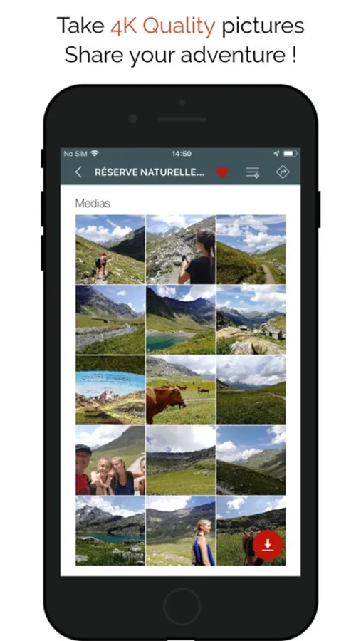
• Record your trails while taking HD and geo-tagged pictures of your adventures.
• Travelled distance, Km-effort, average speed, calories burned, etc.
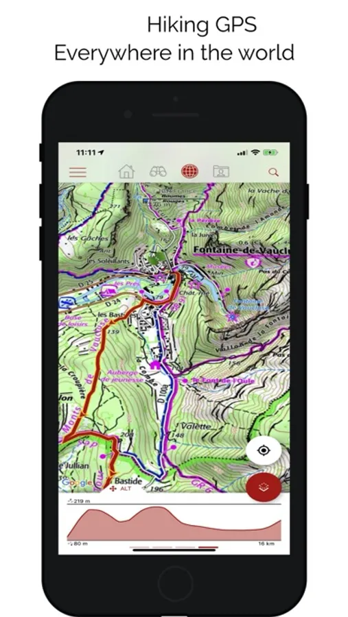
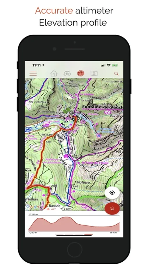
• Accurate altimeter, height differences computing and elevation profile displaying your current location.
• Alarm when you go off the path of the trail being followed. No more need to backtrack!
• Automatic triggering of points of interest with text-to-speech.
• Create a free account and all your data will be available everywhere on every device.
• With our online editor, create your own trails using a Web browser on your PC/Mac and then access them directly from your iPhone to experience them on the ground.
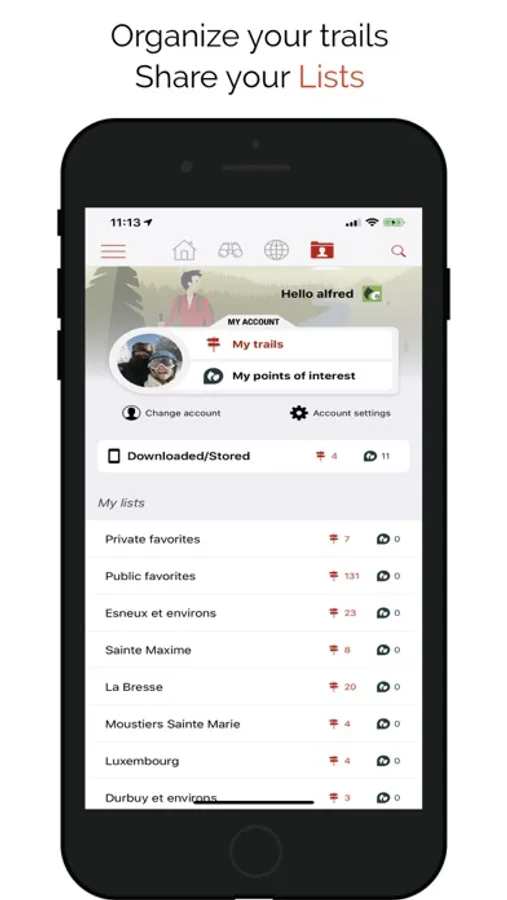
• Sort and classify your trails and points of interest in your own lists.
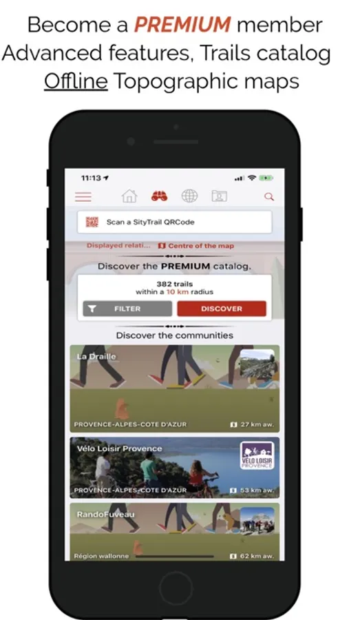
GO FURTHER AND BECOME A PREMIUM USER!
• Download world topographic maps for offline use.
• Add topographic maps of your choice, from IGN France, IGN / NGI Belgium, IGN Spain, swisstopo, Austria, USA (USGS topographic mapping), Canada (Toporama).
• Discover GR hiking paths, European hiking routes, Santiago de Compostela routes for pilgrims, etc.
• You can also discover all cycling networks: Greenway network in France, Ravel in Belgium, European cycling routes, knot points networks in Flanders and the Netherlands.
• And in winter, discover all the ski slopes with their names.
• Access the public catalogue of trails from SityTrail members and communities.
• Advanced tracking and guiding features with calculation of the remaining distance and time and vocal instructions at intersections.
• Go further and transform your favourite trails into real multimedia guides with text, photos, video links, and share them with the SityTrail community.
• Create your own hiker communities and manage your members and newsfeeds.
• Create trails with our advanced features for trail editing via our website.
• Print trails in PDF format with QR codes. (A4, A3).
• Access geotagged Wikipedia articles from our SityTrip module.
HEALTH KIT INTEGRATION
The application is now compatible with Health Kit : you can add your activity (trail following or recording) to the "Health" app.
AVAILABLE ON APPLE WATCH
Find all the features of SityTrail app on your Apple Watch: follow a trail, record a trail, map, voice guidance, vibrations, alarm when you go off the path, elevation profile, compass, etc.
IMPORTANT INFORMATION
• Some features need an internet connection.
• The prolonged use of GPS can reduce battery levels.
• Our privacy policy is available here: https://connect.geolives.com/j8w7fb0dxb6oqm677674/privacy_policy.html
• Our terms of use are available here: https://www.sitytrail.com/en/wiki/?page=help&content=Terms_Of_Use
INFORMATION FOR IN-APP PURCHASES
• Payment will be charged to your iTunes Account on confirmation of purchase.
• Subscription automatically renews unless auto-renew is turned off at least 24-hours before the end of the current period.
• Your account will be charged for renewal within 24-hours of the end of the current period. The cost of the renewal will be the same as the cost of your initial transaction.
• You can manage your subscriptions and auto-renewal may be turned off by going to your Account Settings after purchase.
SityTrail Screenshots
Tap to Rate:
Reviews for SityTrail
PaulCGN
App doesn’t start
I’ve installed, uninstalled, reinstalled, restarted my phone multiple times and the SityTrail app won’t start. All I get is a spinning circle. I have an iPhone 16 Pro with iOS 18.5, so everything is current and the app still doesn’t work. Too bad.
I-B-Illiterate
Huge Downgrade, huge disappointment
My wife and I are planning a trip to the Netherlands .... purchased (for 30 euros!!!) the downloadable map of the Netherlands which had all of the bike routes marked along with the junction numbers on the topographic map. Awesome! Just today, 2 days before leaving for Holland, I was forced to download the new beta SityTrail. The bike routes and junction numbers are no where to be found in the new ap!!!! Grrrrr..... now this ap is TOTALLY worthless for biking. Will have to just buy a paper bike map when we arrive in Holland.