In this GIS Kit app, users can collect, view, and organize geospatial data offline with support for shapefiles and attribute editing. Includes open source map caching, attribute customization, and wireless data transfer features.
AppRecs review analysis
AppRecs rating 4.1. Trustworthiness 86 out of 100. Review manipulation risk 20 out of 100. Based on a review sample analyzed.
★★★★☆
4.1
AppRecs Rating
Ratings breakdown
5 star
42%
4 star
42%
3 star
8%
2 star
0%
1 star
8%
What to know
✓
Low review manipulation risk
20% review manipulation risk
✓
Credible reviews
86% trustworthiness score from analyzed reviews
✓
High user satisfaction
83% of sampled ratings are 4+ stars (4.1★ average)
About GIS Kit
- No desktop GIS software required.
- No prior GIS training required.
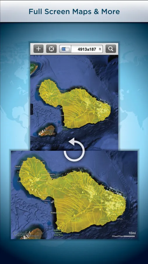
- Completely offline capable.
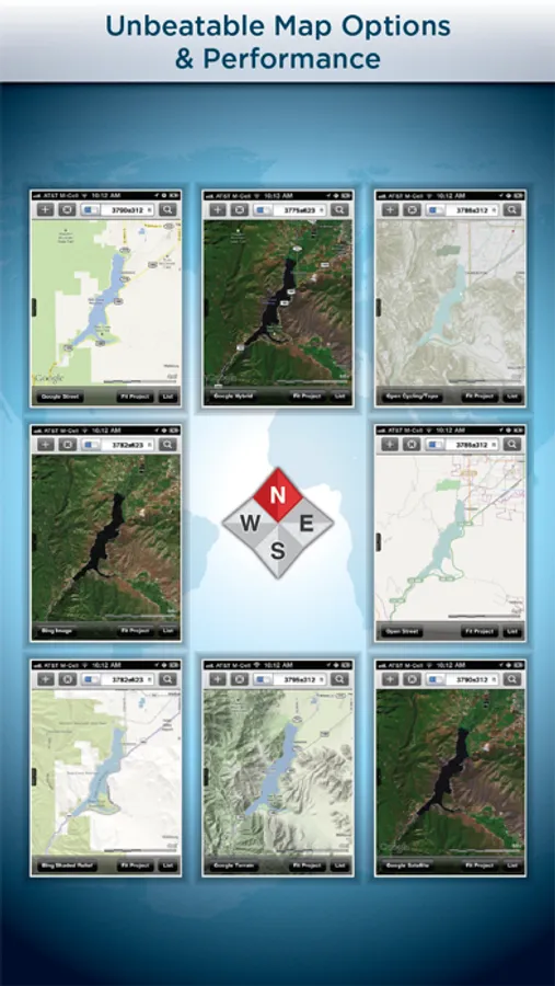
- Cache (download) open source topographic maps, street maps and satellite imagery straight from device.
- Import ESRI Shapefiles and KML/KMZ files including attributes.
- Attribute fields include: Alphanumeric (Description), Photos, numerical values, user defined list of values, addresses, websites, date & time, telephone number, check box.
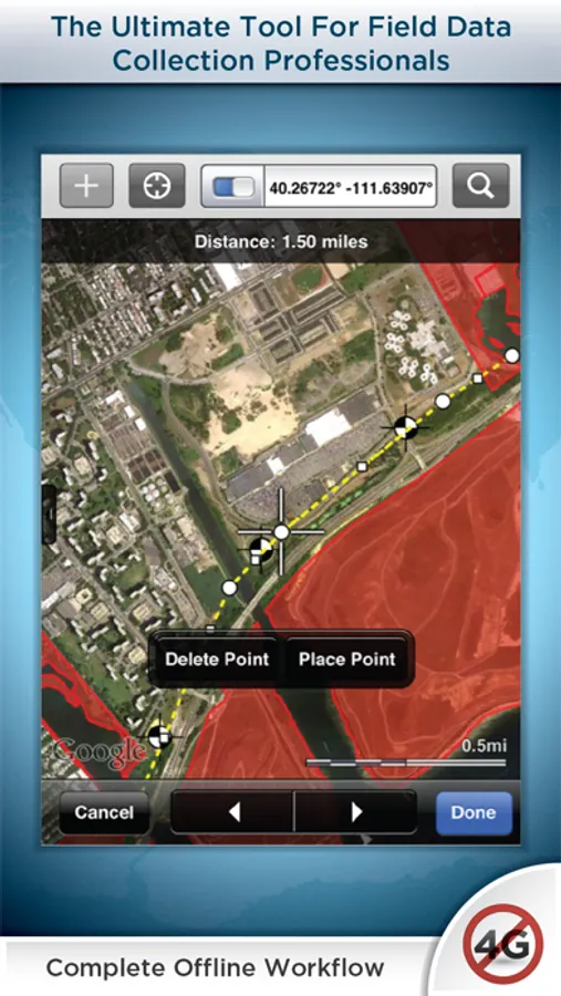
- Easily collect new point, line, and polygon features in the field by GPS or drawing manually.
- Enter attribute values for each feature and/or add new attribute types at time of collection.
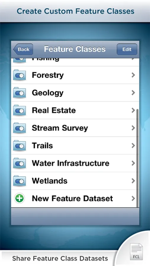
- Create templates of user defined feature classes with custom attributes.
- Comes loaded with numerous example feature templates for professional use in Forestry, Wetland Delineation, Stream Surveys, and Real Estate.
- Import and export data wirelessly by email. Larger data sets can be imported/exported by connecting to any computer with itunes.
- Organize by projects and layers
- Best-in-class performance.
Check our website to see videos, documentation and more information about the "Pro" version. Please note that all the features of the GIS Pro version (such as Shapefile export) are available through in-app purchase in this app as well.
For Businesses:
Please note that a separate license is required for each user or each device that is used by multiple users. See http://www.apple.com/legal/itunes/us/terms.html for details. Also see http://www.apple.com/business/vpp for information on purchasing in volume.
Continued use of GPS running in the background can dramatically decrease battery life.
GIS Kit Screenshots

Tap to Rate:
Reviews for GIS Kit
Giacometti.
By far, the best mobile GIS!
I have been using this app since 2013. It was my first mobile GIS app. Over time, I venture onto the other side of fence with virtually every other available mobile GIS app. Here’s what’s unique about GIS Kit: • Caches ortho-photo maps with a great number of choices • Allows easy customization for a particular project • You can have a number of projects, each remaining uniquely separate • Very reasonable cost, nothing’s hidden; you get the base program with all the bells and whistles for under $100 • I have not found an app anywhere, but here, that EXPORTS Shape files! (Pro version) Well worth the extra $$ if you need that functionality. Although there was a lag in updating this app and it tended to crash (frustrating), it was STILL worth the hassle! Not the team is back to raising the bar. They recently stabilized the crashing issue and are working on a major upgrade. Hands down, this is the best mobile GIS app available.
ttttttttttt12234346578990jyg
Scam
This program is a scam, shuts down when u try and change back ground and no way to contact tech support for help or problem solving, stay away!