AppRecs review analysis
AppRecs rating 4.1. Trustworthiness 65 out of 100. Review manipulation risk 21 out of 100. Based on a review sample analyzed.
★★★★☆
4.1
AppRecs Rating
Ratings breakdown
5 star
62%
4 star
15%
3 star
8%
2 star
8%
1 star
8%
What to know
✓
Low review manipulation risk
21% review manipulation risk
✓
High user satisfaction
77% of sampled ratings are 4+ stars (4.2★ average)
About Wise Pilgrim Camino Primitivo
Celebrating their 14th online, the Wise Pilgrim Guides are the go-to source of up-to-date information on the Camino de Santiago.
Now with a built in itinerary planner, and the ability to import your plan from wisepilgrim.com too.
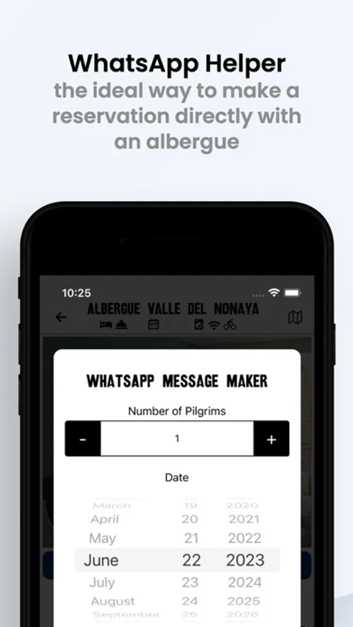
The app offers you the ability to leave tips for pilgrims following behind you, and to benefit from those left before you.
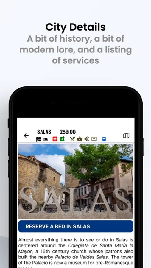
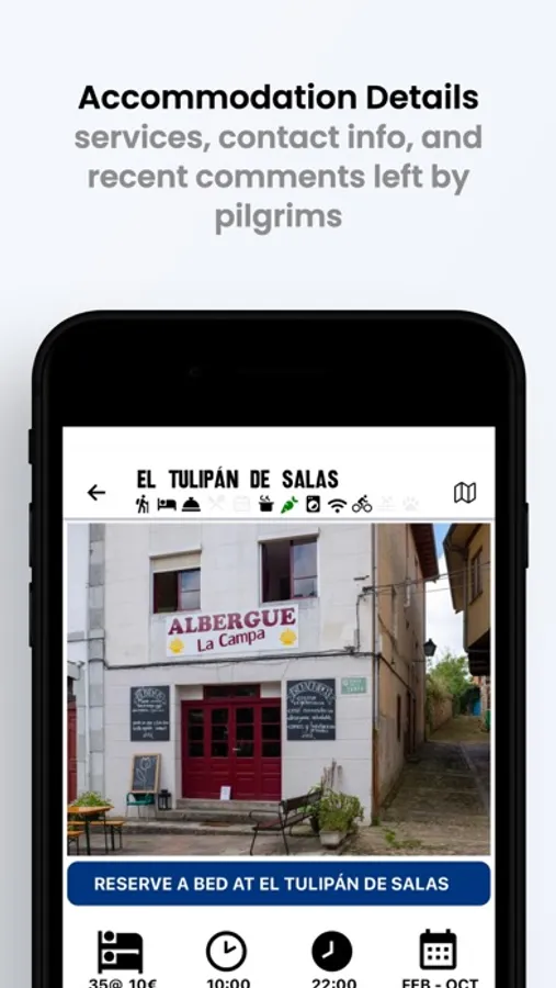
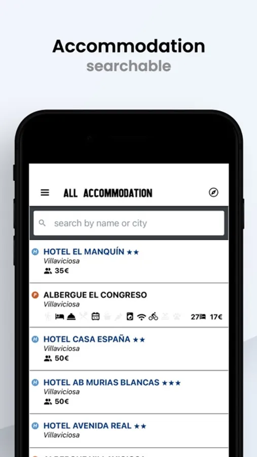
Accommodation Directory: A full directory of Albergues, camping, hotels, pensions, paradors, and cases rurales. Over 900 in total, with special attention to those that can be booked online.
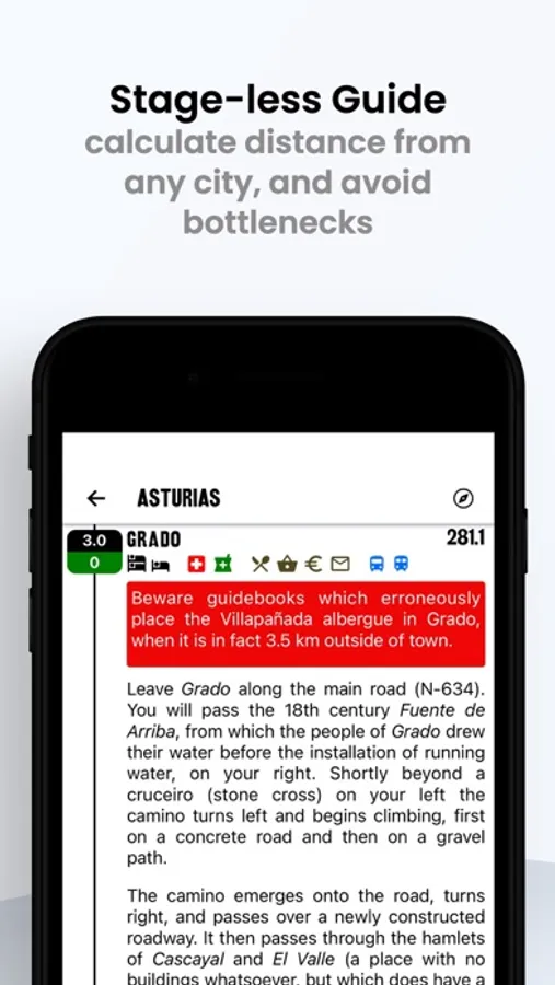
Stageless Guide: No more "stage anxiety" or guide created bottlenecks.
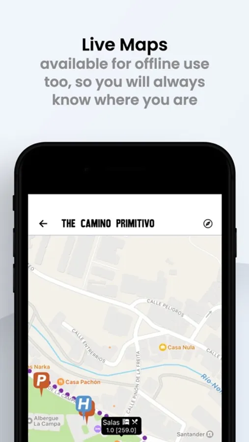
Maps: Offline and online versions of a beautiful topographical may will give you a good view of the terrain ahead.
Photos: Photos of albergues, monuments and other points of interest along the way. Currently 900+ images and growing.
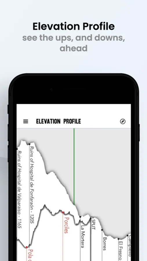
Scrollable Elevation Map: This one is hard to show with just a screenshot, but the elevation that appears at the top of every city page scrolls East to West. One complete elevation, from St. Jean Pied de Port to Santiago, uninterrupted by page folds.
Comments: Albergue closed early for the season? Have a restaurant that you want to share, or perhaps one to warn others about? Every location in the app gives you the opportunity to leave a comment and to read the comments left by others. No registration necessary.
¡Buen Camino and thank you for your support!
Wise Pilgrim Camino Primitivo Screenshots


Tap to Rate:
Reviews for Wise Pilgrim Camino Primitivo
Baby Bee in Wisconsin
Distances comically inaccurate
Format of the app is wonderful. It lacks information about alternative routes (there are many) and albergue/food information could be updated. In the offline map, distances are often inaccurate up to 5km, on one occasion after the Frances joins, it is off by over 20. This makes planning difficult. The route for the offline map is mostly accurate- some stretches being on trail that the app shows as along highways. I assume it was created via bike. Would give 4 stars if the distances were accurate.