In this hunting app, users can view hunting zones overlaid on maps, add waypoints, and track locations. Includes offline maps, weather, sunrise/sunset times, and sharing features.
AppRecs review analysis
AppRecs rating 4.5. Trustworthiness 63 out of 100. Review manipulation risk 20 out of 100. Based on a review sample analyzed.
★★★★☆
4.5
AppRecs Rating
Ratings breakdown
5 star
87%
4 star
9%
3 star
3%
2 star
0%
1 star
1%
What to know
✓
Low review manipulation risk
20% review manipulation risk
✓
High user satisfaction
87% of sampled ratings are 5 stars
✓
Authentic reviews
No red flags detected
About iHunter
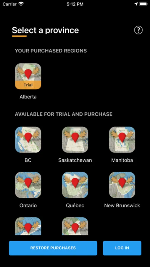
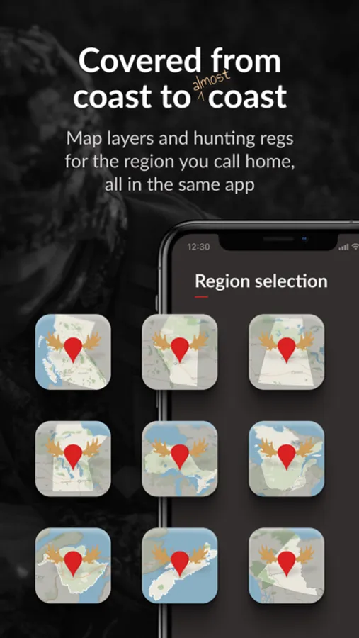
iHunter is Canada's all-in-one hunting app designed for hunters across British Columbia, Alberta, Saskatchewan, Manitoba, Ontario, Quebec, New Brunswick, Nova Scotia, and the Yukon Territories. The app is both free to download and free to use.
Regulations are updated annually upon release by the respective provinces.
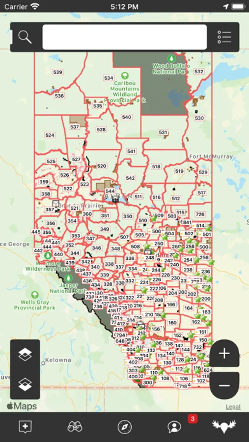
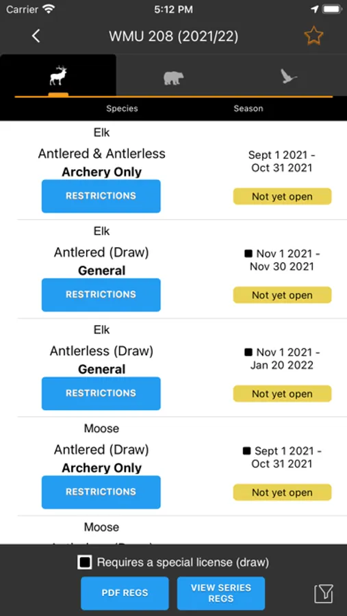
By overlaying hunting zones onto various base maps, users can easily determine their current location and the corresponding zone. Users can delve deeper into specific zones to view the open seasons for big game, predators, game birds, and small game. Additionally, they can add their own waypoints, tracks, and drawings to keep track of hunting spots, past harvests, and landowner contact information.
Features (Most functional offline):
• View Hunting zones overlaid on your choice of map.
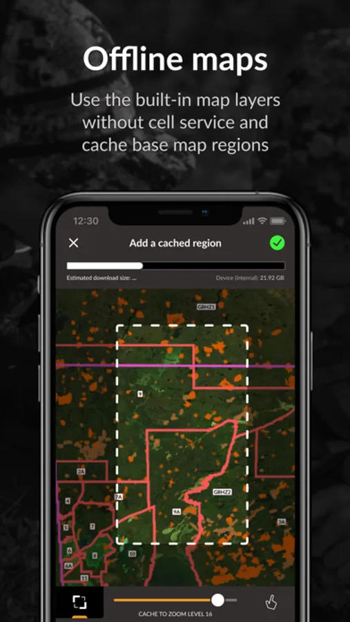
• Multiple satellite, topographic, and road maps included which automatically caching for offline use.
• Add waypoints to the map at your current location, known GPS locations, or by tapping on the map.
• Log in to back up and synchronize waypoints and preferences across devices.
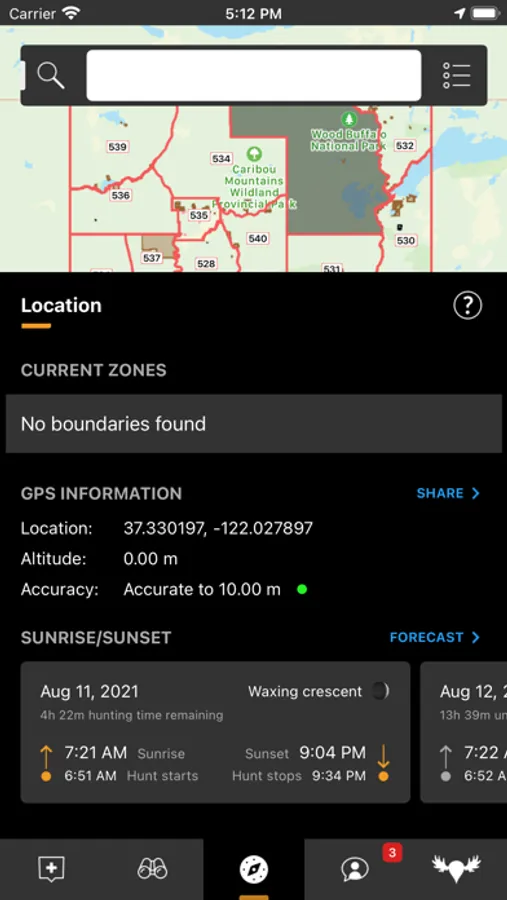
• Utilize the sunrise/sunset calculator to determine legal hunting light at your location or a waypoint.
• Share your current location with friends or family via email or text for easy location tracking requires internet.
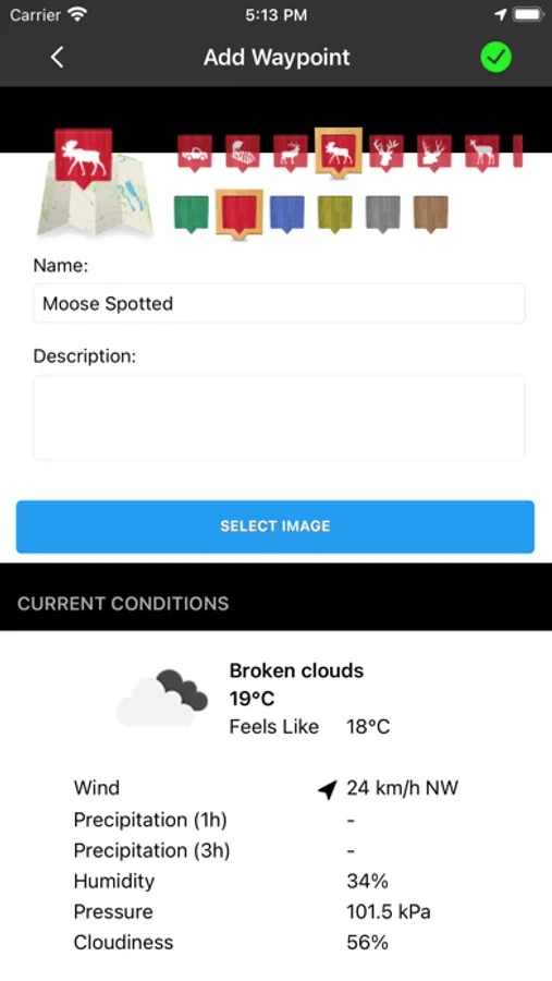
• Display weather at your current location or a waypoint (requires internet).
• First Nations Reserve boundaries.
• Import waypoints and tracks from GPX, KML, and KMZ files.
• Track your position, speed, and altitude; draw over the map; search the map; view recently viewed and favourited items. (Note: Continued use of GPS running in the background can significantly decrease battery life).
For each province, there are two subscription options to enhance the iHunter app:
With an iHunter Core yearly subscription, you will receive:
• Access to select hunting zones to view summaries of big-game, predators, game birds, and small game seasons (works offline).
• Ability to select regions of base maps and map layers to cache for offline use.
• Unlimited waypoints, tracks, and drawings.
• Capability to add your own TMS and WMS map layers.
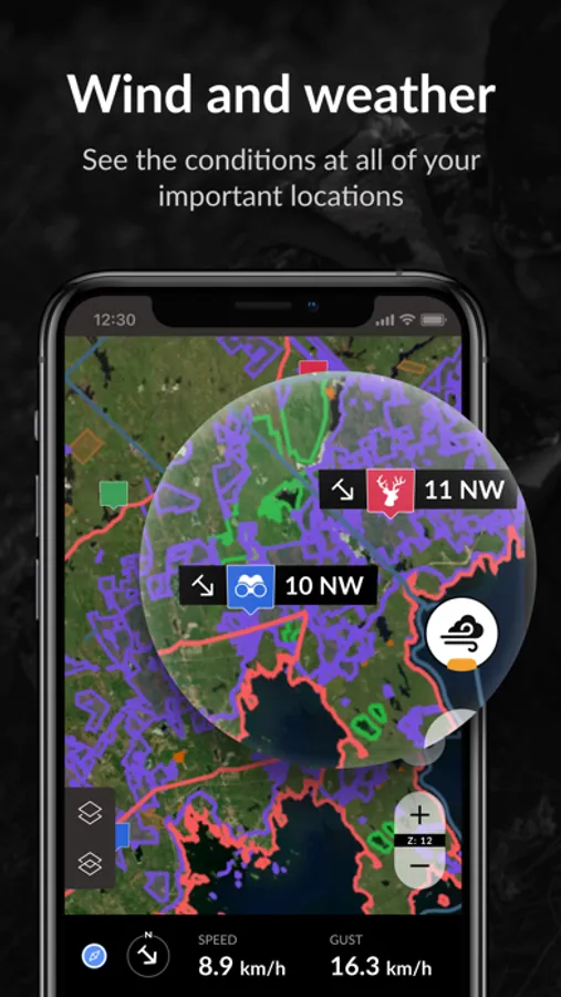
• Wind condition display by location (requires internet).
• 3D base maps.
With an iHunter Pro yearly subscription, you will receive:
• All features included in the Core Subscription.
• CarPlay integration.
• iHunter layers in driving navigation for both CarPlay and in-app navigation.
• Additional public and private land layers. The available layers differ for each province. See https://www.ihunterapp.com/ for more information.
For more information, visit: https://www.ihunterapp.com/subscription-terms-of-use/
Other available purchases:
• Land Ownership Maps (AB): Over 60 county land ownership overlays ranging in price from $9.99 to $29.99 are available for Alberta.
• Land Ownership Maps (SK): Over 180 RM land ownership overlays ranging in price from $14.99 to $21.99 are available for Saskatchewan.
• Land Ownership Maps (MB): Over 70 RM land ownership overlays ranging in price from $14.99 to $44.99 are available for Manitoba.
Regulations are updated annually upon release by the respective provinces.
By overlaying hunting zones onto various base maps, users can easily determine their current location and the corresponding zone. Users can delve deeper into specific zones to view the open seasons for big game, predators, game birds, and small game. Additionally, they can add their own waypoints, tracks, and drawings to keep track of hunting spots, past harvests, and landowner contact information.
Features (Most functional offline):
• View Hunting zones overlaid on your choice of map.
• Multiple satellite, topographic, and road maps included which automatically caching for offline use.
• Add waypoints to the map at your current location, known GPS locations, or by tapping on the map.
• Log in to back up and synchronize waypoints and preferences across devices.
• Utilize the sunrise/sunset calculator to determine legal hunting light at your location or a waypoint.
• Share your current location with friends or family via email or text for easy location tracking requires internet.
• Display weather at your current location or a waypoint (requires internet).
• First Nations Reserve boundaries.
• Import waypoints and tracks from GPX, KML, and KMZ files.
• Track your position, speed, and altitude; draw over the map; search the map; view recently viewed and favourited items. (Note: Continued use of GPS running in the background can significantly decrease battery life).
For each province, there are two subscription options to enhance the iHunter app:
With an iHunter Core yearly subscription, you will receive:
• Access to select hunting zones to view summaries of big-game, predators, game birds, and small game seasons (works offline).
• Ability to select regions of base maps and map layers to cache for offline use.
• Unlimited waypoints, tracks, and drawings.
• Capability to add your own TMS and WMS map layers.
• Wind condition display by location (requires internet).
• 3D base maps.
With an iHunter Pro yearly subscription, you will receive:
• All features included in the Core Subscription.
• CarPlay integration.
• iHunter layers in driving navigation for both CarPlay and in-app navigation.
• Additional public and private land layers. The available layers differ for each province. See https://www.ihunterapp.com/ for more information.
For more information, visit: https://www.ihunterapp.com/subscription-terms-of-use/
Other available purchases:
• Land Ownership Maps (AB): Over 60 county land ownership overlays ranging in price from $9.99 to $29.99 are available for Alberta.
• Land Ownership Maps (SK): Over 180 RM land ownership overlays ranging in price from $14.99 to $21.99 are available for Saskatchewan.
• Land Ownership Maps (MB): Over 70 RM land ownership overlays ranging in price from $14.99 to $44.99 are available for Manitoba.
iHunter Screenshots
Tap to Rate:
Reviews for iHunter
Wn frscnc
Good
It would be nice to see the satellite images and land owners names
jaredlanny
Miss this app
Made me sad when they went to Canada exclusively. Please come back to Idaho!