In this earthquake alert app, users can view recent seismic events on a map, receive push notifications, and filter data by location or magnitude. Includes earthquake catalogs, tsunami bulletins, map layers, and social sharing options.
AppRecs review analysis
AppRecs rating 4.6. Trustworthiness 77 out of 100. Review manipulation risk 27 out of 100. Based on a review sample analyzed.
★★★★☆
4.6
AppRecs Rating
Ratings breakdown
5 star
84%
4 star
10%
3 star
3%
2 star
1%
1 star
2%
What to know
✓
Low review manipulation risk
27% review manipulation risk
✓
Credible reviews
77% trustworthiness score from analyzed reviews
✓
High user satisfaction
84% of sampled ratings are 5 stars
About Earthquake - alerts and map
#1 Earthquake app for iPhone and iPad, 5M downloads, supports Apple Watch.
Get the latest worldwide data from several sources and receive push notifications alerts.
Main features:
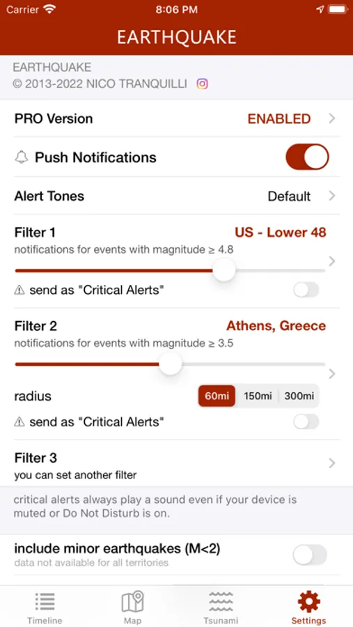
• rich push notifications on your phone as soon as the event data is available from an official source (you can set up to 4 alerts based on location and/or magnitude threshold)
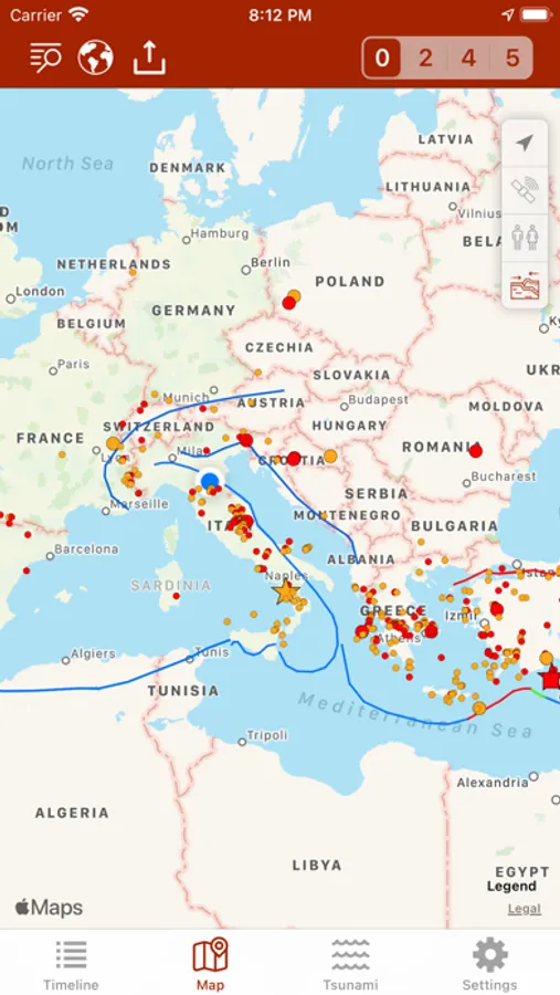
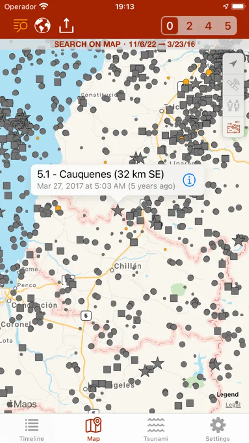
• map with different sized and colored circles to represent event magnitude and age
• filter events by area (country, continent) or magnitude
• multiple sources, including U.S. Geological Survey (USGS), European-Mediterranean Seismological Centre (EMSC), GeoScience Australia, GNS Science (GeoNet), Instituto Geográfico Nacional, Servicio Sismológico Nacional, British Geological Survey, GFZ GEOFON, Natural Resources Canada, NOAA
• no ads
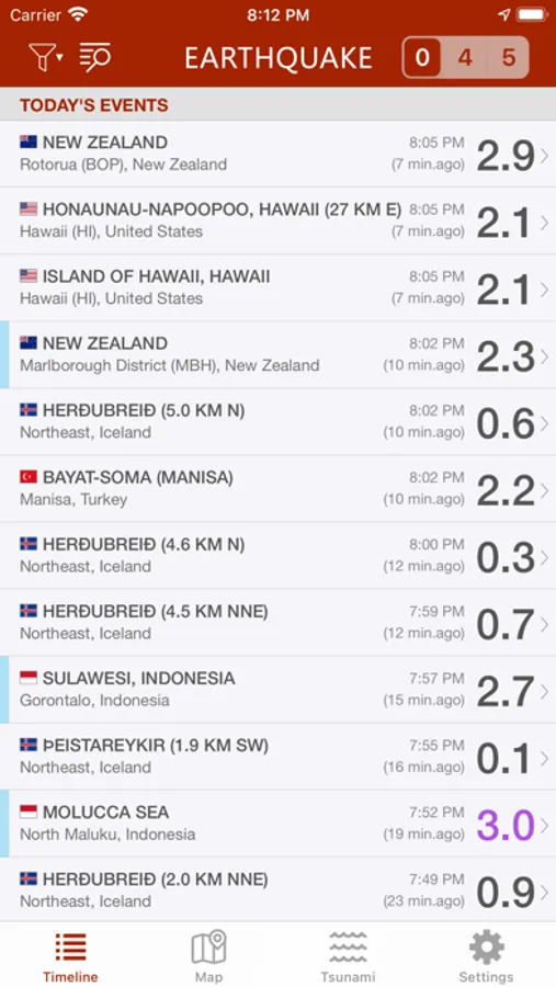
• event timeline (today, yesterday, previous days)
• earthquakes catalog (all world regions covered, back to 1970), search by date, territory, city or reporting agency
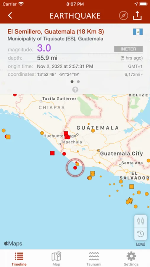
• detail view for each event, reachable from map and timeline views
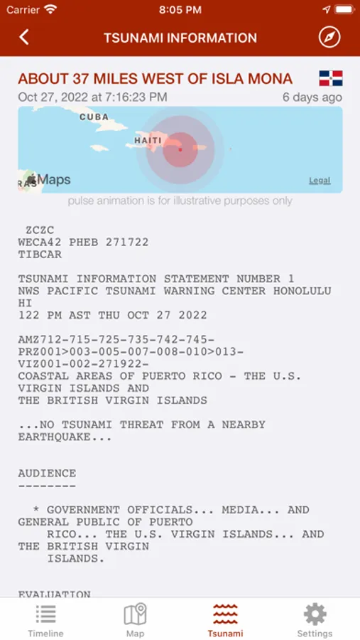
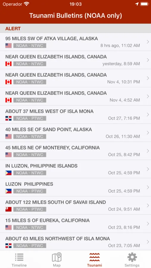
• Tsunami bulletins (NOAA data)
• map layers: tectonic plate boundaries, orogens, volcanoes, nuclear power plants, population density
• population estimates for each event
• export data to Google Earth or other installed apps supporting kml file format
• social sharing: share event map and data to Facebook, Twitter, Email
• reverse geocoding: names of locations, when unavailable, are calculated automatically from their geographical coordinates
• Widgets for your home screen or today view, to keep the latest seismic data at your fingertips
• 3D Touch and Haptic feedback support
• Siri Shortcuts support - "Hey Siri, what are the latest earthquakes in the United States?"
• "Critical Alerts" and "Dark Mode" support
• earthquake catalog: search by date, city, country, continent and reporting agency
• multiple languages: the app is localized in English, Spanish, French, German, Italian, Greek, Russian, Chinese, Dutch, Portuguese, Turkish, Hungarian, Romanian, Korean, Croatian
• Notifications based on user reports
Get the latest worldwide data from several sources and receive push notifications alerts.
Main features:
• rich push notifications on your phone as soon as the event data is available from an official source (you can set up to 4 alerts based on location and/or magnitude threshold)
• map with different sized and colored circles to represent event magnitude and age
• filter events by area (country, continent) or magnitude
• multiple sources, including U.S. Geological Survey (USGS), European-Mediterranean Seismological Centre (EMSC), GeoScience Australia, GNS Science (GeoNet), Instituto Geográfico Nacional, Servicio Sismológico Nacional, British Geological Survey, GFZ GEOFON, Natural Resources Canada, NOAA
• no ads
• event timeline (today, yesterday, previous days)
• earthquakes catalog (all world regions covered, back to 1970), search by date, territory, city or reporting agency
• detail view for each event, reachable from map and timeline views
• Tsunami bulletins (NOAA data)
• map layers: tectonic plate boundaries, orogens, volcanoes, nuclear power plants, population density
• population estimates for each event
• export data to Google Earth or other installed apps supporting kml file format
• social sharing: share event map and data to Facebook, Twitter, Email
• reverse geocoding: names of locations, when unavailable, are calculated automatically from their geographical coordinates
• Widgets for your home screen or today view, to keep the latest seismic data at your fingertips
• 3D Touch and Haptic feedback support
• Siri Shortcuts support - "Hey Siri, what are the latest earthquakes in the United States?"
• "Critical Alerts" and "Dark Mode" support
• earthquake catalog: search by date, city, country, continent and reporting agency
• multiple languages: the app is localized in English, Spanish, French, German, Italian, Greek, Russian, Chinese, Dutch, Portuguese, Turkish, Hungarian, Romanian, Korean, Croatian
• Notifications based on user reports
Earthquake - alerts and map Screenshots

Tap to Rate:
Reviews for Earthquake - alerts and map
Sophie Q
Stay informed
Excellent
ruff F B
I enjoy getting the daily update.
Receiving the updates, help me to feel a part of the world, and understanding the humanity that people go through when tragedy happens.