In this hiking app, you can create, edit, and track routes using GPS, then upload data to your online account. Includes offline maps, trail guides, elevation charts, and trip reports.
AppRecs review analysis
AppRecs rating 4.4. Trustworthiness 85 out of 100. Review manipulation risk 27 out of 100. Based on a review sample analyzed.
★★★★☆
4.4
AppRecs Rating
Ratings breakdown
5 star
85%
4 star
10%
3 star
0%
2 star
3%
1 star
2%
What to know
✓
Low review manipulation risk
27% review manipulation risk
✓
Credible reviews
85% trustworthiness score from analyzed reviews
✓
High user satisfaction
85% of sampled ratings are 5 stars
About MyHikes
Join a community built by hikers, for hikers! Whether you’re uncovering a hidden waterfall in the Northeast, trekking through the lush jungles of Kauai, or hiking below towering peaks in the Alps, MyHikes is your essential companion for the trail. From advanced 3D mapping to offline navigation, we provide the tools you need to explore with confidence and leave a digital footprint of your adventures.
EXPLORE WITH CONFIDENCE
- Discover 3,100+ curated trails covering over 8,500 miles.
- Use high-resolution trail maps, elevation charts, and real-world photos to prep for your next hike.
- Trip Reports: Read recent reviews from fellow hikers to check current trail conditions, or log your own stats to track your progress.
TRACK YOUR ADVENTURE
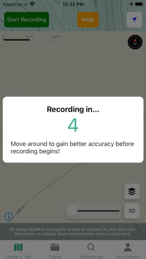
- Precision Tracking: Use background GPS to record your route, distance, and elevation in real-time.
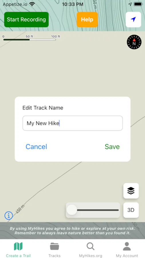
- Clean Data: Built-in editing tools allow you to remove unwanted segments from your track for a perfect map.
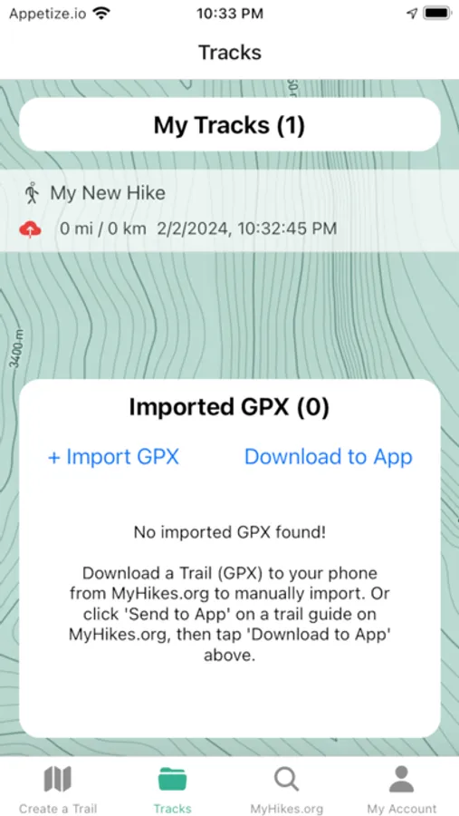
- Sync to the Cloud: Upload your tracks to your MyHikes.org account to build a lifelong hiking journal or contribute to the public database.
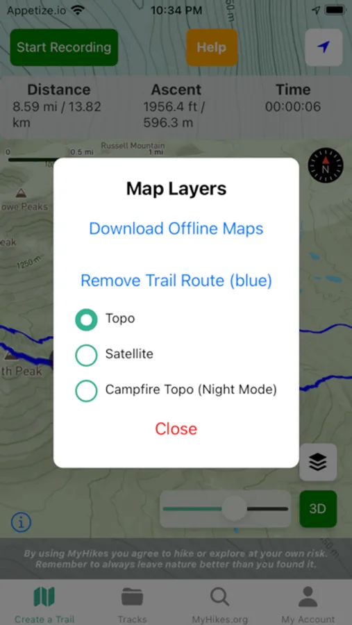
GO OFF-GRID (OFFLINE MAPS)
- Offline Regions: Download map regions to your device for reliable navigation deep in the wilderness.
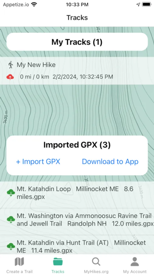
- GPX Support: Import external GPX files directly into MyHikes to follow any route, anywhere.
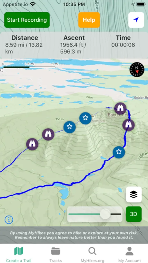
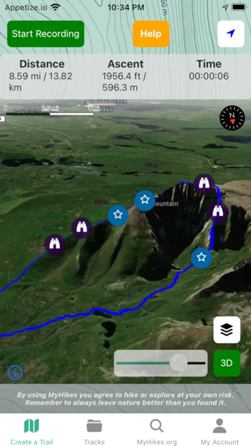
- 3D Topography: Visualize the terrain like never before with immersive 3D maps that bring elevation profiles to life.
BECOME A MYHIKES SUPPORTER
Support a solo-developer project and unlock the full power of the platform:
- Unlimited Everything: Enjoy unlimited GPS track saves, GPX imports, and offline map downloads.
- Download: One-click syncing! Send up to 50 routes or entire "Offline Parks" (including POIs like waterfalls and campsites) directly from MyHikes.org to your phone.
- Pro Navigation: Access advanced tools to help you stay on the path and find the best views.
PRIVACY FIRST
Your location is your business. MyHikes never tracks your data on our servers while you're on the trail. Your GPS information is only sent to us if and when you choose to upload a track to your account.
STREAKS & MOTIVATION
Keep the momentum going! Earn weekly streaks by hitting the trail and staying active in the great outdoors.
SUPPORT & TERMS
MyHikes is a labor of love owned and operated by a single developer. By using MyHikes, you agree to hike at your own risk. Please practice Leave No Trace principles and respect local regulations.
Learn more about Supporter features: https://myhikes.org/supporter-account
EXPLORE WITH CONFIDENCE
- Discover 3,100+ curated trails covering over 8,500 miles.
- Use high-resolution trail maps, elevation charts, and real-world photos to prep for your next hike.
- Trip Reports: Read recent reviews from fellow hikers to check current trail conditions, or log your own stats to track your progress.
TRACK YOUR ADVENTURE
- Precision Tracking: Use background GPS to record your route, distance, and elevation in real-time.
- Clean Data: Built-in editing tools allow you to remove unwanted segments from your track for a perfect map.
- Sync to the Cloud: Upload your tracks to your MyHikes.org account to build a lifelong hiking journal or contribute to the public database.
GO OFF-GRID (OFFLINE MAPS)
- Offline Regions: Download map regions to your device for reliable navigation deep in the wilderness.
- GPX Support: Import external GPX files directly into MyHikes to follow any route, anywhere.
- 3D Topography: Visualize the terrain like never before with immersive 3D maps that bring elevation profiles to life.
BECOME A MYHIKES SUPPORTER
Support a solo-developer project and unlock the full power of the platform:
- Unlimited Everything: Enjoy unlimited GPS track saves, GPX imports, and offline map downloads.
- Download: One-click syncing! Send up to 50 routes or entire "Offline Parks" (including POIs like waterfalls and campsites) directly from MyHikes.org to your phone.
- Pro Navigation: Access advanced tools to help you stay on the path and find the best views.
PRIVACY FIRST
Your location is your business. MyHikes never tracks your data on our servers while you're on the trail. Your GPS information is only sent to us if and when you choose to upload a track to your account.
STREAKS & MOTIVATION
Keep the momentum going! Earn weekly streaks by hitting the trail and staying active in the great outdoors.
SUPPORT & TERMS
MyHikes is a labor of love owned and operated by a single developer. By using MyHikes, you agree to hike at your own risk. Please practice Leave No Trace principles and respect local regulations.
Learn more about Supporter features: https://myhikes.org/supporter-account
MyHikes Screenshots
Tap to Rate:
Reviews for MyHikes
Rebecca Lippman
Invaluable Tool
Finally! Trail maps that I can follow live. Thomas took one he should become my favorite hiking tool.
THEYRE
Amazing hiking app!!!
Perfect hiking app for finding and exploring trails wherever you are. I’ve discovered lots of new places and trails - me and my dog have really had a great time.