AppRecs review analysis
AppRecs rating 4.5. Trustworthiness 65 out of 100. Review manipulation risk 23 out of 100. Based on a review sample analyzed.
★★★★☆
4.5
AppRecs Rating
Ratings breakdown
5 star
100%
4 star
0%
3 star
0%
2 star
0%
1 star
0%
What to know
✓
Low review manipulation risk
23% review manipulation risk
✓
High user satisfaction
100% of sampled ratings are 5 stars
About Henro Helper
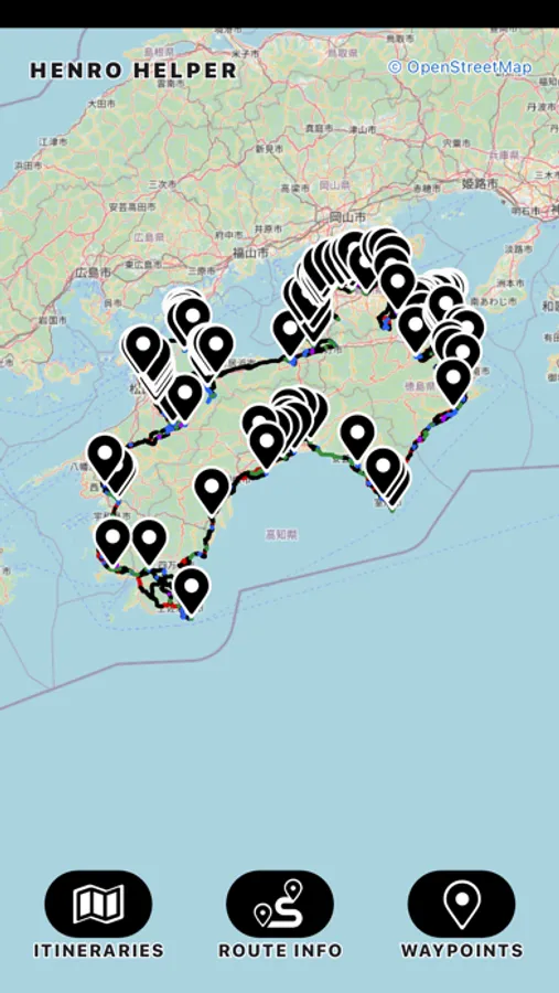
This application uses real time GPS tracking and heading information to help keep you on your preferred route. The routes are colour coded to show you busy roads (red), quiet roads (black), easy trails (green), moderate trails (blue) and difficult trails (purple). There is also distance and elevation gain information as well as a topographic map option.
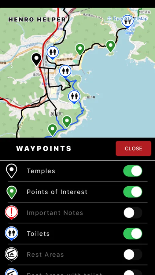
This application contains easy to read waypoints for temples, points of interest, toilets, rest areas, convenience stores, accommodations, campgrounds and much more. Many of the waypoints are clickable to get more information.
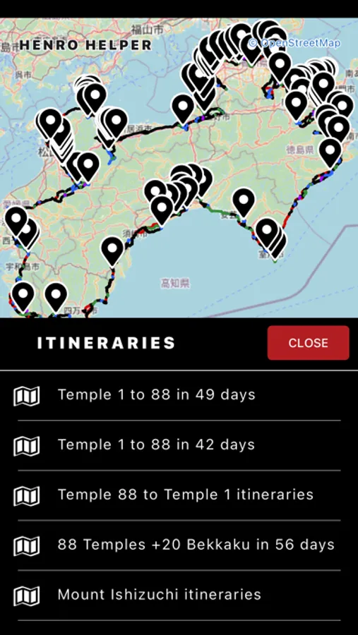
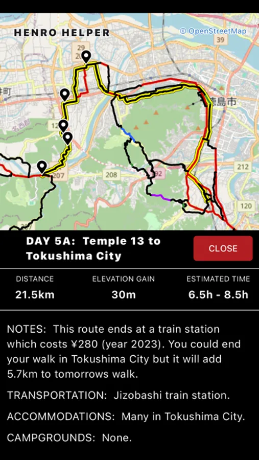
This application also contains daily walking itineraries to visit the 88 Temples in 42 to 49 days. The daily walking itineraries also give you the choice of easy to more difficult routes. Each choice of route has information such as distance, elevation gain, estimated time as well as relevant notes.
With the new "measure" tool you can measure routes for distance, elevation gain and estimated time. You can also build and save your own routes to build your own custom itinerary.
Henro Helper Screenshots
Tap to Rate:
Reviews for Henro Helper
Old Skool Film Junky
A new paradigm for pilgrims
Thank you for this app! Sadly I only learned of this app while already on the henro michi. After discovering this app I rarely consulted the guide book. Next pilgrimage I will only use guidebook for planning from home. Using this app fully replaces need to carry that book, especially as there are so many presumably abandoned copies to be found in lodgings along the route for reference. Same for carrying Dunskas' hiking guide. Again, a book every pilgrim should own and study at home. But having this app made it unnecessary to carry the above mentioned books. Suggestions to make this even better: Please allow for other base maps and or satellite imagery. I found I had to keep other mapping applications open as reference. This is especially the case for mountainous sections of the Henro Michi in that it would be helpful to see the proposed path on a proper contour map. And how to contact the developer to report discrepancies and current conditions? The section between Tsukiyama jinja and Hotel Bellreaf is in a dangerous condition with some sections of the trail eroded away which required me to traverse near vertical wall using rock climbing technique. This section should be marked in purple and the level of danger advertised. Fortunately it is not on the regular henro michi and likely few people will use this route, but advance warning is in order. My next visit I will be sure to make notes at the pilgrim hut. Along with the Henro.org interactive map showing lodgings and other sites of interest these two digital guides made my pilgrimage from November and December 2024 much easier to negotiate. Arigato gozaimasu! October 2025: Thank you for the updates! Especially love the ability to use topo base map as well the addition of okunoin. I'm a sucker for an out of the way detour through mountains to find okunoin!