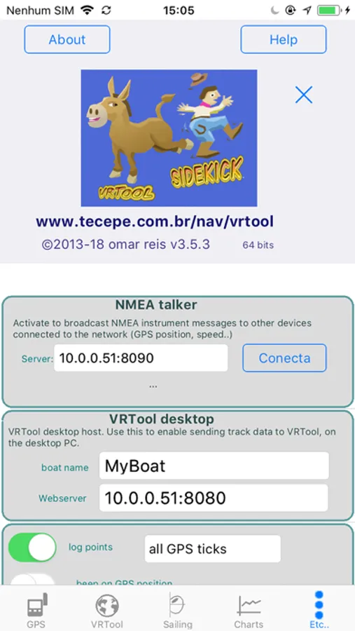
About VRTool
VRTool is a sailing planner and calculator.
Calculators combine the following data:
- GPS position ( or DR position )
- Polar chart customized for your boat ( your boat performance charts )
- 144h wind forecasts from NOAA GFS.
- High resolution GSHHS world maps
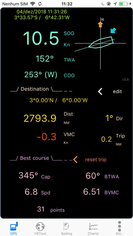
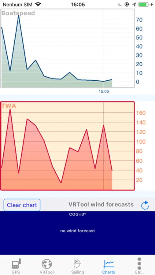
Real time sailing monitor shows the polar point, TWA, sail efficiency, best course, great circle distance and course to destination. Also logs boat positions, saving boat parameters periodically.
Charting tools include: measure tool, route and track design, fixed wind angle tracks, marks, geodesic circles.
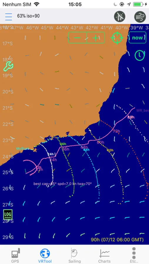
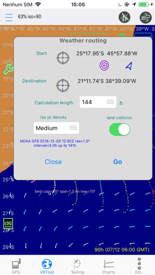
Weather routing calculation up to 144h, with land collision detection. This finds the optimized route to destination considering the wind forecasts and performance of the boat.
Wind forecasts from NOAA GFS, via VRTool webserver.
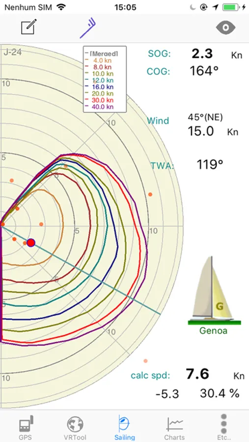
Interactive Polar Chart Editor, for customizing your boat polar charts.
VRTool can be configured to act as a NMEA talker, broadcasting GPS messages to other software connected to the boat local network ( including VRTool desktop edition)
Calculators combine the following data:
- GPS position ( or DR position )
- Polar chart customized for your boat ( your boat performance charts )
- 144h wind forecasts from NOAA GFS.
- High resolution GSHHS world maps
Real time sailing monitor shows the polar point, TWA, sail efficiency, best course, great circle distance and course to destination. Also logs boat positions, saving boat parameters periodically.
Charting tools include: measure tool, route and track design, fixed wind angle tracks, marks, geodesic circles.
Weather routing calculation up to 144h, with land collision detection. This finds the optimized route to destination considering the wind forecasts and performance of the boat.
Wind forecasts from NOAA GFS, via VRTool webserver.
Interactive Polar Chart Editor, for customizing your boat polar charts.
VRTool can be configured to act as a NMEA talker, broadcasting GPS messages to other software connected to the boat local network ( including VRTool desktop edition)
VRTool Screenshots
Tap to Rate: