In this vessel tracking app, you can view real-time positions and details of ships worldwide. Includes ship search, movement history, port information, and map filters.
AppRecs review analysis
AppRecs rating 3.0. Trustworthiness 70 out of 100. Review manipulation risk 23 out of 100. Based on a review sample analyzed.
★★★☆☆
3.0
AppRecs Rating
Ratings breakdown
5 star
39%
4 star
11%
3 star
5%
2 star
11%
1 star
34%
What to know
✓
Low review manipulation risk
23% review manipulation risk
✓
Authentic reviews
Natural distribution, no red flags
⚠
High negative review ratio
45% of sampled ratings are 1–2 stars
About VesselFinder Lite
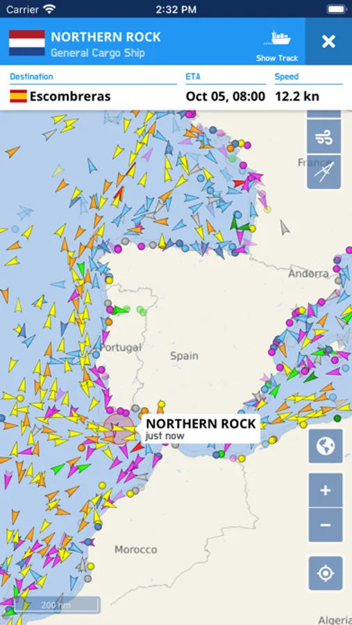
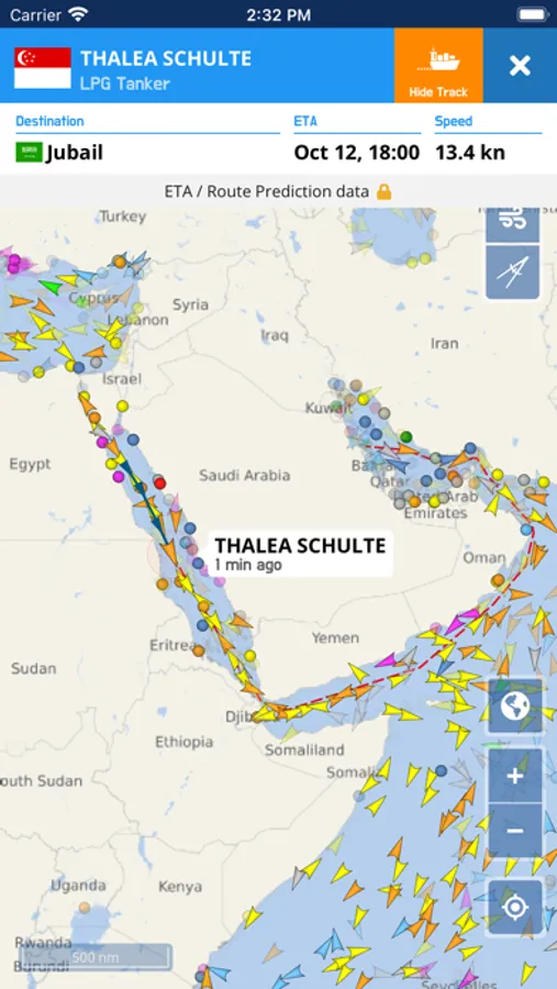
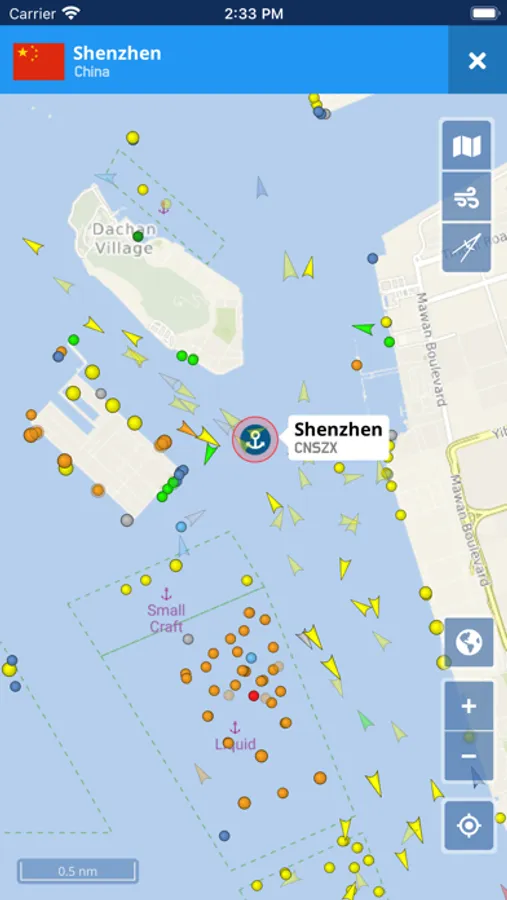
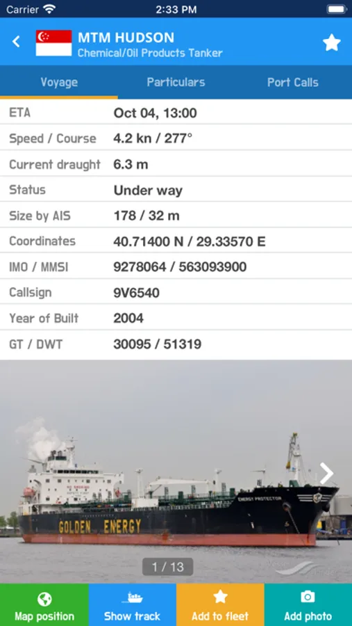
VesselFinder is the world’s most popular and trusted vessel tracking and marine traffic app, delivering real-time information on ship positions and movements worldwide. Using a powerful network of satellites, roaming and terrestrial AIS receivers, VesselFinder provides accurate and up-to-date insight into global maritime activity.
Designed for maritime professionals, shipping enthusiasts, and anyone interested in live ship tracking, VesselFinder offers a fast, intuitive, and reliable way to explore vessel traffic across the globe.
VesselFinder key features:
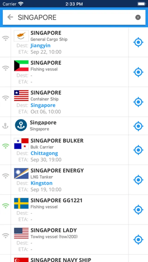
• Real-time tracking of over 300,000 vessels daily using global AIS data
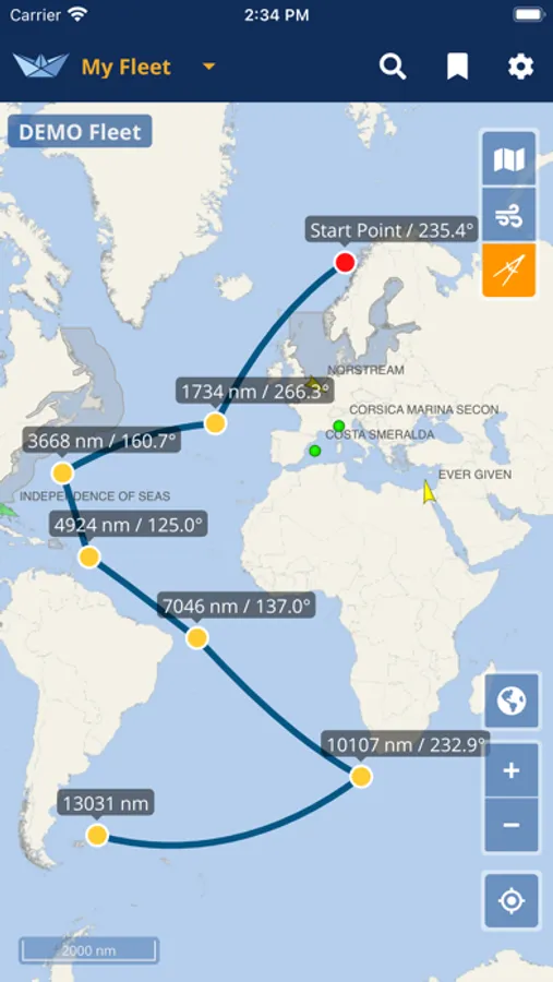
• Vessel movement history with track visualization
• Predicted routes and ETAs to next port
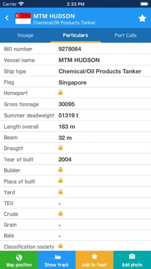
• Comprehensive vessel particulars, including technical specifications, and cargo capacity information
• Contact details for the owning company, manager, ISM manager, and more
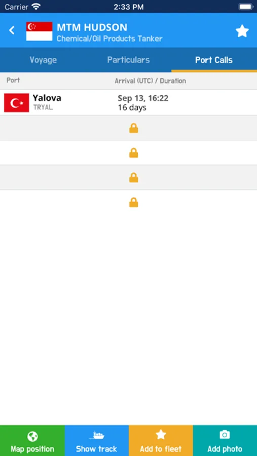
• Port Calls per vessel, showing arrival times and duration of stay
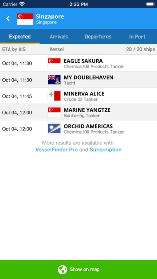
• Port Calls per port, with detailed lists of expected vessels, arrivals, departures, and ships currently in port
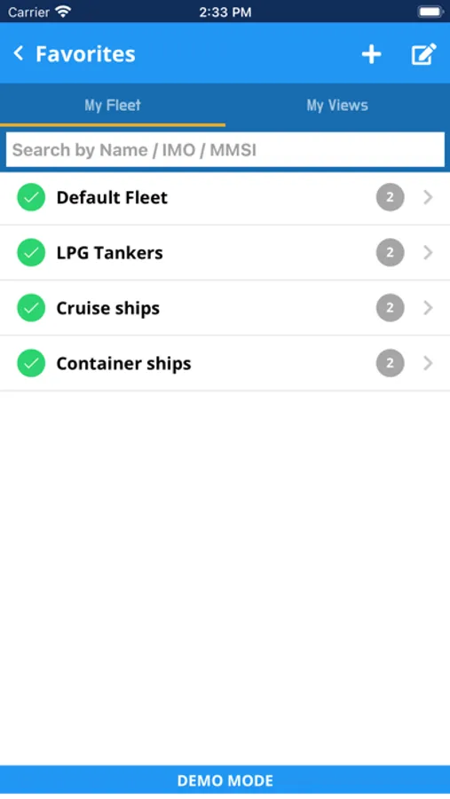
• My Fleet – save and monitor favorite vessels, synchronized with your VesselFinder account
• My Views – save preferred map views for fast and easy navigation
• Ship Photos contributed by the VesselFinder user community
• Multiple map styles: Simple, Detailed, Dark, Satellite, and Nautical
• Weather overlays, including wind, waves, and temperature
• See your location feature for instant orientation
• Distance measurement tool for route and range estimation
Vessel visibility depends on AIS signal availability, with near-shore coverage consistent with the data provided on VesselFinder.com. If a vessel is outside our terrestrial AIS coverage area, its last reported position will be displayed and updated as soon as new data is received. Extended real-time coverage via satellite and roaming AIS sources is available through a subscription. While we make every effort to ensure accuracy, the completeness of the information cannot be guaranteed.
Connect with VesselFinder
• Facebook: http://www.facebook.com/vesselfinder
• Twitter: http://www.twitter.com/vesselfinder
Designed for maritime professionals, shipping enthusiasts, and anyone interested in live ship tracking, VesselFinder offers a fast, intuitive, and reliable way to explore vessel traffic across the globe.
VesselFinder key features:
• Real-time tracking of over 300,000 vessels daily using global AIS data
• Vessel movement history with track visualization
• Predicted routes and ETAs to next port
• Comprehensive vessel particulars, including technical specifications, and cargo capacity information
• Contact details for the owning company, manager, ISM manager, and more
• Port Calls per vessel, showing arrival times and duration of stay
• Port Calls per port, with detailed lists of expected vessels, arrivals, departures, and ships currently in port
• My Fleet – save and monitor favorite vessels, synchronized with your VesselFinder account
• My Views – save preferred map views for fast and easy navigation
• Ship Photos contributed by the VesselFinder user community
• Multiple map styles: Simple, Detailed, Dark, Satellite, and Nautical
• Weather overlays, including wind, waves, and temperature
• See your location feature for instant orientation
• Distance measurement tool for route and range estimation
Vessel visibility depends on AIS signal availability, with near-shore coverage consistent with the data provided on VesselFinder.com. If a vessel is outside our terrestrial AIS coverage area, its last reported position will be displayed and updated as soon as new data is received. Extended real-time coverage via satellite and roaming AIS sources is available through a subscription. While we make every effort to ensure accuracy, the completeness of the information cannot be guaranteed.
Connect with VesselFinder
• Facebook: http://www.facebook.com/vesselfinder
• Twitter: http://www.twitter.com/vesselfinder
VesselFinder Lite Screenshots
Tap to Rate:
Reviews for VesselFinder Lite
hill top farm 47118
i was using it now it won’t let me in
it’s gotten to be a joke. it won’t let me in now
W.Salgado
App won’t open
Suddenly app won’t open,