In this satellite mapping app, you can view, search for, and download near real-time satellite imagery to assess fishing conditions offshore. Includes features like customizable overlays, waypoints management, and offline map storage.
AppRecs review analysis
AppRecs rating 4.4. Trustworthiness 75 out of 100. Review manipulation risk 23 out of 100. Based on a review sample analyzed.
★★★★☆
4.4
AppRecs Rating
Ratings breakdown
5 star
89%
4 star
7%
3 star
2%
2 star
1%
1 star
2%
What to know
✓
Low review manipulation risk
23% review manipulation risk
✓
Credible reviews
75% trustworthiness score from analyzed reviews
✓
High user satisfaction
89% of sampled ratings are 5 stars
About RipCharts
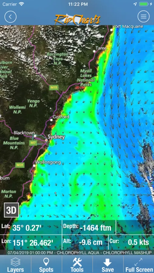
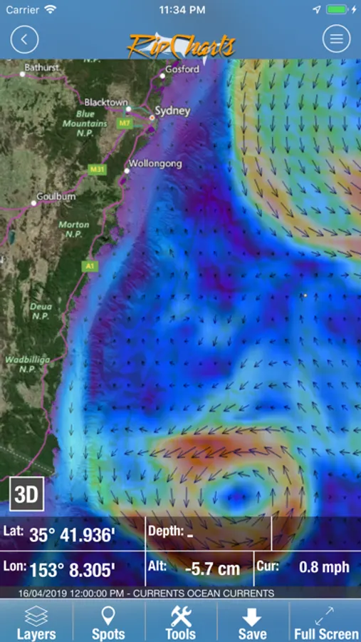
The RipCharts mobile app is a powerful tool that enables offshore fishermen to evaluate recent satellite imagery in order to determine favorable fishing conditions. Search for, view, and download maps of near realtime satellite imagery onto your device to take with you offshore.
View the latest imagery datasets:
Raw SST orbit scans
Composite SST (1day, 3day)
Multi-Res/Cloud Free SST
Sub-Surface SST. 0m, -25m, -50m, -100m
5 day SST forecast models
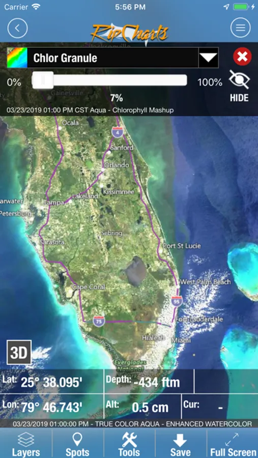
Chlorophyll
Chlorophyll/Cloud mashups
Chlorophyll composites
True Color
Altimetry
Currents
Salinity
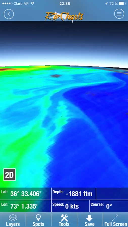
Bathymetry
Map Features:
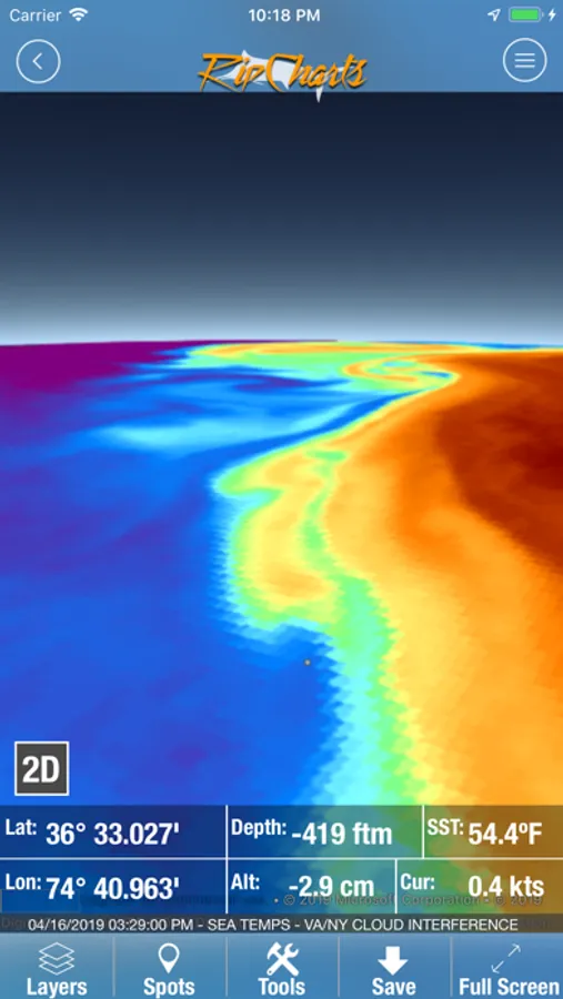
Use the multi touch map to zoom, pan, view waypoints, and overlay additional data layers to gain insight into where the most favorable fishing zones are located.
Mapping Tools:
Measure distances and headings between points
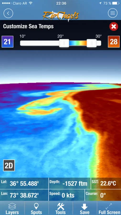
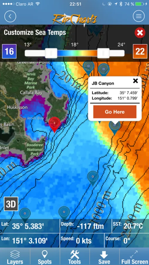
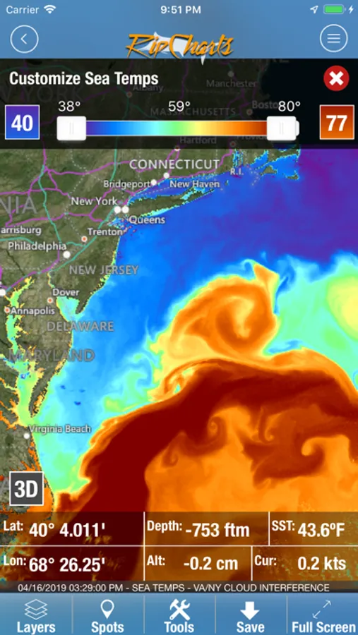
Dynamically customize temp/color ranges on SST maps to identify subtle breaks - powerful feature!
Overlay bathymetry, altimetry, currents, and Loran layers
Tap the map to receive point information (lat, lon, depth, SST)
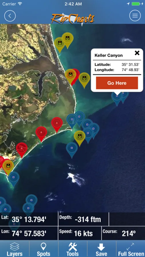
Popular waypoints and fishing hotspots come pre-loaded
Manage your personal waypoints (add, edit, delete)
Save imagery to your device for offline/offshore use
Show your position and navigate on saved imagery using GPS satellites
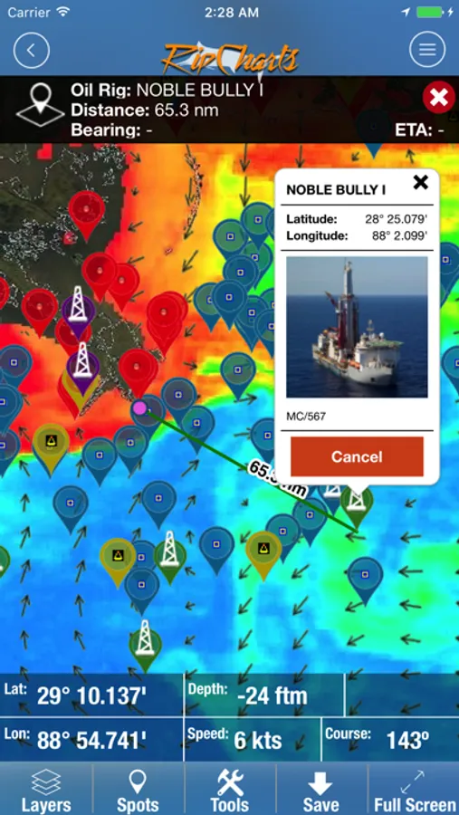
"Go Here" navigation with bearing, ETA, and speed displays
Floater oil rig positions updated twice daily (Gulf of Mexico only)
RipCharts Screenshots
Tap to Rate:
Reviews for RipCharts
wmccann89
Great App
Great SST App. Plus many more features.
Sweet on G
My Go Yo App for Water Temp Breaks
I got this app 3 years ago and it way improved my accuracy to find blue water for tuna. This year I also started using it to find 57 degree water for salmon. Love the multiple shots I get over the day for a comprehensive trend of the water & currents. I use the layers & tools to find structure & distance. It’s the one app I pay for every year. I Love this app!