About RWY Check
RWY Check is designed to display the official maps & charts required for several categories of UAV / RPAS / RPA / UAS operation in Australia.
Data includes:
- VTC, VNC and WAC maps
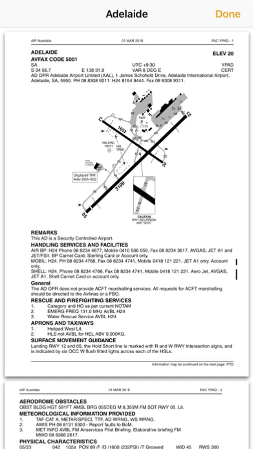
- ERSA
- AIP SUP
- TAF, TTF and NOTAMs
Features:
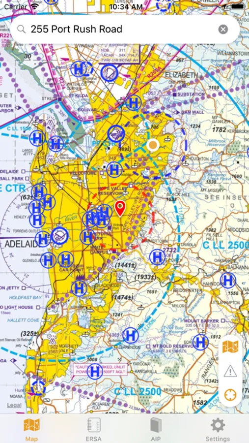
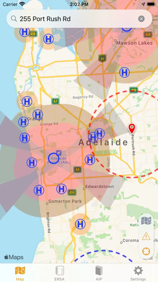
- Street Address Search
- 3.0 NM (5.5 km) overlay around controlled aerodrome boundaries
- Departure and Approach overlays for controlled aerodromes (iaw CASR Part 101)
- 1.5 NM diameter boundaries around HLS
- 3.0 NM circle around user position + street address results
- Ruler (hold 2 fingers on map)
If you have an existing OzRunways or RWY subscription, it will work with your existing UserID.
Otherwise start the app and create a trial.
Visit help.ozrunways.com for support and feedback.
Note: Continued use of GPS running in the background can dramatically decrease battery life.
Data includes:
- VTC, VNC and WAC maps
- ERSA
- AIP SUP
- TAF, TTF and NOTAMs
Features:
- Street Address Search
- 3.0 NM (5.5 km) overlay around controlled aerodrome boundaries
- Departure and Approach overlays for controlled aerodromes (iaw CASR Part 101)
- 1.5 NM diameter boundaries around HLS
- 3.0 NM circle around user position + street address results
- Ruler (hold 2 fingers on map)
If you have an existing OzRunways or RWY subscription, it will work with your existing UserID.
Otherwise start the app and create a trial.
Visit help.ozrunways.com for support and feedback.
Note: Continued use of GPS running in the background can dramatically decrease battery life.
RWY Check Screenshots
Tap to Rate: