AppRecs review analysis
AppRecs rating 4.4. Trustworthiness 0 out of 100. Review manipulation risk 0 out of 100. Based on a review sample analyzed.
★★★★☆
4.4
AppRecs Rating
Ratings breakdown
5 star
60%
4 star
20%
3 star
20%
2 star
0%
1 star
0%
What to know
✓
High user satisfaction
80% of sampled ratings are 4+ stars (4.4★ average)
About vSite AR
Construction Management for Subsurface Infrastructure
Real-time visibility into progress, quantities, and profitability.
vSite simplifies and de-risks underground utility work by making it easy to understand, document, and track projects in the field. On the back end, it delivers real-time insights—powered by AI, AR, and phone-based 3D capture—to keep quantities, costs, and updates accurate and current.
What teams can do with vSite:
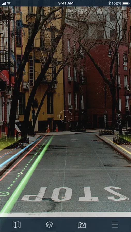
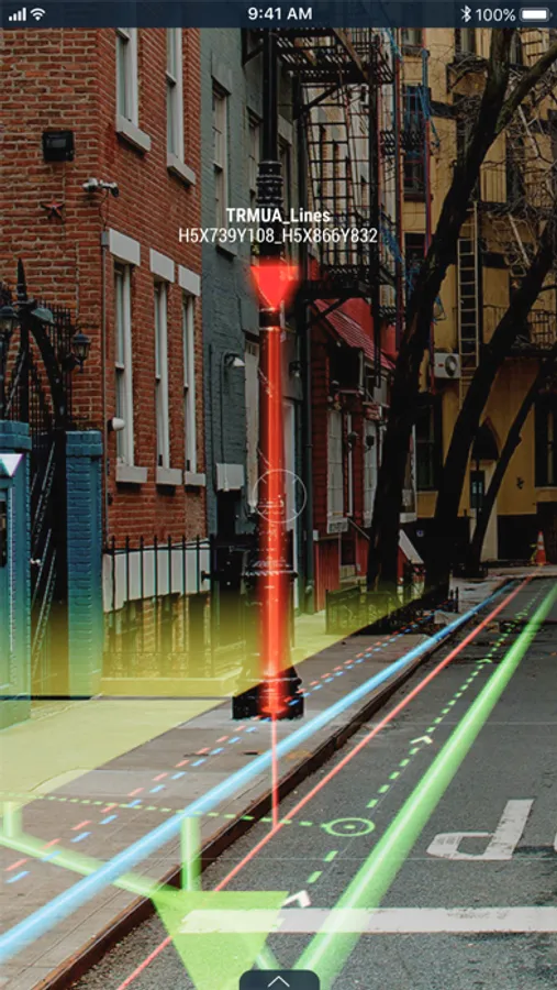
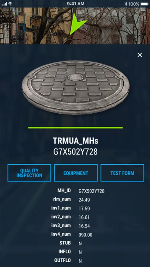
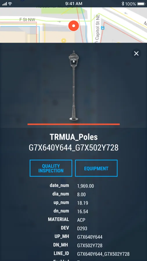
- Get instant answers in the field — open the latest drawings and utility data, visualize with AR, and capture 3D test pits/as-builts in minutes.
- Track production & costs automatically — reconcile utilization, quantities, and spend against estimates without spreadsheets.
- Stay on schedule with fewer errors — AI-powered QA/QC, tolerance checks, and alerts reduce rework and delays.
- Collaborate seamlessly — owners, engineers, locators, and contractors work from the same source of truth via web and mobile.
A single easy-to-use toolbox:
Stop juggling scanning apps, data collectors, BIM viewers, time sheets, and CSV exports. vSite unifies them into a single, intuitive platform that integrates with Autodesk Construction Cloud, Bentley iTwin, Esri ArcGIS, and other leading systems, simplifying your stack and boosting efficiency.
AI-Powered efficiency, AR-grade precision:
vSite’s AI automates manual documentation and performs real-time quality checks, while construction-grade AR guides field operations with trench-ready accuracy.
Used on hundreds of utility projects, vSite helps teams track progress, ensure quality, reduce line-strike risk, and prevent delays, so jobs finish on time and on budget.Take your infrastructure projects to the next level with vSite AR. Download today!
Real-time visibility into progress, quantities, and profitability.
vSite simplifies and de-risks underground utility work by making it easy to understand, document, and track projects in the field. On the back end, it delivers real-time insights—powered by AI, AR, and phone-based 3D capture—to keep quantities, costs, and updates accurate and current.
What teams can do with vSite:
- Get instant answers in the field — open the latest drawings and utility data, visualize with AR, and capture 3D test pits/as-builts in minutes.
- Track production & costs automatically — reconcile utilization, quantities, and spend against estimates without spreadsheets.
- Stay on schedule with fewer errors — AI-powered QA/QC, tolerance checks, and alerts reduce rework and delays.
- Collaborate seamlessly — owners, engineers, locators, and contractors work from the same source of truth via web and mobile.
A single easy-to-use toolbox:
Stop juggling scanning apps, data collectors, BIM viewers, time sheets, and CSV exports. vSite unifies them into a single, intuitive platform that integrates with Autodesk Construction Cloud, Bentley iTwin, Esri ArcGIS, and other leading systems, simplifying your stack and boosting efficiency.
AI-Powered efficiency, AR-grade precision:
vSite’s AI automates manual documentation and performs real-time quality checks, while construction-grade AR guides field operations with trench-ready accuracy.
Used on hundreds of utility projects, vSite helps teams track progress, ensure quality, reduce line-strike risk, and prevent delays, so jobs finish on time and on budget.Take your infrastructure projects to the next level with vSite AR. Download today!
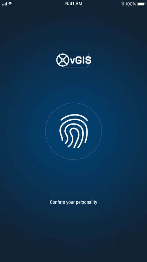
vSite AR Screenshots
Tap to Rate: