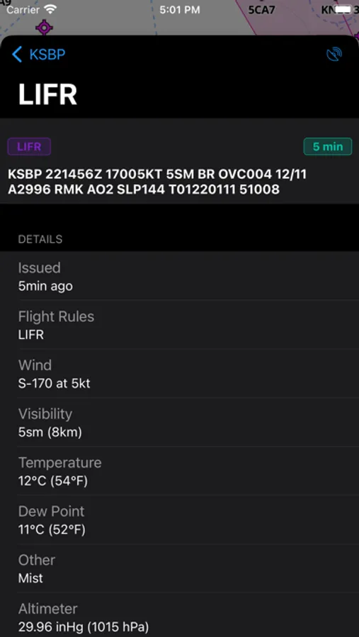
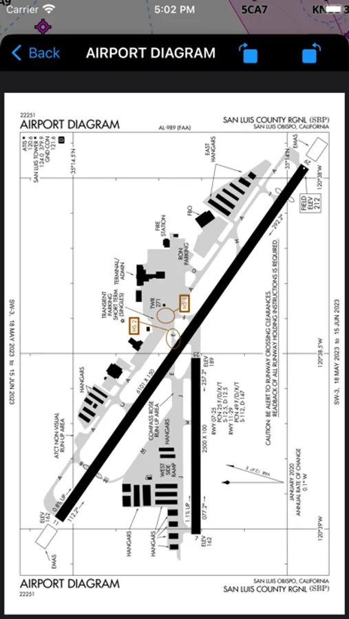
With this navigation app, you can track your real-time position on detailed aeronautical maps and access live PilotEdge traffic and ATC audio. Includes multiple map styles, weather overlays, FAA procedures, and radio frequency controls.
AppRecs review analysis
AppRecs rating 4.4. Trustworthiness 84 out of 100. Review manipulation risk 25 out of 100. Based on a review sample analyzed.
★★★★☆
4.4
AppRecs Rating
Ratings breakdown
5 star
80%
4 star
5%
3 star
5%
2 star
0%
1 star
10%
What to know
✓
Low review manipulation risk
25% review manipulation risk
✓
Credible reviews
84% trustworthiness score from analyzed reviews
✓
High user satisfaction
85% of sampled ratings are 4+ stars (4.5★ average)
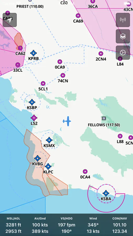
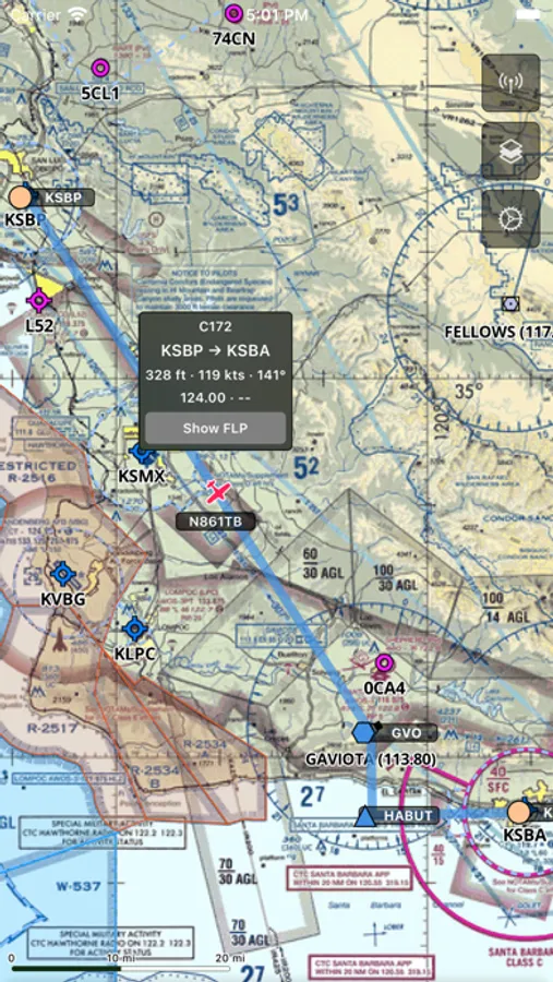
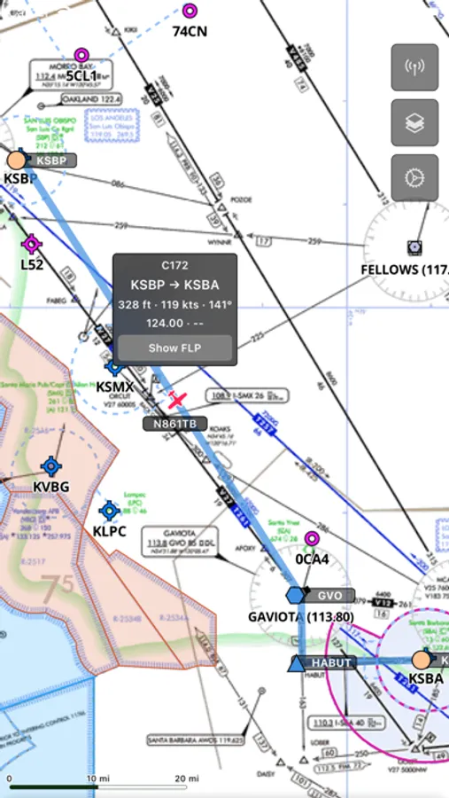
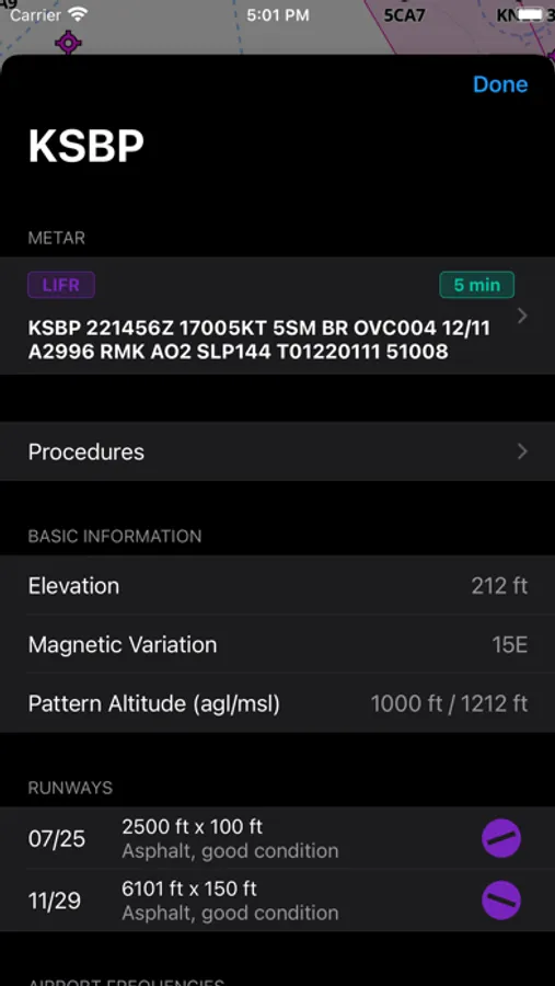
About AeroNavMap
Features
- X-Plane live position on the map
- Display many data from X-Plane
- Detailed aeronautical maps with updated nav cycles
- Different map styles (dark, light, terrain, satellite, aeronautical)
- FAA D-TTP Procedures
- Sectional VFR charts
- IFR high/low enroute charts
- Weather overlays
- Live PilotEdge traffic
- Live PilotEdge ATC audio
- Set the nav radio frequencies X-Plane by selecting them on the map
- ATIS
AeroNavMap Screenshots

Tap to Rate:
Reviews for AeroNavMap
kishvideo
Confused
Downloaded plugin and tried to connect, it’s not even on the official list of available efb’s on xplane’s website?
slow bing
Worked GREAT!
Easy to use. Put the plugin Xplane Resources(see instructions to get zip file containing plugin ). Up in running in 15 minutes after finding this app. Have a Win 7 machine running XP11 easily connected to my iPad. Terrific Ap. 😊