AppRecs review analysis
AppRecs rating 3.9. Trustworthiness 80 out of 100. Review manipulation risk 20 out of 100. Based on a review sample analyzed.
★★★☆☆
3.9
AppRecs Rating
Ratings breakdown
5 star
59%
4 star
15%
3 star
4%
2 star
7%
1 star
15%
What to know
✓
Low review manipulation risk
20% review manipulation risk
✓
Credible reviews
80% trustworthiness score from analyzed reviews
✓
Good user ratings
74% positive sampled reviews
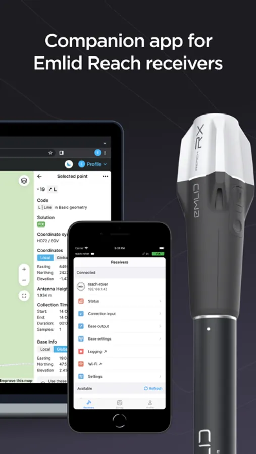
About Emlid Flow
The app has Free and Pro plans for a wide range of applications, from ground control point collection to topographic mapping and earthworks.
What you get with the free version:
- Full control of your receivers: set up base and rover, update, configure RTK and PPK.
- Point collection and stakeout.
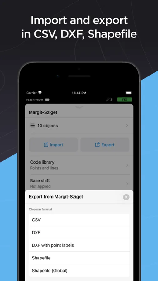
- Import/Export CSV, DXF, KML, or Shapefile files.
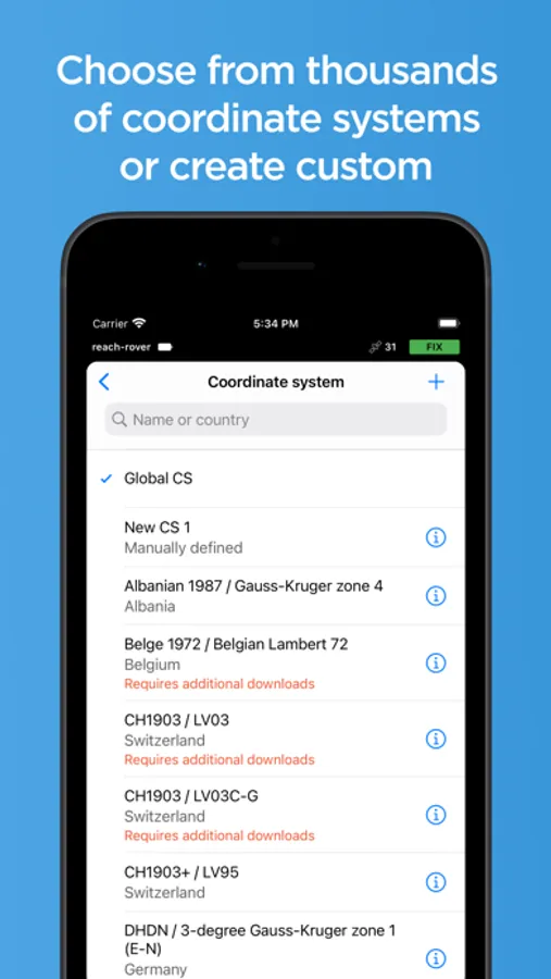
- Built-in coordinate system library with over 1000 systems.
- Ability to create custom coordinate systems.
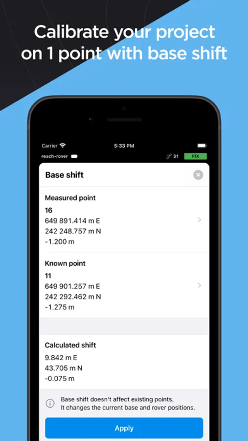
- Base shift.
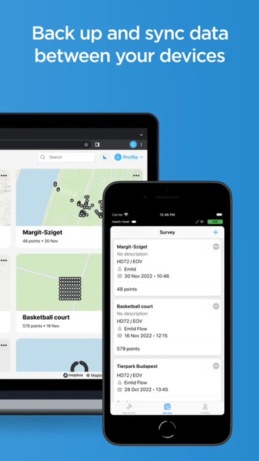
- Cloud sync with Emlid Flow 360.
- Team collaboration with up to 10 members.
Emlid Flow 360 is the web platform where you can access all data from the app and vice versa! Sync works instantly, allowing you to prepare, manage, and export projects in the office without manual file transfers and even with the receiver at hand.
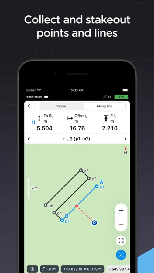
For more advanced survey workflows, Emlid Flow offers Pro Plan:
- Collect and stakeout lines and polygons.
- Stakeout reports and collect rules for accuracy control.
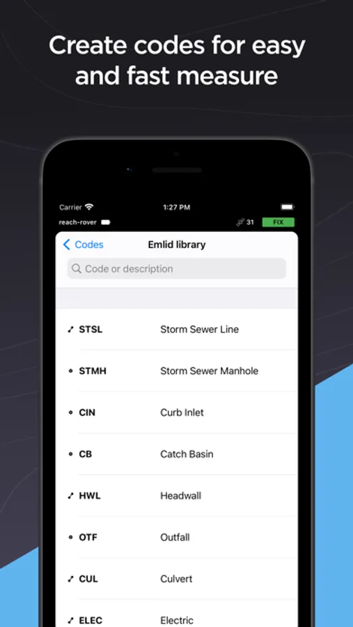
- Survey codes to better differentiate data.
- DTM support.
- Auto collection tool to free your hands.
- Inverse & Traverse for geometry calculations.
- Team collaboration with an unlimited number of members.
And much more with continuous updates! Try Pro Plan with a 30-day trial available on all platforms.
Terms of use: https://emlid.com/legal/#apps-terms
Privacy Policy: https://emlid.com/legal/#privacy
Emlid Flow Screenshots
Tap to Rate:
Reviews for Emlid Flow
bm-nospam
So Far, So Good
I’ve been using this app quite a bit lately with my Emlid Reach RS3 GNSS receivers and, overall, I’m pretty happy with it. My only gripes are: 1) I’m not at all a fan of subscription-based services, and the free version just doesn’t have all the features I need. I don’t mind supporting development of a product that I find useful but I would much rather pay a one-time fee and be done with it for a while. 2) The Bluetooth and WiFi connectivity can be flakey and the connection sometimes drops for no apparent reason or the app can’t find the receiver. Also, if a Reach receiver is joined to one WiFi network and then moved to another network, it usually doesn’t connect correctly without a reboot. I’m not sure if the problem is with something in my network setup or the device firmware or something else but it can be a problem. This is my first GNSS RTK equipment so I don’t have anything to compare it to but, in general, I like this app and hardware and it seems to keep getting better.
misturtea
Latest update broke data export-RESOLVED!
UPDATE: Reached out to support and was able to resolve the issue. App is working as normal and able to provide needed data. Support was both quick to respond and very helpful. ORIGINAL: Used to be able to export DXF with point labels and view data within CAD seamlessly. Now with the updated export function, data is garbled and ununsable. Basically this makes the units themselves useless. Once the export feature is fixed, will update review. For now, word of advice, if it’s working, don’t update