Propeller Mobile: 3D mapping
Propeller Aerobotics Pty Ltd
4.6 ★
9 ratings
Free
AppRecs review analysis
AppRecs rating 4.2. Trustworthiness 75 out of 100. Review manipulation risk 23 out of 100. Based on a review sample analyzed.
★★★★☆
4.2
AppRecs Rating
Ratings breakdown
5 star
89%
4 star
0%
3 star
0%
2 star
0%
1 star
11%
What to know
✓
Low review manipulation risk
23% review manipulation risk
✓
Credible reviews
75% trustworthiness score from analyzed reviews
✓
High user satisfaction
89% of sampled ratings are 5 stars
About Propeller Mobile: 3D mapping
Propeller Mobile is a 3D site inspection app built to keep field crews connected, aligned, and in control. With your job site in your pocket, Propeller Mobile supports real-time navigation, site checks, and reality capture, empowering faster decisions and keeping projects on track.
More than just a map, Propeller Mobile connects every person on-site to the data they need—enabling teams to move faster, collaborate smarter, and drive results.
Why Propeller Mobile?
• Stay aligned, wherever you are: Turn your mobile device into a powerful site inspection tool to help you map your next move
• Eliminate bottle necks: Verify, document, and adjust plans directly from the field to prevent delays and unnecessary office trips
• Keep your projects on track: From live navigation to high-accuracy measurements, you’ll translate field data and designs into decisions
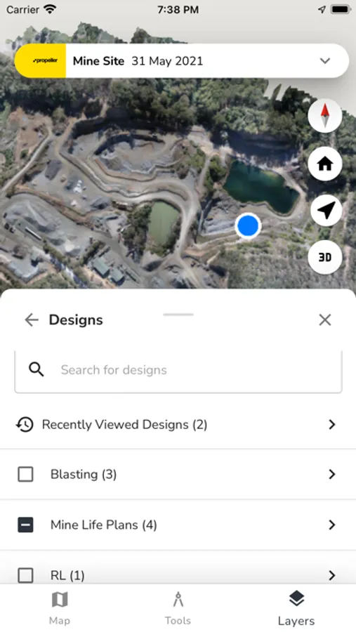
Key features:
• Live navigation: Instantly see your real-time position relative to designs and site features
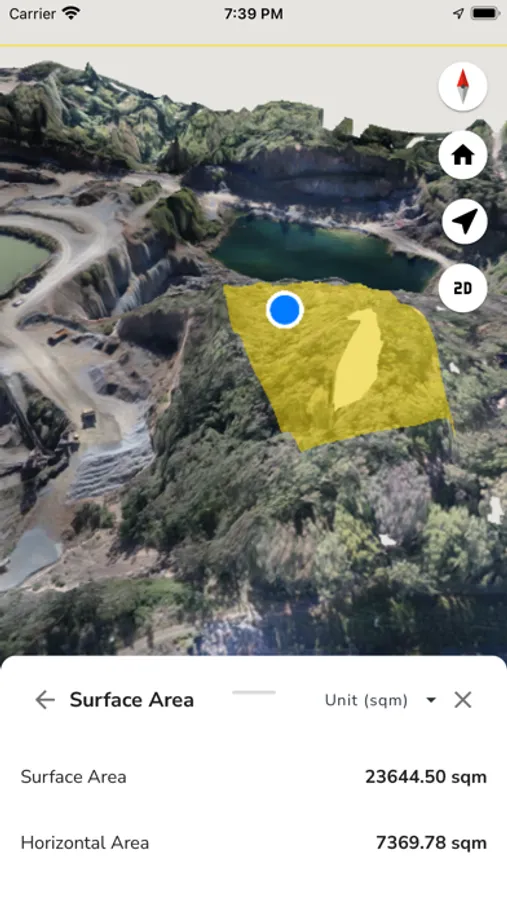
• 3D site mapping: Explore a digital twin of your site in 3D or 2D for informed decision-making
• Media documentation: Pin images and 360° photos to the map to document conditions and share with office teams
• Alignments: Measure and track your live position along alignments and stations/chainages
• Grade checking: Assess grades as degrees, percentages, or ratios
• Cut-fill analysis: Compare surfaces to monitor volume changes and progress over time
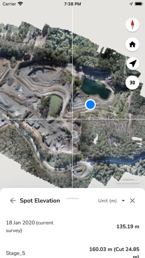
• Point of interest tagging: Drop points to check elevations or add notes for clarity
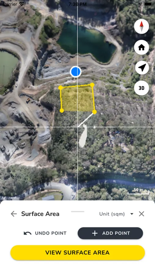
• Surface area measurement: Quickly calculate areas within any shape
• Stockpile volumes: Measure stockpile volumes and create reports in seconds
• Cross-section analysis: Generate cross-section charts of designs and surveys
• Distance measurement: Measure point-to-point distances with precision
• Elevation tracking: Monitor elevation changes and height differences
More than just a map, Propeller Mobile connects every person on-site to the data they need—enabling teams to move faster, collaborate smarter, and drive results.
Why Propeller Mobile?
• Stay aligned, wherever you are: Turn your mobile device into a powerful site inspection tool to help you map your next move
• Eliminate bottle necks: Verify, document, and adjust plans directly from the field to prevent delays and unnecessary office trips
• Keep your projects on track: From live navigation to high-accuracy measurements, you’ll translate field data and designs into decisions
Key features:
• Live navigation: Instantly see your real-time position relative to designs and site features
• 3D site mapping: Explore a digital twin of your site in 3D or 2D for informed decision-making
• Media documentation: Pin images and 360° photos to the map to document conditions and share with office teams
• Alignments: Measure and track your live position along alignments and stations/chainages
• Grade checking: Assess grades as degrees, percentages, or ratios
• Cut-fill analysis: Compare surfaces to monitor volume changes and progress over time
• Point of interest tagging: Drop points to check elevations or add notes for clarity
• Surface area measurement: Quickly calculate areas within any shape
• Stockpile volumes: Measure stockpile volumes and create reports in seconds
• Cross-section analysis: Generate cross-section charts of designs and surveys
• Distance measurement: Measure point-to-point distances with precision
• Elevation tracking: Monitor elevation changes and height differences
Propeller Mobile: 3D mapping Screenshots
Tap to Rate:
Reviews for Propeller Mobile: 3D mapping
MichaelGCC
Great for Heavy Civil
Add designs and measurements!
AGS5555
Can’t log in
App won’t let me log in. Tap “Sign In” and nothing happens. Button flashes but I can hit it a million times with no result.