About Radar AR - Augmented Reality
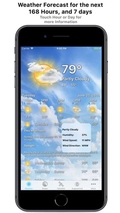
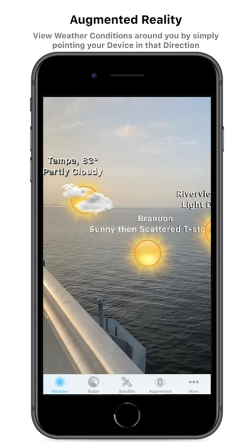
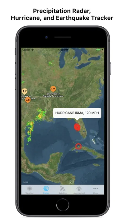
Introducing Radar AR: The most beautiful and accurate Doppler Radar and Weather app, that also shows you Weather conditions around you in Augmented Reality. Simply hold your Device up in the direction of a City or Tropical Cyclone, to see what Weather conditions are like in that area! In addition to our groundbreaking Augmented Reality feature, Radar AR includes a full Local Weather Forecast, Interactive Radar, Full color Satellites, Local Radar, Regional Radar, and more! Local Weather includes Current Weather, a 7 Day Forecast, and an Hour-by-Hour forecast for an unheard-of 168 Hours. If you want to view more information for a Day or Hour, simply Touch it and additional data is unobtrusively displayed. And with our Interactive Radar feature, viewing Animated Precipitation, Earthquakes, and even Tropical Cyclones is literally a breeze.
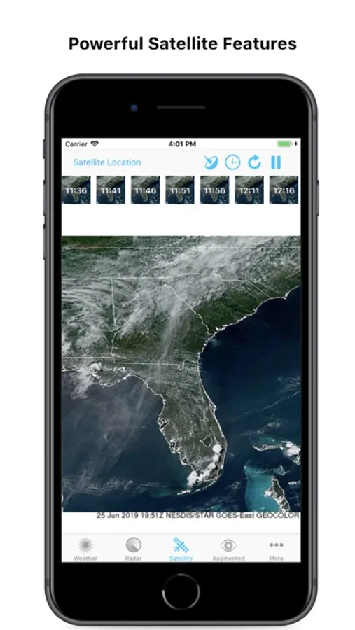
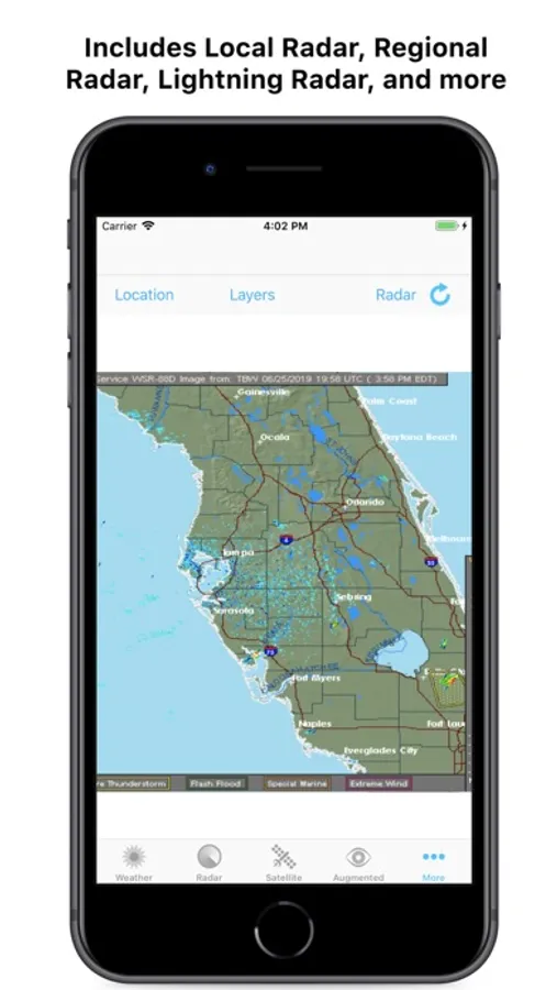
Radar AR also offers live Full Color Satellite animations made possible by the newly launched and operational GOES-16 and GOES-17 Satellites which offer 17 Radar Viewing Modes per Satellite -- with each Satellite being operational until the year 2036. While our Local Radar feature is based upon hundreds of NEXRAD Doppler Radars located throughout the U.S., with each Radar offering 6 Radar Viewing modes per Location. While the Regional Radar shows you Precipitation in your Local State and immediate surrounding States. And finally the Lightning Radar shows Lightning Strike Intensity in the region of your choosing. With hundreds of Radars and Satellites at your disposal, Radar AR offers more Radars than any other app!
With our Local Weather feature, you can simply Touch a Day to view a detailed Day/Night Forecast for that Day; or Touch an Hour to view Conditions, Wind Speed, Humidity, and more. And in addition to offering beautiful Daytime Graphics, Radar AR knows when it’s nighttime outside and updates to beautiful Nighttime Graphics as well. Radar AR also automatically knows when you’re on Land or by/on the Water, and morphs from a Weather Forecast to a Marine Forecast when it detects you’re by the Water! With all these features, Radar AR takes the concept of the Radar App, modernizes it, and brings it into the next decade and beyond!
Advanced yet Easy to Use Features
- Current Weather, Hour-by-Hour Forecast for the next 168 Hours, and 7 Day Forecast
- Interactive Radar displays Animated Precipitation (U.S. only), current Tropical Cyclones, and Earthquakes for the past 24 hours
- Full Color Satellite features 30 Locations for you to Zoom in on, with 17 Radar Modes per Location
- Local Radar features hundreds of Doppler Radar locations to choose from, with 6 Radar Modes per Location
- Augmented Reality (AR) shows you current Weather conditions around you
- Simply hold your device up in the direction of a City or Tropical Cyclone to see what Weather conditions are like in that direction
- AR displays Weather conditions for Cities within a 25 mile radius of your location, with populations greater than 50,000
- AR displays current Atlantic/Pacific Tropical Cyclones
- Local Weather includes Auto-Updating Daytime/Nighttime Graphics
- For Local Weather, Touch Hour or Day for more Detailed Information
- Local Weather Forecast feature morphs into a Local Marine Forecast when it detects you’re on/near the Ocean/Water
- Regional Radar shows Precipitation in your local Region
- Lightning Radar shows Lightning Strike Intensity for various locations
- Works great in iPhone Landscape Orientation
