AppRecs review analysis
AppRecs rating 4.5. Trustworthiness 65 out of 100. Review manipulation risk 28 out of 100. Based on a review sample analyzed.
★★★★☆
4.5
AppRecs Rating
Ratings breakdown
5 star
94%
4 star
6%
3 star
0%
2 star
0%
1 star
0%
What to know
✓
Low review manipulation risk
28% review manipulation risk
✓
High user satisfaction
94% of sampled ratings are 5 stars
About GNSS Log App
GNSS Obs - Professional Observation Logs
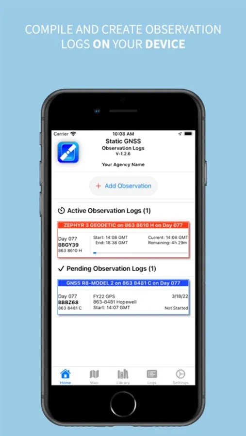
GNSS Obs is the professional solution for documenting static GNSS observations. Designed for surveyors, geodesists, and geospatial professionals, it eliminates transcription errors and ensures consistent, accurate project documentation.
Replace Paper Logs with Digital Precision
Stop relying on paper forms, fillable PDFs, and handwritten notes. GNSS Obs provides a structured workflow that promotes accuracy and completeness while maintaining the professional standards required for geodetic control projects.
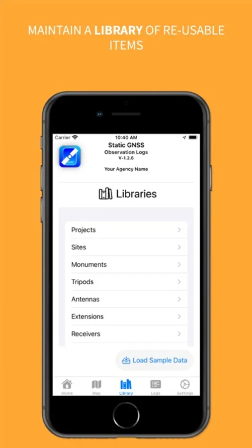
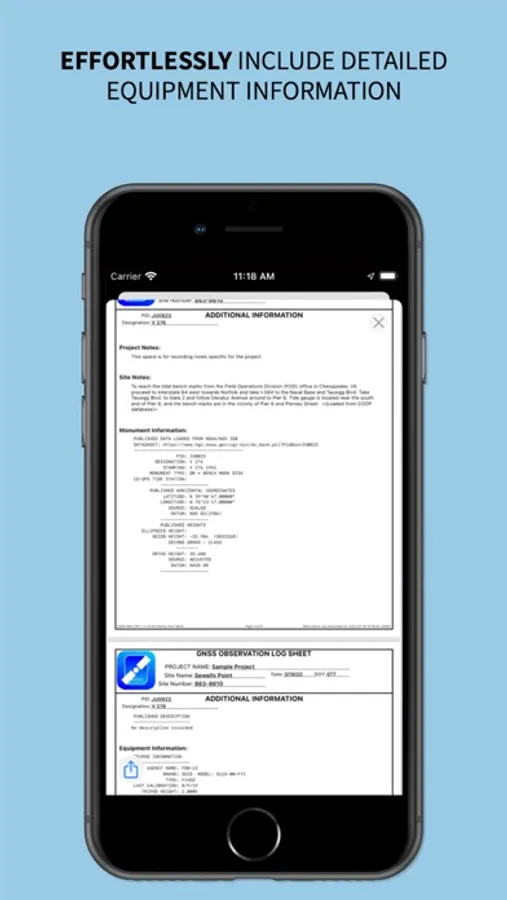
Comprehensive Equipment Management
Build and maintain your equipment library with support for:
• Fixed height, collapsible and adjustable tripods
• Antenna extensions
• Integrated antenna/receiver configurations
• Complete metadata for NGS compliance
Import and export library items to share standardized configurations across your organization.
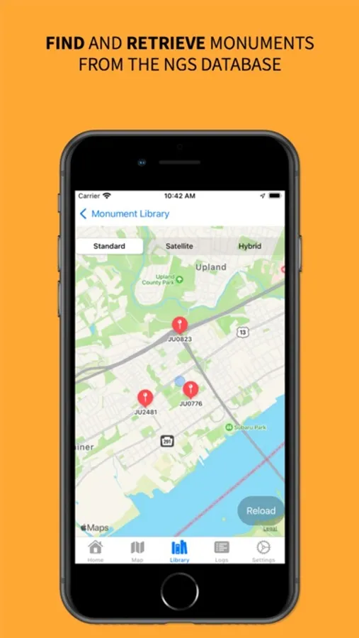
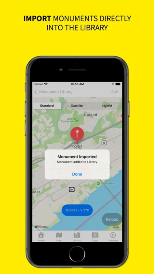
Direct NGS Database Integration
Access public monument data directly from:
• National Geodetic Survey Integrated Database (IDB)
• OPUS Share Database
• NOAA CO-OPS Stations
Monuments can also be entered manually when working with local control networks.
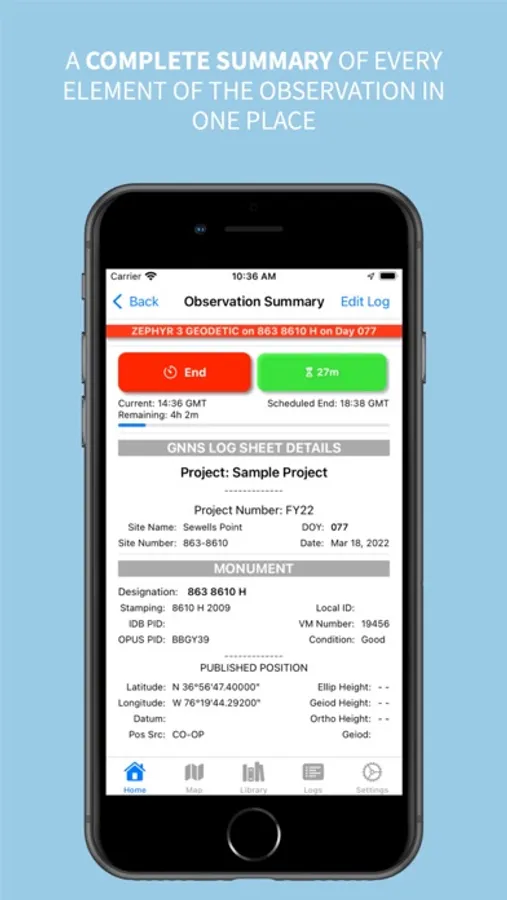
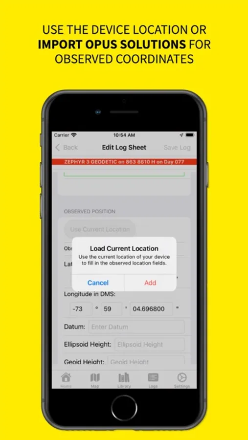
OPUS Solution Integration
Import OPUS solution emails to automatically populate:
• Observed positions
• Actual observation times
• Session statistics
• Solution quality metrics
Include the complete OPUS solution in your PDF output for comprehensive project records.
Essential Field Tools
• Session timers with local notifications
• Automatic weather recording at session start and end
• Photo documentation with NGS-compliant naming
• Satellite visibility diagrams using device motion sensors
• Real-time editing before, during, and after observations
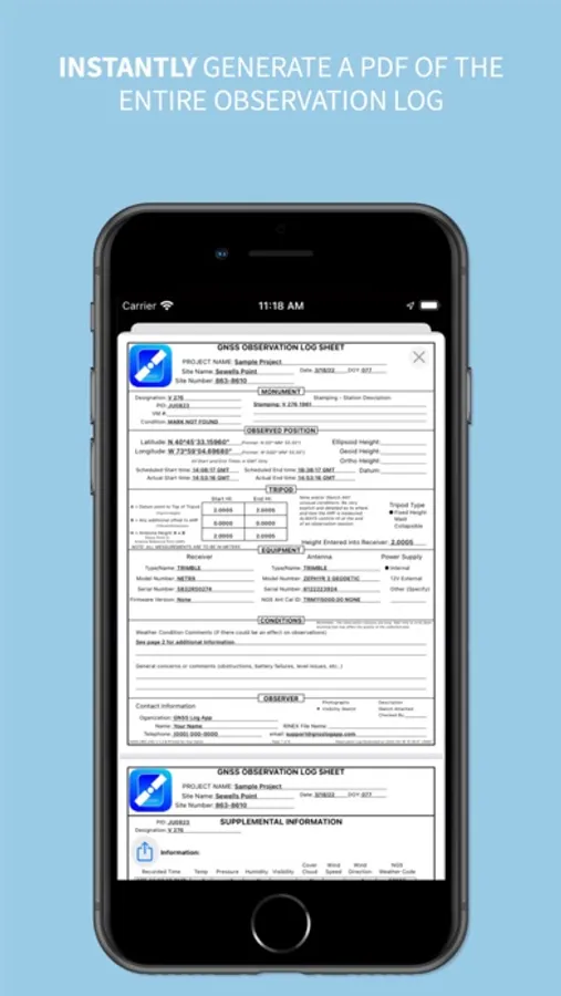
Professional Documentation
Export publication-ready PDF observation logs featuring:
• Your company logo and branding
• Complete equipment configurations
• Weather conditions
• Site photographs
• Visibility diagrams
• OPUS solutions
Share via Files, email, AirDrop, or messaging.
Note: This app documents observations and does not communicate with GNSS receivers. It is designed as a field companion for recording session metadata and producing professional deliverables.
Privacy First
All data remains on your device. No account required. Full control over exports and backups.
Terms of Use (EULA): https://www.apple.com/legal/internet-services/itunes/dev/stdeula/
GNSS Obs is the professional solution for documenting static GNSS observations. Designed for surveyors, geodesists, and geospatial professionals, it eliminates transcription errors and ensures consistent, accurate project documentation.
Replace Paper Logs with Digital Precision
Stop relying on paper forms, fillable PDFs, and handwritten notes. GNSS Obs provides a structured workflow that promotes accuracy and completeness while maintaining the professional standards required for geodetic control projects.
Comprehensive Equipment Management
Build and maintain your equipment library with support for:
• Fixed height, collapsible and adjustable tripods
• Antenna extensions
• Integrated antenna/receiver configurations
• Complete metadata for NGS compliance
Import and export library items to share standardized configurations across your organization.
Direct NGS Database Integration
Access public monument data directly from:
• National Geodetic Survey Integrated Database (IDB)
• OPUS Share Database
• NOAA CO-OPS Stations
Monuments can also be entered manually when working with local control networks.
OPUS Solution Integration
Import OPUS solution emails to automatically populate:
• Observed positions
• Actual observation times
• Session statistics
• Solution quality metrics
Include the complete OPUS solution in your PDF output for comprehensive project records.
Essential Field Tools
• Session timers with local notifications
• Automatic weather recording at session start and end
• Photo documentation with NGS-compliant naming
• Satellite visibility diagrams using device motion sensors
• Real-time editing before, during, and after observations
Professional Documentation
Export publication-ready PDF observation logs featuring:
• Your company logo and branding
• Complete equipment configurations
• Weather conditions
• Site photographs
• Visibility diagrams
• OPUS solutions
Share via Files, email, AirDrop, or messaging.
Note: This app documents observations and does not communicate with GNSS receivers. It is designed as a field companion for recording session metadata and producing professional deliverables.
Privacy First
All data remains on your device. No account required. Full control over exports and backups.
Terms of Use (EULA): https://www.apple.com/legal/internet-services/itunes/dev/stdeula/
GNSS Log App Screenshots
Tap to Rate:
Reviews for GNSS Log App
PDM1970
Best Survey App
I love this app!!! It's very user friendly. Helps keep all my records in order. Great for archiving data and will help others down the road, after I’ve retired. This is the best app/log for any static survey.