With this GPS+Weather Tracking App, you can record location data, view current weather, and export track information. Includes track recording limits, data analysis tools, and import/export features.
AppRecs review analysis
AppRecs rating 4.4. Trustworthiness 66 out of 100. Review manipulation risk 17 out of 100. Based on a review sample analyzed.
★★★★☆
4.4
AppRecs Rating
Ratings breakdown
5 star
75%
4 star
9%
3 star
4%
2 star
3%
1 star
10%
What to know
✓
Low review manipulation risk
17% review manipulation risk
✓
High user satisfaction
83% of sampled ratings are 4+ stars (4.4★ average)
✓
Authentic reviews
Natural distribution, no red flags
About GeoTracker Lite
*** This version of GeoTracker can record up to 10 minutes or 10 kilometers per track, whichever comes first.
GeoTracker Lite is an ad-free, no-registration GPS+Weather Tracking App with many useful features:
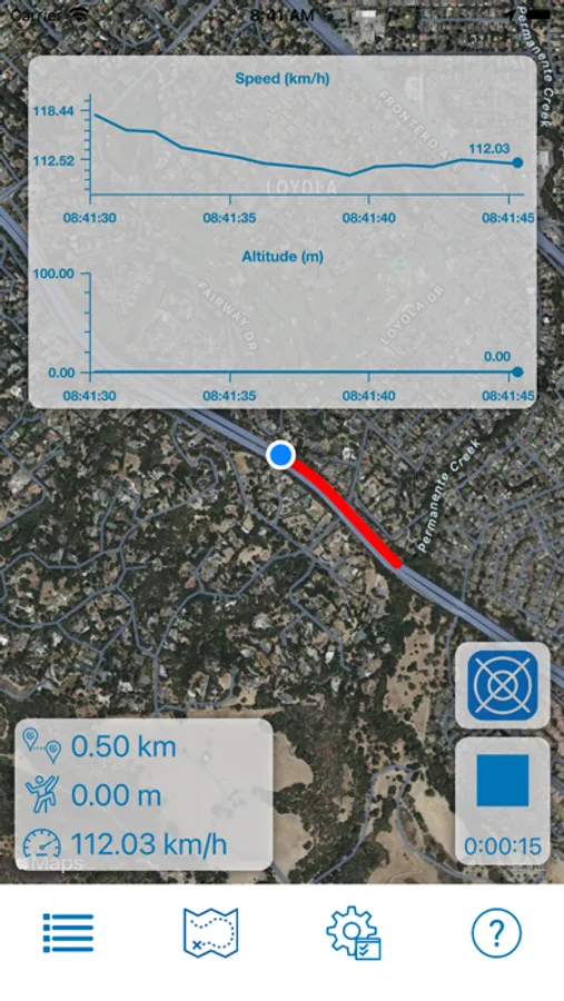
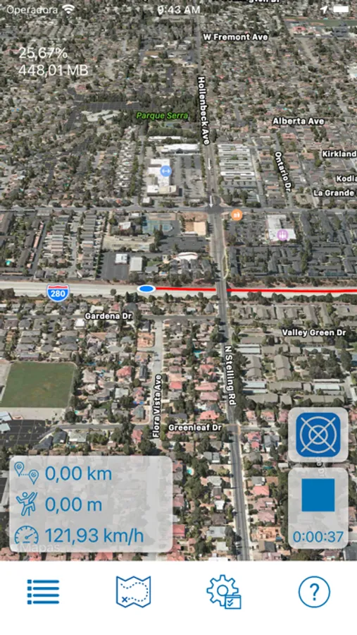
- Records your location, speed, altitude, heading, acceleration, g-force (if available) and atmospheric pressure (if available)
- Retrieves, displays and records current weather information (internet connection required)
- Plays recorded tracks at 1x, 2x, 4x, 8x and 16x speeds
- Get suggested routes/directions and use them as reference paths for your current activity
- Pause/Continue Tracking
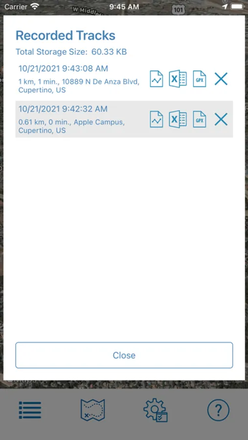
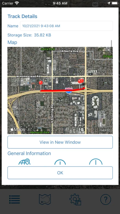
- Exports recorded track data to KMZ, GPX and XLSX files
- Create PDF Reports with Track Statistics, Marker/Bookmark Details and Charts
- Import tracks from external files
- Import/Create tracks from GPX files
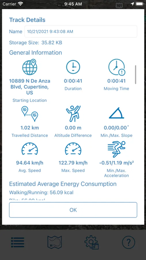
- View recorded track details: Distance Travelled, Moving duration, Avg/Max Speeds, Min/Max Acceleration, Min/Max Slope and more
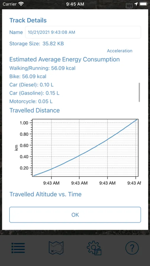
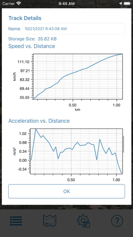
- Time charts: Distance, Speed, Altitude, Acceleration, G-Force (if available), Pressure (if available)
- Customize Distance, Speed, Acceleration, Altitude, Temperature and Pressure units
- Import/Export Backups from/to ZIP files
GeoTracker Lite is an ad-free, no-registration GPS+Weather Tracking App with many useful features:
- Records your location, speed, altitude, heading, acceleration, g-force (if available) and atmospheric pressure (if available)
- Retrieves, displays and records current weather information (internet connection required)
- Plays recorded tracks at 1x, 2x, 4x, 8x and 16x speeds
- Get suggested routes/directions and use them as reference paths for your current activity
- Pause/Continue Tracking
- Exports recorded track data to KMZ, GPX and XLSX files
- Create PDF Reports with Track Statistics, Marker/Bookmark Details and Charts
- Import tracks from external files
- Import/Create tracks from GPX files
- View recorded track details: Distance Travelled, Moving duration, Avg/Max Speeds, Min/Max Acceleration, Min/Max Slope and more
- Time charts: Distance, Speed, Altitude, Acceleration, G-Force (if available), Pressure (if available)
- Customize Distance, Speed, Acceleration, Altitude, Temperature and Pressure units
- Import/Export Backups from/to ZIP files
GeoTracker Lite Screenshots
Tap to Rate:
Reviews for GeoTracker Lite
zroosa’
Cell phone
This app doesn’t let me see another cell phone user… . It only lets me see mine that’s no good.
Indian pond
Review
Seems to be easy to use