AppRecs review analysis
AppRecs rating 4.5. Trustworthiness 0 out of 100. Review manipulation risk 0 out of 100. Based on a review sample analyzed.
★★★★☆
4.5
AppRecs Rating
Ratings breakdown
5 star
88%
4 star
0%
3 star
0%
2 star
0%
1 star
13%
What to know
✓
High user satisfaction
88% of sampled ratings are 5 stars
About GeoSizer
Geographic Comparison Made Easy!
GeoSizer aims to be the easiest way to compare the actual size and shape of one geographic feature (a country, state, province, etc.) to another.
It’s as easy as 3 steps:
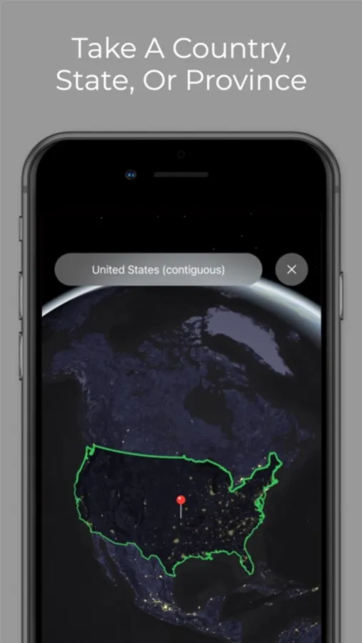
1. Select a geographic feature by either tapping on the map, or by using the “GO TO” button
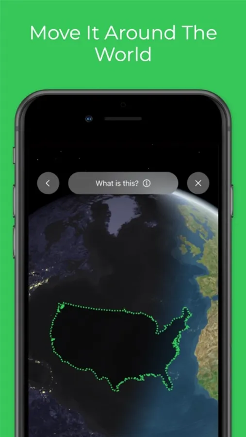
2. Once you’ve selected a feature, press a single button to take that shape and begin moving it around the world
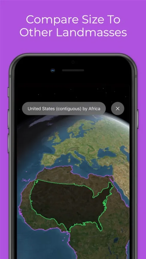
3. When you’ve decided where to place it, press another button to leave the shape there, and view the feature from new angles
And near-instantly you’ve got an accurate comparison right in front of you.
Discover the true size and shape of landmasses around the world!
GeoSizer aims to be the easiest way to compare the actual size and shape of one geographic feature (a country, state, province, etc.) to another.
It’s as easy as 3 steps:
1. Select a geographic feature by either tapping on the map, or by using the “GO TO” button
2. Once you’ve selected a feature, press a single button to take that shape and begin moving it around the world
3. When you’ve decided where to place it, press another button to leave the shape there, and view the feature from new angles
And near-instantly you’ve got an accurate comparison right in front of you.
Discover the true size and shape of landmasses around the world!
GeoSizer Screenshots
Tap to Rate: