3D Offline Maps: GPS tracker
SERGEI BEZDENEZHNYKH
4.6 ★
501 ratings
Free
In this GPS tracker app, you can view detailed 2D and 3D maps, download offline maps, and plan routes. Includes offline navigation, waypoint management, track creation, import, export, and sensor integration.
AppRecs review analysis
AppRecs rating 4.6. Trustworthiness 67 out of 100. Review manipulation risk 33 out of 100. Based on a review sample analyzed.
★★★★☆
4.6
AppRecs Rating
Ratings breakdown
5 star
80%
4 star
9%
3 star
5%
2 star
3%
1 star
3%
What to know
✓
High user satisfaction
80% of sampled ratings are 5 stars
✓
Authentic reviews
Natural distribution, no red flags
About 3D Offline Maps: GPS tracker
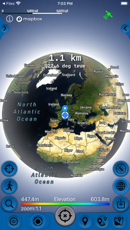
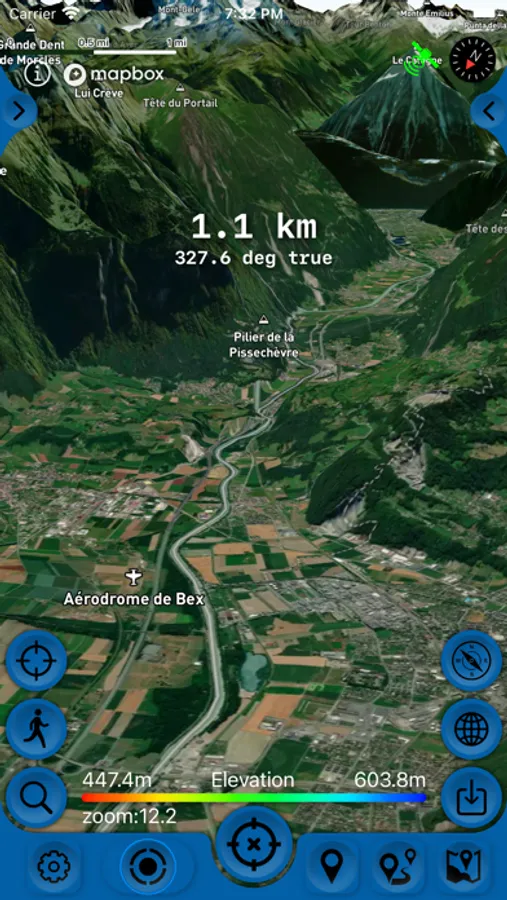
Detailed 2D and 3D maps, with the ability to download maps for offline navigation and comfortable travel without an Internet connection anywhere in the world!
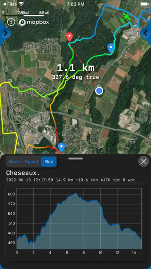
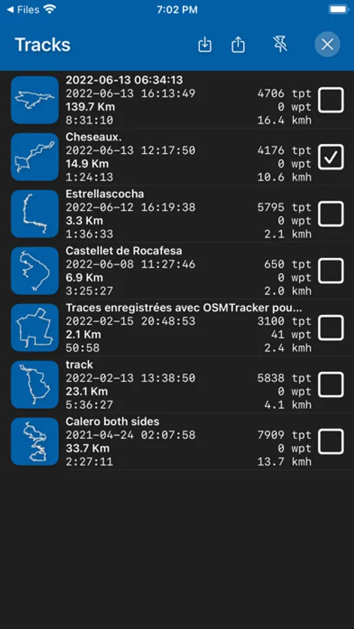
Choose and save your routes, create a collection of tracks with waypoints, share with friends, mark interesting places on the map, download ready-made tracks and waypoints in GPX format.
Create, import, export tracks with waypoints. Offline map support, no time limits, no ads.
The main functions of the application:
- compatible with Apple Silicon MacBook.
- work in the background.
- convenient and accelerated loading of maps.
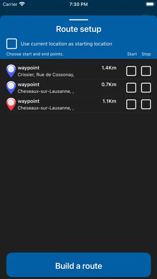
- route planner.
- pedometer with viewing data for the last three months (steps, distance).
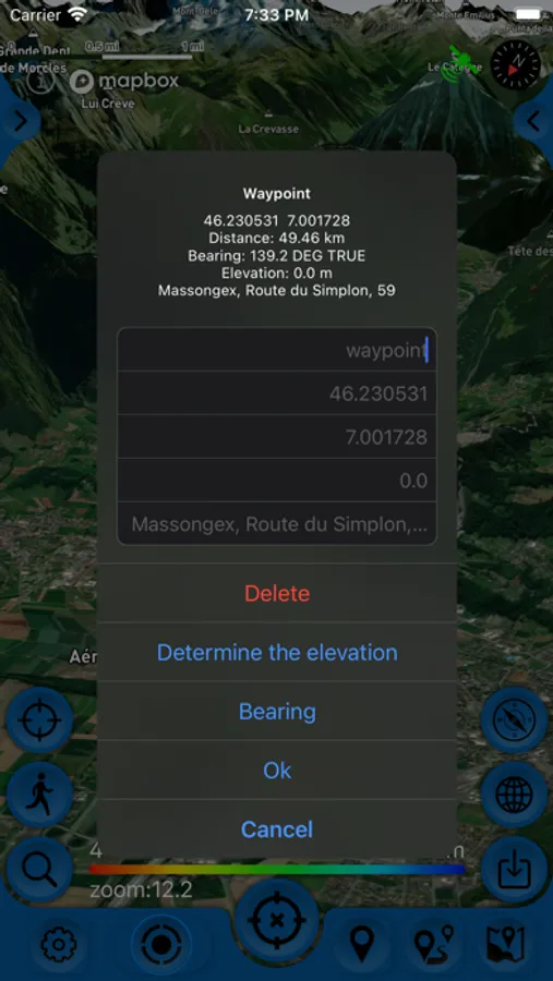
- determining the height of any waypoint.
- search by address.
- search by coordinates.
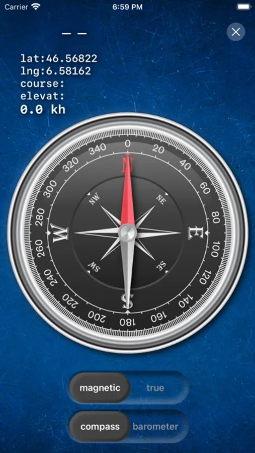
- compass.
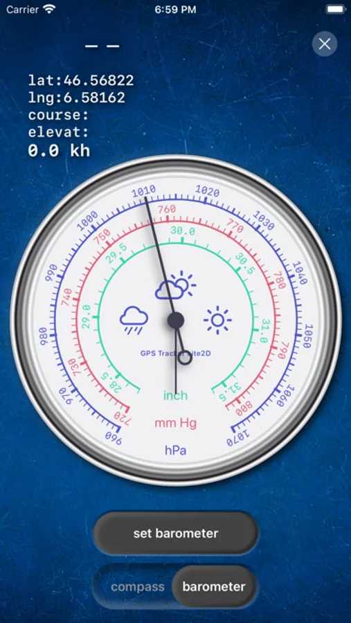
- barometer.
- processing and optimization of tracks.
- Linking tracks to the road network.
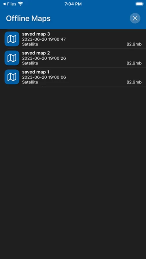
- Downloading and unlimited storage of travel area maps.
- Supports all methods of import and export with services, friends and applications in .gpx format available for your device.
- Color gradient for speed and altitude, if this information is in the imported track.
- Color gradient for speed and altitude for recorded tracks.
- Recording speed and altitude in the track.
- Terrain contours in outdoor mode
- Extended track information: average and maximum speed, track duration by time and distance, number of waypoints and number of steps.
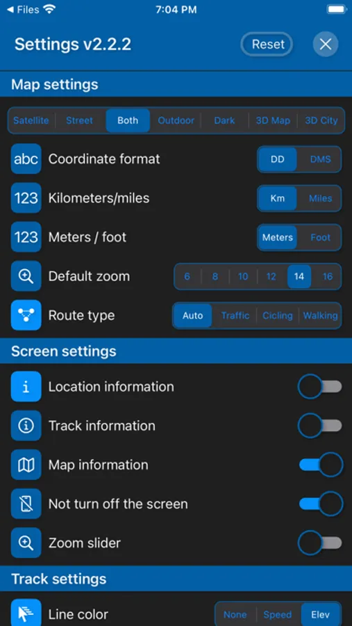
- Different units of measurement: miles, kilometers, feet, meters.
- Viewing one or more tracks in any application mode, including the mode of recording another track.
- Setting, editing, deleting waypoints in any application mode and in any place.
- Custom icons for waypoints.
- the ability to customize the track quality, distance filters, power saving mode.
- export and import tracks and waypoints to various services - Open Street Map and others.
- has a pointer to the target waypoint and shows the distance to it. Easy selection of the target waypoint in several ways.
- display additional information on the screen - scale, coordinates, altitude, speed, number of steps.
- shows the current distance traveled track and the time on the road or walk.
- has several map styles - satellite, streets, combined and dark.
- supports the dark theme.
- easy start and stop tracking in several ways.
- the ability to continue any previously recorded or imported track.
- several modes of map orientation - by phone title, by direction of travel, centering and north.
- the ability to tilt the map with a double pinch.
- quick and easy selection and viewing of saved tracks, waypoints and maps.
- speed and altitude graphs can be scaled and scrolled.
- in the settings there is a link to the user manual.
- Terms of Service: https://appsupport.store/terms/
- Privacy Policy: https://appsupport.store/privacy
Choose and save your routes, create a collection of tracks with waypoints, share with friends, mark interesting places on the map, download ready-made tracks and waypoints in GPX format.
Create, import, export tracks with waypoints. Offline map support, no time limits, no ads.
The main functions of the application:
- compatible with Apple Silicon MacBook.
- work in the background.
- convenient and accelerated loading of maps.
- route planner.
- pedometer with viewing data for the last three months (steps, distance).
- determining the height of any waypoint.
- search by address.
- search by coordinates.
- compass.
- barometer.
- processing and optimization of tracks.
- Linking tracks to the road network.
- Downloading and unlimited storage of travel area maps.
- Supports all methods of import and export with services, friends and applications in .gpx format available for your device.
- Color gradient for speed and altitude, if this information is in the imported track.
- Color gradient for speed and altitude for recorded tracks.
- Recording speed and altitude in the track.
- Terrain contours in outdoor mode
- Extended track information: average and maximum speed, track duration by time and distance, number of waypoints and number of steps.
- Different units of measurement: miles, kilometers, feet, meters.
- Viewing one or more tracks in any application mode, including the mode of recording another track.
- Setting, editing, deleting waypoints in any application mode and in any place.
- Custom icons for waypoints.
- the ability to customize the track quality, distance filters, power saving mode.
- export and import tracks and waypoints to various services - Open Street Map and others.
- has a pointer to the target waypoint and shows the distance to it. Easy selection of the target waypoint in several ways.
- display additional information on the screen - scale, coordinates, altitude, speed, number of steps.
- shows the current distance traveled track and the time on the road or walk.
- has several map styles - satellite, streets, combined and dark.
- supports the dark theme.
- easy start and stop tracking in several ways.
- the ability to continue any previously recorded or imported track.
- several modes of map orientation - by phone title, by direction of travel, centering and north.
- the ability to tilt the map with a double pinch.
- quick and easy selection and viewing of saved tracks, waypoints and maps.
- speed and altitude graphs can be scaled and scrolled.
- in the settings there is a link to the user manual.
- Terms of Service: https://appsupport.store/terms/
- Privacy Policy: https://appsupport.store/privacy
3D Offline Maps: GPS tracker Screenshots
Tap to Rate:
Reviews for 3D Offline Maps: GPS tracker
Mg Zaw
SAE
KZZ
da goo oo
Costly
Cost to much