AppRecs review analysis
AppRecs rating 4.5. Trustworthiness 58 out of 100. Review manipulation risk 31 out of 100. Based on a review sample analyzed.
★★★★☆
4.5
AppRecs Rating
Ratings breakdown
5 star
100%
4 star
0%
3 star
0%
2 star
0%
1 star
0%
What to know
✓
High user satisfaction
100% of sampled ratings are 5 stars
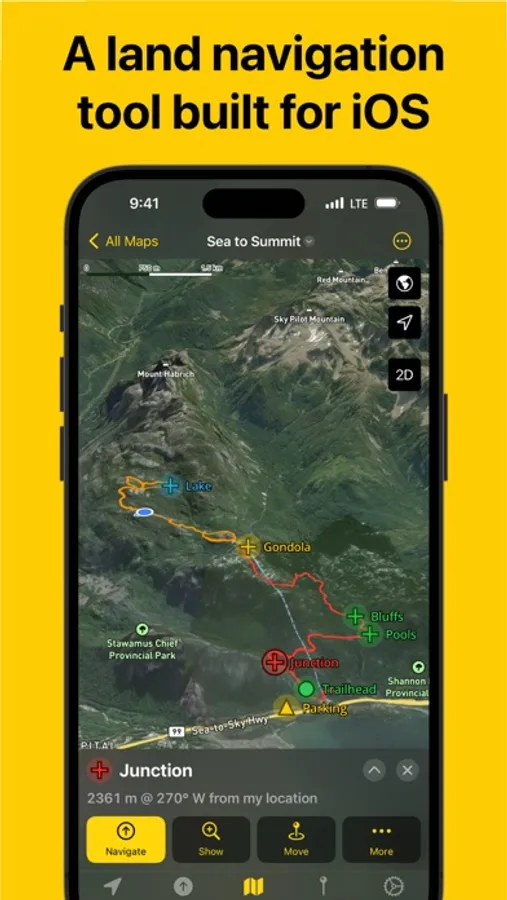
About Land Nav
A land navigation GPS and offline map app built for iOS. No ads. Privacy respected.
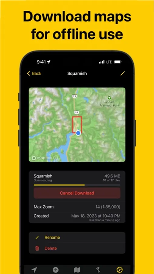
Land Nav will help you navigate the outdoors providing you with a GPS, compass, 3D topographic and satellite maps. Place a marker on the map and get a bearing to that location in seconds. Import GPX waypoints and tracks into a task specific map documents that are synced using iCloud to all your devices. Downloadable maps allow use while offline.
## Main Features
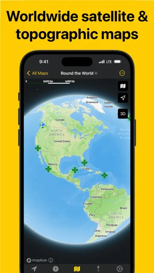
- Worldwide 3D topographic and satellite maps powered by Open Street map
- Download maps for online use
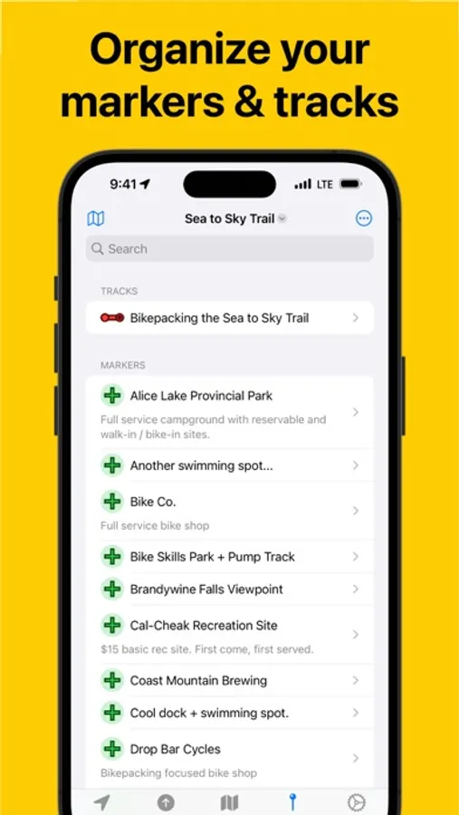
- Organize tracks and markers in task based documents
- Designed from the ground for iOS using the latest Apple technologies
- Universal app supports iPhone and iPad with macOS coming soon.
## Additional Features
- Compass with inclinometer
- Show sunset & sunrise times, moon phase, and magnetic declination
- GPX import/export for waypoints, tracks, and routes
- Customizable coordinate formats and units including UTM, MGRS and Mils
- Document interface to organize map data
- Universal app works on iOS and iPad (macOS comming soon)
- iCloud sync, plan on your iPad, navigate on your phone
- No ads and no tracking
- Generous free trial, no subscription, single in-app purchase to buy
- Support independent app developer with a passion for the outdoors
Land Nav will help you navigate the outdoors providing you with a GPS, compass, 3D topographic and satellite maps. Place a marker on the map and get a bearing to that location in seconds. Import GPX waypoints and tracks into a task specific map documents that are synced using iCloud to all your devices. Downloadable maps allow use while offline.
## Main Features
- Worldwide 3D topographic and satellite maps powered by Open Street map
- Download maps for online use
- Organize tracks and markers in task based documents
- Designed from the ground for iOS using the latest Apple technologies
- Universal app supports iPhone and iPad with macOS coming soon.
## Additional Features
- Compass with inclinometer
- Show sunset & sunrise times, moon phase, and magnetic declination
- GPX import/export for waypoints, tracks, and routes
- Customizable coordinate formats and units including UTM, MGRS and Mils
- Document interface to organize map data
- Universal app works on iOS and iPad (macOS comming soon)
- iCloud sync, plan on your iPad, navigate on your phone
- No ads and no tracking
- Generous free trial, no subscription, single in-app purchase to buy
- Support independent app developer with a passion for the outdoors
Land Nav Screenshots
Tap to Rate:
Reviews for Land Nav
agwhite11
Solid Land Nav App
I think this is a great app. It would be a stellar app if it integrated with an Apple Watch and would allow you to plot and find waypoints using the watch. Maybe that is coming down the line but I think that would make this app unbeatable in the market. Overall good job!
yuh boy uriah
Very solid
Good for military use!