In this app, you can geotag your photos by recording location data with your device and applying it to images stored across multiple platforms. Includes support for JPEG and RAW files, GPX file export and import, and background recording options.
AppRecs review analysis
AppRecs rating 3.3. Trustworthiness 79 out of 100. Review manipulation risk 22 out of 100. Based on a review sample analyzed.
★★★☆☆
3.3
AppRecs Rating
Ratings breakdown
5 star
52%
4 star
4%
3 star
9%
2 star
4%
1 star
30%
What to know
✓
Low review manipulation risk
22% review manipulation risk
✓
Credible reviews
79% trustworthiness score from analyzed reviews
About GeoTagr
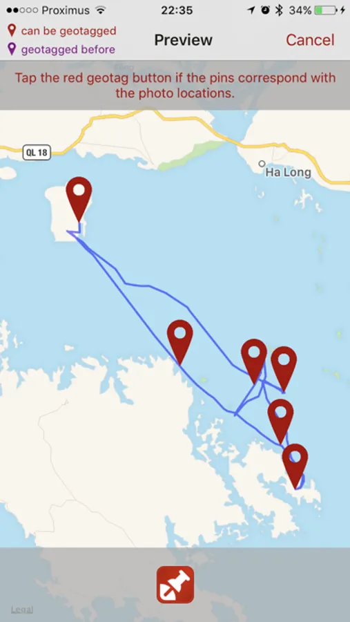
That's where GeoTagr comes to the rescue. GeoTagr tags your photos with the location where you made them (a.k.a. geotagging).
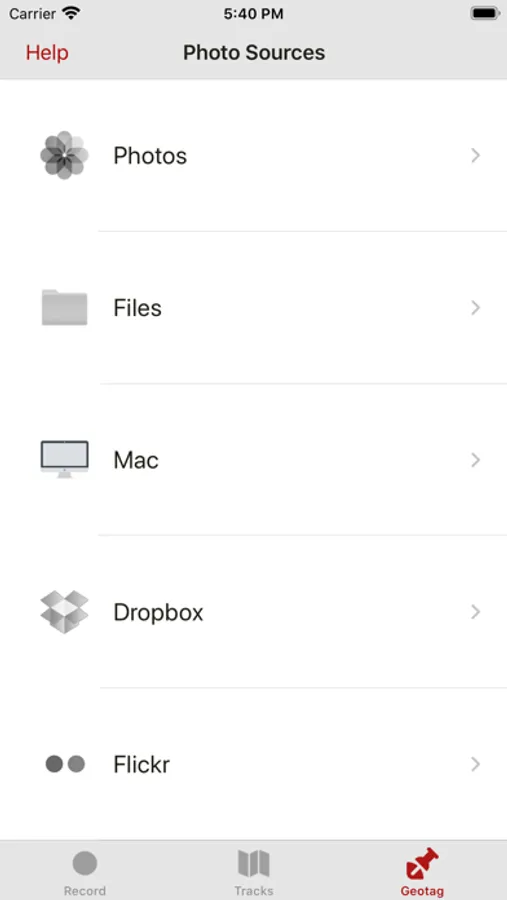
GeoTagr supports 6000+ types of digital cameras and geotags iPhone, iPad, Mac, Dropbox and Flickr photos.
CORE FEATURES:
- Record your location with an iPhone or iPad while you make photos with a digital camera
- Geotag those photos no matter where you manage them (iPhone, iPad, Mac, Dropbox, SmugMug)
- Support for JPEG and RAW photos
- Export GPX files (iTunes Sharing, Dropbox, Mail, browser)
- Import GPX files (iTunes Sharing, Dropbox, Mail, …) e.g. generated by a dedicated GPS data logger
EXTRA:
- Record your location with an iPhone and use those locations to wirelessly geotag photos on your iPad or Mac
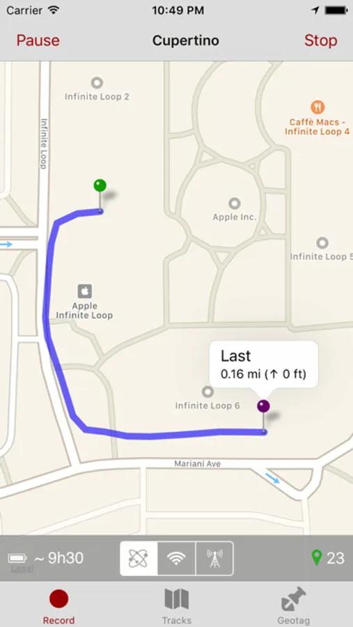
- 3 recording modes on iPhone for optimal balance between accuracy and battery life
- Pause and resume when recording locations
- While recording, shows an estimate for the remaining battery time
- Background recording
- Track management
- Geotags photos on your Mac using the GeoTagr Companion menubar app (available in the Mac App Store for free)
- Today extension for quick access
- All maps have 3 modes: Standard, Satellite, Hybrid
- Comprehensive built-in Help section
Continued use of GPS running in the background can dramatically decrease battery life.
GeoTagr Screenshots
Tap to Rate:
Reviews for GeoTagr
Zampano11
Love this app
I have been using this app for years. I don’t geotag photos with it, but rather use it to create a GPX file of where I’ve been when I travel. I then import the GPX file into Google Maps and I then have a nice map that shows me the route I’ve traveled.
ggddrrt
10 At A Time?!
I really like the app, except that recent versions only allow me to tag 10-20 photos at a time, which is ridiculous! In addition, it only deletes about half the updated photos, which makes an entire day’s excursion a huge pain to tag. Almost easier to do it manually by memory.