Marine Rules & Signals
FB Imray Laurie Norie & Wilson GmbH
2.5 ★
6 ratings
$5.99
AppRecs review analysis
AppRecs rating 2.5. Trustworthiness 82 out of 100. Review manipulation risk 22 out of 100. Based on a review sample analyzed.
★★☆☆☆
2.5
AppRecs Rating
Ratings breakdown
5 star
17%
4 star
17%
3 star
17%
2 star
0%
1 star
50%
What to know
✓
Low review manipulation risk
22% review manipulation risk
✓
Credible reviews
82% trustworthiness score from analyzed reviews
⚠
Mixed user feedback
Average 2.5★ rating suggests room for improvement
About Marine Rules & Signals
Beautifully illustrated with diagrams and short, clear text. Remind yourself quickly about a rule or light, or learn at home, traveling or in the winter while planning your trips.
INCLUDES
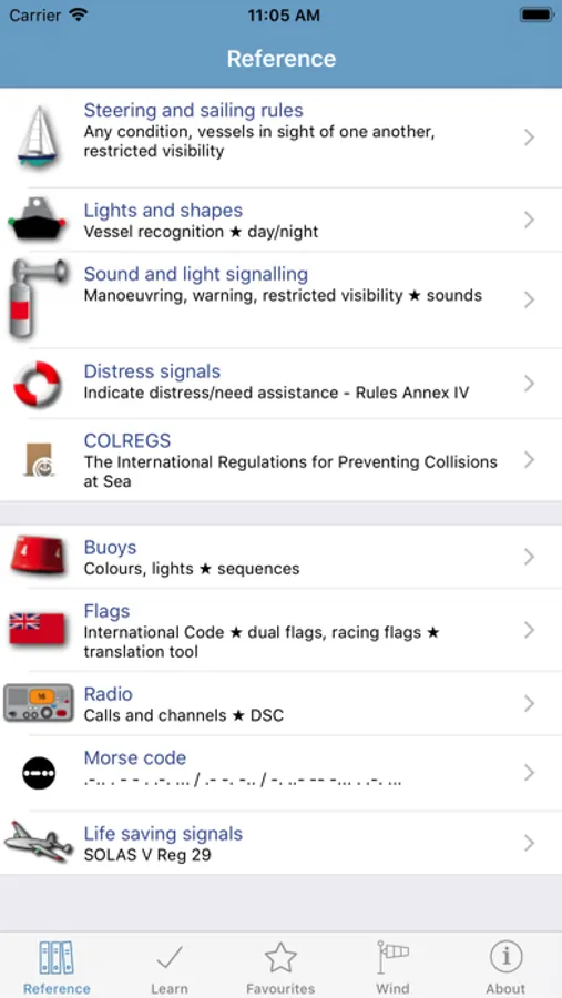
RULES OF THE ROAD:
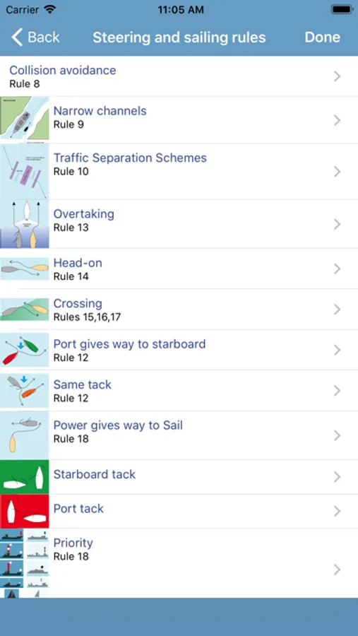
- Steering and sailing rules.
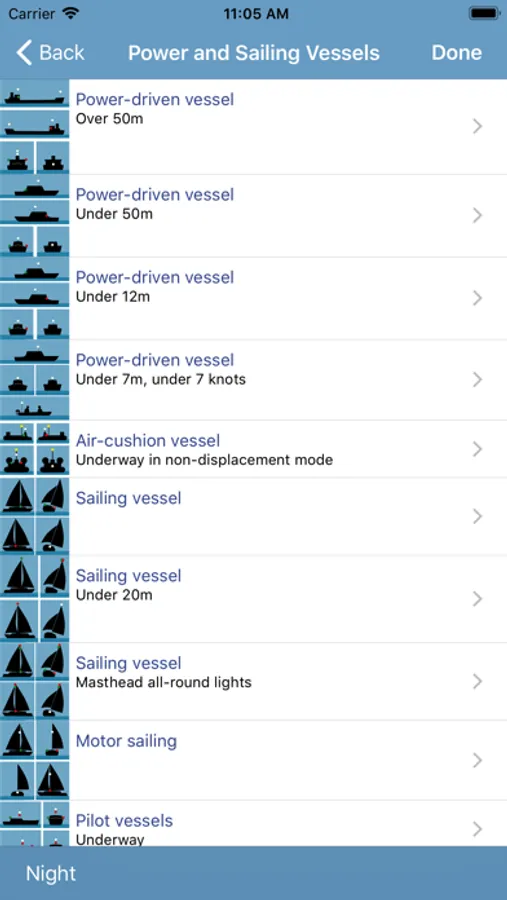
- Lights and shapes: day and night time marking of boats.
- Sound signals in restricted visibility. Actual sounds.
- Distress signals.
- Full Colregs text.
SIGNALS & COMMUNICATION:
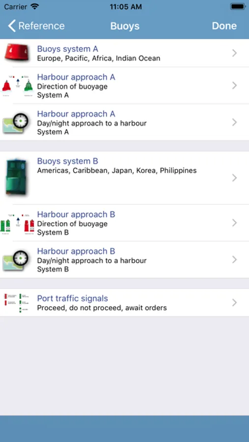
- Buoys: worldwide buoyage systems A & B and animated harbour approaches.
- Buoy lights, animated.
- Sample harbour charts from around the world, with animated lights.
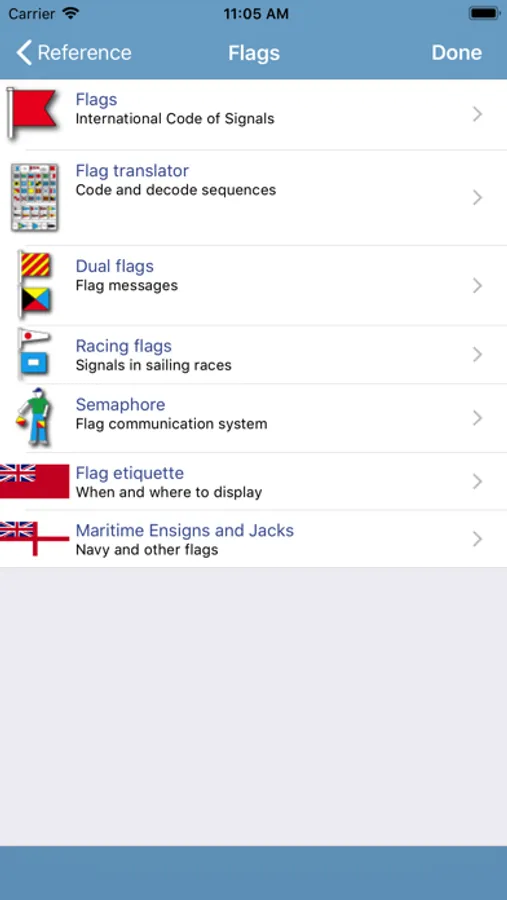
- Flags: flag translator, phonetic alphabet, morse code and message builder.
- Dual flag messages.
- Racing flags.
- Semaphore flags.
- Radio calls including Mayday/PanPan and radio channels.
- Life saving communication including air rescue: Solas V.
- Communication with air rescue.
LEARNING SYSTEM:
- Learning cards for all content, by section or for all Rules together.
Content can be scrolled, viewed individually or in sequence. Large images (charts and at a glance images) can be zoomed and panned.
Based on the International Regulations for Preventing Collisions and Sea, 1972, with amendments in force from November 1995, SOLAS Chapter V Regulation 29 and the general guidelines for buoys and signals.
LANGUAGES
English, French, German, Italian, Spanish, Japanese
ABOUT US
Imray are a leading chart and marine book publishers, based in England and with a catalogue of charts that covers Europe, the Mediterranean and the Caribbean. Imray's pilot books cover the whole world in extensive detail.
In partnership with Imray, software developers and sailors.
Follow us on Twitter - http://twitter.com/imray_charts
Facebook - imraynautical
Look out for other applications in the Marine Navigation Series from Imray:
TIDES PLANNER - tide predictions any date
MARINE CHARTS - Europe Atlantic, Mediterranean, Caribbean, Australia
BOAT INSTRUMENTS & AIS (requires WiFI NMEA bridge)
CHART SYMBOLS
Marine Rules & Signals Screenshots
Tap to Rate:
Reviews for Marine Rules & Signals
Adammp1
Needs work
Thought this would be the one that quizzes you with the actual questions on the CG exam; instead it’s just and electronic version of the navigation rules. One problem I found was it does not specify whether a rule is ‘inland’ or ‘international’.
ezkk
A great tool
Ignore the other reviewers, I’m guessing they didn’t look before they bought and now they’re peeved. There are many other applications to get in depth Collision Regulations , but at that point you may as well get a book (iBooks has some good interactive ones.) This app is a quick study guide that I like to let my students use when studying advanced cruising. It serves as a helpful reminder, that clears up the cluttered mess of other apps, since everything is organized well. I like to use it for morse code as well, but the flash cards are a great way to teach anything from ColRegs to semaphore. There are ways it could be improved, but it does not merit such low reviews.