AppRecs review analysis
AppRecs rating 3.1. Trustworthiness 73 out of 100. Review manipulation risk 21 out of 100. Based on a review sample analyzed.
★★★☆☆
3.1
AppRecs Rating
Ratings breakdown
5 star
38%
4 star
0%
3 star
13%
2 star
13%
1 star
38%
What to know
✓
Low review manipulation risk
21% review manipulation risk
✓
Credible reviews
73% trustworthiness score from analyzed reviews
⚠
Mixed user feedback
Average 2.9★ rating suggests room for improvement
About FWAS–Fire Weather Alert System
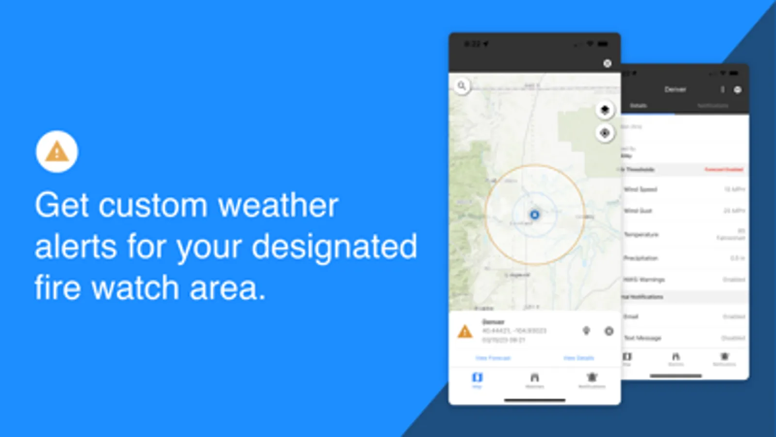
GET CUSTOM WEATHER ALERTS
• Get custom weather alerts when wind speed, wind gust, relative humidity, air temperature, and precipitation exceed your set thresholds.
• RAWS/ASOS stations and short-term forecasts (HRRR model) are monitored.
• Designate the watch area for your fire.
• Alerts broadcast using in-app messages, text, and/or email.
VIEW RAWS DATA
• Select weather stations from a map and view data in graph and tabular form.
• Access RAWS, iRAWS, ASOS, and other station networks.
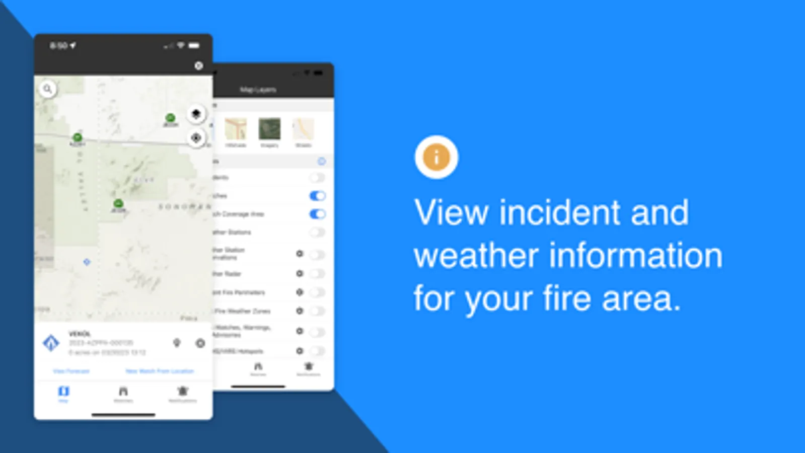
VIEW SATELLITE HOTSPOTS
• Display VIIRS and MODIS hotspots on the map.
VIEW INCIDENT LOCATIONS AND FIRE PERIMETERS
• View incident name, type, size, and most recent perimeter (including smaller IA fires).
VIEW NWS WATCHES, WARNINGS AND ADVISORIES
• See National Weather Service Active Alerts on the map and read the text.
• Monitor Red Flag Warnings, Fire Weather Watches, Wind Advisories, Severe Thunderstorm Warnings, etc.
ACCESS ZONE FIRE WEATHER FORECASTS
• Access and read your local fire weather forecast.
• See fire weather zone names and boundaries on the map.
MONITOR APPROACHING STORMS WITH NEXRAD RADAR
• Display animated radar data on the map.
FWAS–Fire Weather Alert System Screenshots
Tap to Rate:
Reviews for FWAS–Fire Weather Alert System
LoReed8
2 stars for the days it did work
I live in the forest as a park ranger and wanted an app to alert me, in addition to the one I have. There are 3000+ acres burning 4 miles away & the map is not showing it, nor is it pink. Firefighters have died, farm animals are being evacuated, the wildlife is suffering & our homes are in danger & this app is showing nothing. I’m getting more alerts from the standard weather app. I recommend people put their zip code into nixel.us for alerts. This app is a huge disappointment when you are terrified
Jenbl97
Extend watch length please
Need to be able to set watches for longer then 1 week.