In this outdoor navigation app, you can work with waypoints, track logs, and maps to assist your navigation. Includes offline map support, waypoint management, and session photo storage.
AppRecs review analysis
AppRecs rating 4.5. Trustworthiness 0 out of 100. Review manipulation risk 0 out of 100. Based on a review sample analyzed.
★★★★☆
4.5
AppRecs Rating
Ratings breakdown
5 star
90%
4 star
10%
3 star
0%
2 star
0%
1 star
0%
What to know
✓
High user satisfaction
90% of sampled ratings are 5 stars
About Handy GPS
The perfect companion for your next outdoor adventure. Seek, find, record and return home with Handy GPS.
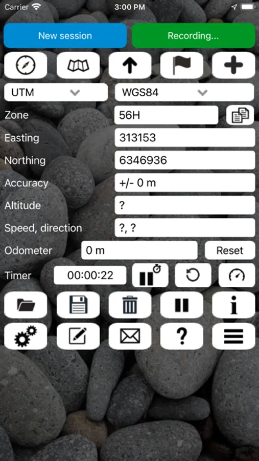
This app is a real navigation tool designed for outdoors sports like hiking, bushwalking, mountain biking, kayaking and trail riding. It allows you to work in UTM or lat/lon coordinates.
Features:
* View your current location in UTM or Lat/Lon formats.
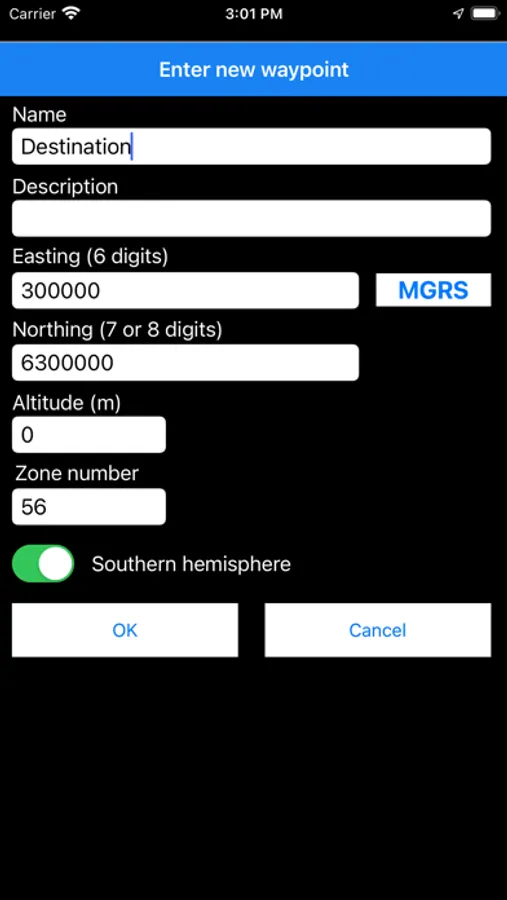
* Record and/or manually enter waypoints in UTM, Lat/Lon, or MGRS.
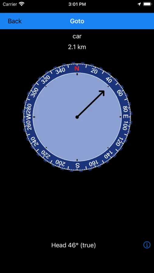
* Goto a waypoint, with optional audio proximity alarm and spoken directions.
* Record a track log.
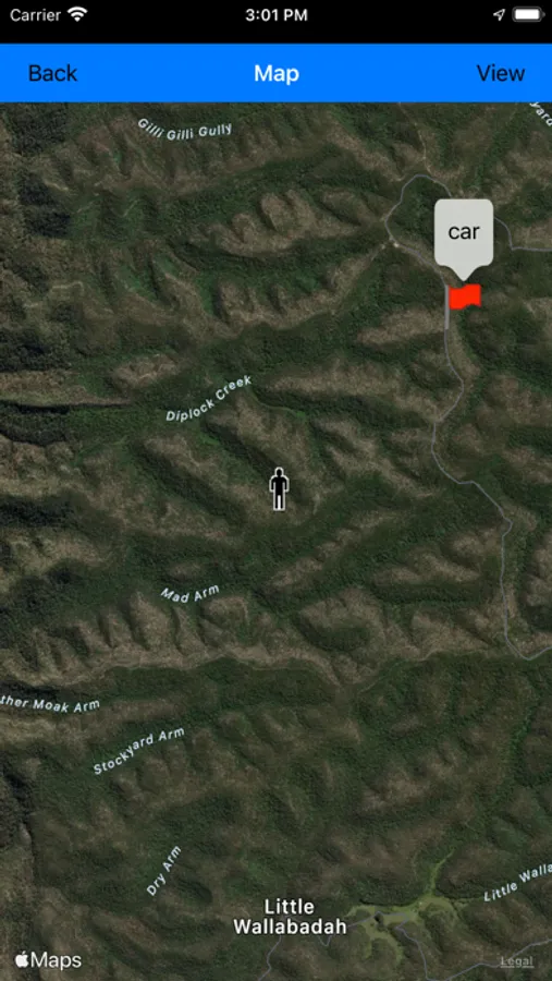
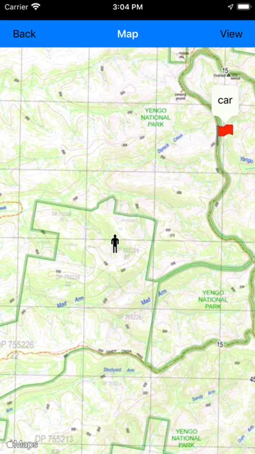
* Show your current location, waypoints and tracklogs on a map.
* Export waypoints and tracklogs to a KML file for viewing in Google Earth, or to a GPX file.
* Export waypoints to a comma delimited (CSV) text file.
* Import KML or GPX files and view in the app.
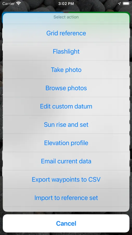
* Email your current location to a friend.
* Odometer to keep track of how far you've gone.
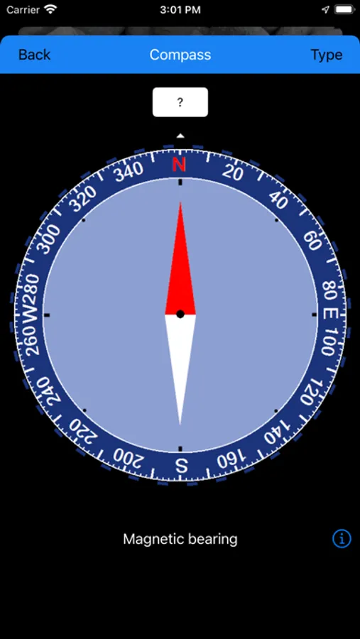
* Magnetic compass.
* Elevation profile.
* Compute sun and moon rise and set times.
* Supports both metric and US/imperial units.
* Supports datums WGS84, GDA94, AGD66 and AGD84. (Use WGS84 for NAD83)
* Allows entry of parameters for a custom datum (e.g. ED50, SAD69, OSGB36, GDA2020 etc), as well as supporting affine parameters for local grid systems.
* Can display your location a normal grid ref, an MGRS grid ref (WGS84 datum only), or as a UK Ordinance Survey (OS) grid ref.
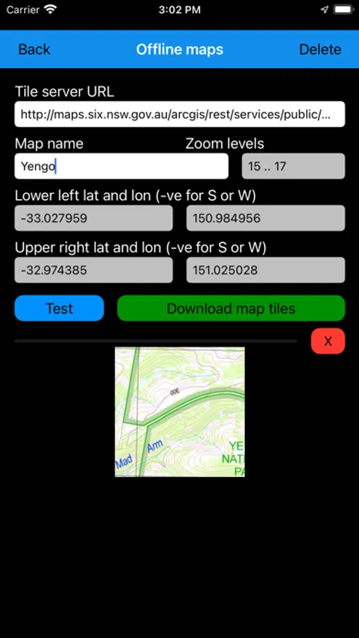
* Can download offline map tiles for use where there is no cellular coverage.
* Can import pre-prepared state or country-level base maps from a zip file.
* Optional walk timer.
* Email your current waypoints and tracklogs as a KML file.
* Take photos from within the app to be stored with the current session.
Disclaimer: Continued use of GPS running in the background can dramatically decrease battery life. To save battery power you can close the app from the task manager. The developer accepts no responsibility for you getting lost while using this app.
This app is a real navigation tool designed for outdoors sports like hiking, bushwalking, mountain biking, kayaking and trail riding. It allows you to work in UTM or lat/lon coordinates.
Features:
* View your current location in UTM or Lat/Lon formats.
* Record and/or manually enter waypoints in UTM, Lat/Lon, or MGRS.
* Goto a waypoint, with optional audio proximity alarm and spoken directions.
* Record a track log.
* Show your current location, waypoints and tracklogs on a map.
* Export waypoints and tracklogs to a KML file for viewing in Google Earth, or to a GPX file.
* Export waypoints to a comma delimited (CSV) text file.
* Import KML or GPX files and view in the app.
* Email your current location to a friend.
* Odometer to keep track of how far you've gone.
* Magnetic compass.
* Elevation profile.
* Compute sun and moon rise and set times.
* Supports both metric and US/imperial units.
* Supports datums WGS84, GDA94, AGD66 and AGD84. (Use WGS84 for NAD83)
* Allows entry of parameters for a custom datum (e.g. ED50, SAD69, OSGB36, GDA2020 etc), as well as supporting affine parameters for local grid systems.
* Can display your location a normal grid ref, an MGRS grid ref (WGS84 datum only), or as a UK Ordinance Survey (OS) grid ref.
* Can download offline map tiles for use where there is no cellular coverage.
* Can import pre-prepared state or country-level base maps from a zip file.
* Optional walk timer.
* Email your current waypoints and tracklogs as a KML file.
* Take photos from within the app to be stored with the current session.
Disclaimer: Continued use of GPS running in the background can dramatically decrease battery life. To save battery power you can close the app from the task manager. The developer accepts no responsibility for you getting lost while using this app.
Handy GPS Screenshots
Tap to Rate: