In this outdoor navigation app, users can record, view, and navigate to waypoints and tracklogs, with features like map display and coordinate conversions. Includes waypoint management, track recording, and file export options.
AppRecs review analysis
AppRecs rating 4.1. Trustworthiness 0 out of 100. Review manipulation risk 0 out of 100. Based on a review sample analyzed.
★★★★☆
4.1
AppRecs Rating
Ratings breakdown
5 star
53%
4 star
18%
3 star
12%
2 star
18%
1 star
0%
What to know
✓
High user satisfaction
71% of sampled ratings are 4+ stars (4.1★ average)
About Handy GPS lite
The perfect companion for your next outdoor adventure. Seek, find, record and return home with Handy GPS.
This app is a real navigation tool designed for outdoors sports like hiking, bushwalking, mountain biking, kayaking and trail riding. It allows you to work in UTM or lat/lon coordinates.
Note: This version of the app is limited to storing 3 waypoints and 40 tracklog points. The paid version does not have these limits.
Features:
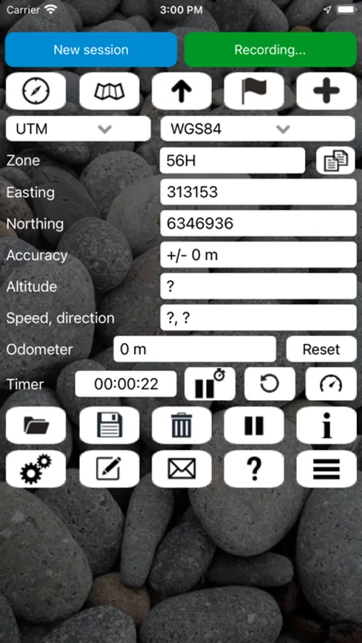
* View your current location in UTM or Lat/Lon formats.
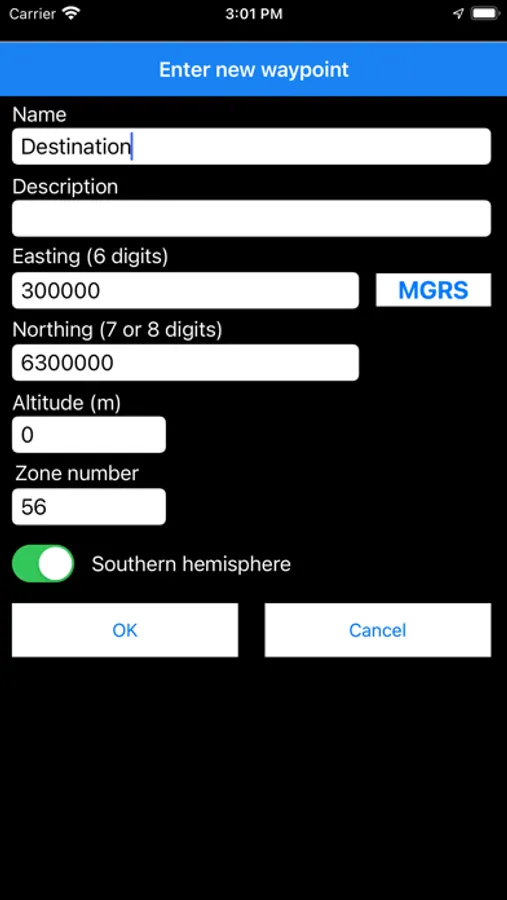
* Record and/or manually enter waypoints.
* Goto a waypoint.
* Record a track log.
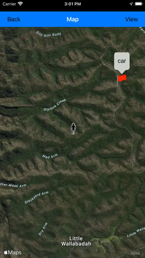
* Show your current location, waypoints and tracklogs on a map.
* Export waypoints and tracklogs to a KML file for viewing in Google Earth, or to a GPX file.
* Import KML or GPX files and view in the app.
* Email your current location to a friend.
* Odometer to keep track of how far you've gone.
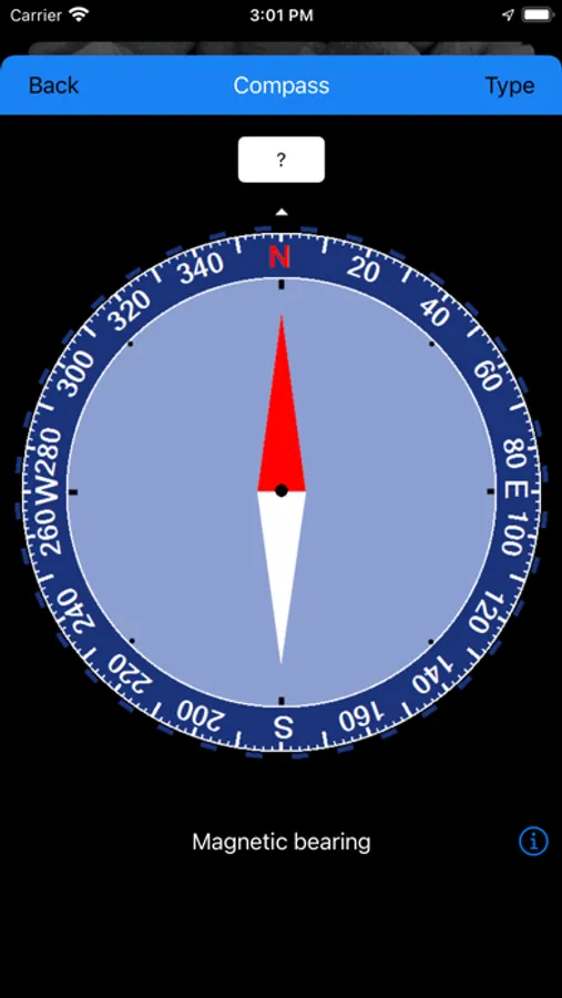
* Magnetic compass.
* Supports both metric and US/imperial units.
* Supports datums WGS84, GDA94, AGD66 and AGD84. (Use WGS84 for NAD83)
* Can show your current location as an MGRS grid ref (WGS84 only).
* Optional walk timer.
Additional features only available in the paid version include:
* Use of custom datums (e.g. ED50, SAD69, OSGB36, etc)
* Elevation profile.
* Compute sun rise and set times.
* Unlimited waypoints and tracklog points.
* Offline map support.
Disclaimer: Continued use of GPS running in the background can dramatically decrease battery life. To save battery power you can close the app from the task manager. The developer accepts no responsibility for you getting lost while using this app.
This app is a real navigation tool designed for outdoors sports like hiking, bushwalking, mountain biking, kayaking and trail riding. It allows you to work in UTM or lat/lon coordinates.
Note: This version of the app is limited to storing 3 waypoints and 40 tracklog points. The paid version does not have these limits.
Features:
* View your current location in UTM or Lat/Lon formats.
* Record and/or manually enter waypoints.
* Goto a waypoint.
* Record a track log.
* Show your current location, waypoints and tracklogs on a map.
* Export waypoints and tracklogs to a KML file for viewing in Google Earth, or to a GPX file.
* Import KML or GPX files and view in the app.
* Email your current location to a friend.
* Odometer to keep track of how far you've gone.
* Magnetic compass.
* Supports both metric and US/imperial units.
* Supports datums WGS84, GDA94, AGD66 and AGD84. (Use WGS84 for NAD83)
* Can show your current location as an MGRS grid ref (WGS84 only).
* Optional walk timer.
Additional features only available in the paid version include:
* Use of custom datums (e.g. ED50, SAD69, OSGB36, etc)
* Elevation profile.
* Compute sun rise and set times.
* Unlimited waypoints and tracklog points.
* Offline map support.
Disclaimer: Continued use of GPS running in the background can dramatically decrease battery life. To save battery power you can close the app from the task manager. The developer accepts no responsibility for you getting lost while using this app.
Handy GPS lite Screenshots

Tap to Rate: