With this app, you can import and view GPX files from various sources and customize map display options. Includes support for multiple map tiles, color customization, file organization, and chart creation.
AppRecs review analysis
AppRecs rating 4.4. Trustworthiness 81 out of 100. Review manipulation risk 20 out of 100. Based on a review sample analyzed.
★★★★☆
4.4
AppRecs Rating
Ratings breakdown
5 star
78%
4 star
10%
3 star
4%
2 star
1%
1 star
8%
What to know
✓
Low review manipulation risk
20% review manipulation risk
✓
Credible reviews
81% trustworthiness score from analyzed reviews
✓
High user satisfaction
78% of sampled ratings are 5 stars
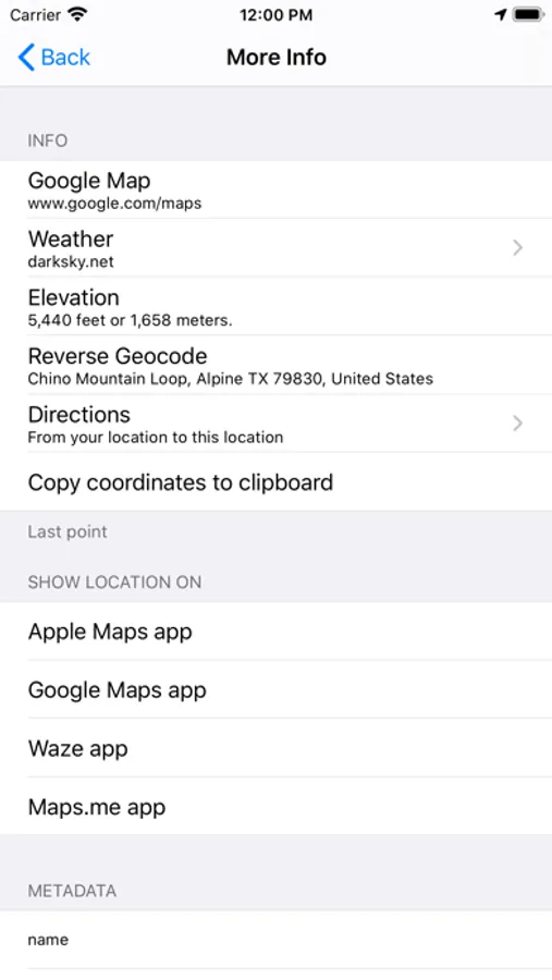
About GPX-Viewer
Import GPX files from the Cloud (includes iCloud, Dropbox, Google Drive, etc), your local device, or by using iTunes file sharing, email, a URL, or your pasteboard.
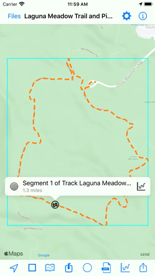
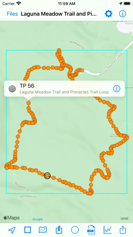
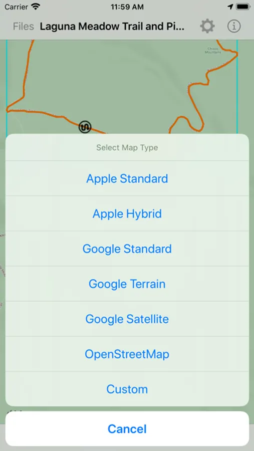
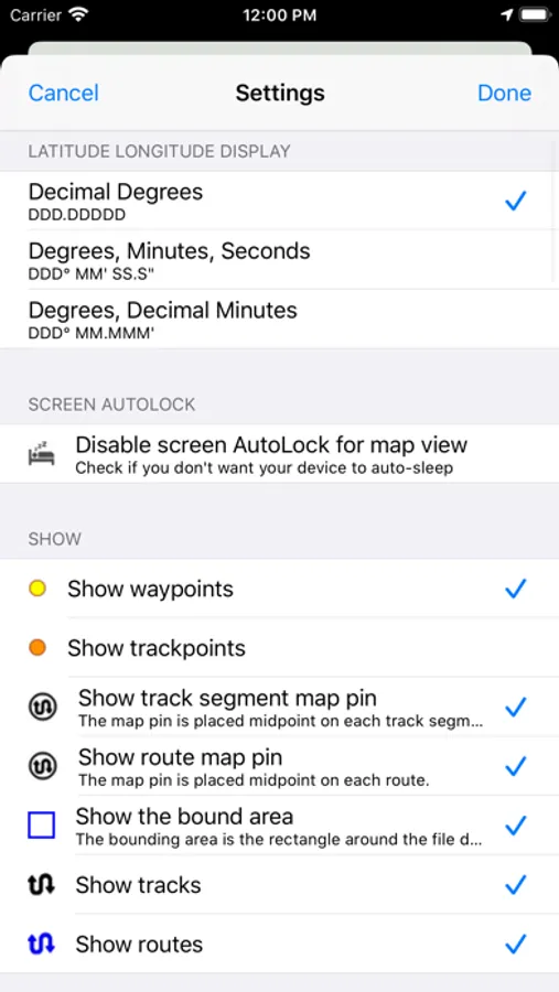
- Customize your map: Apple Maps, Google Maps, OpenStreetMaps, or use a custom map tile source URL
- Color customization for waypoints, track points, routes and tracks
- Hide or show the waypoints, track points, routes or tracks on the map
- Choose units: Metric, imperial, or nautical
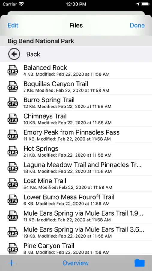
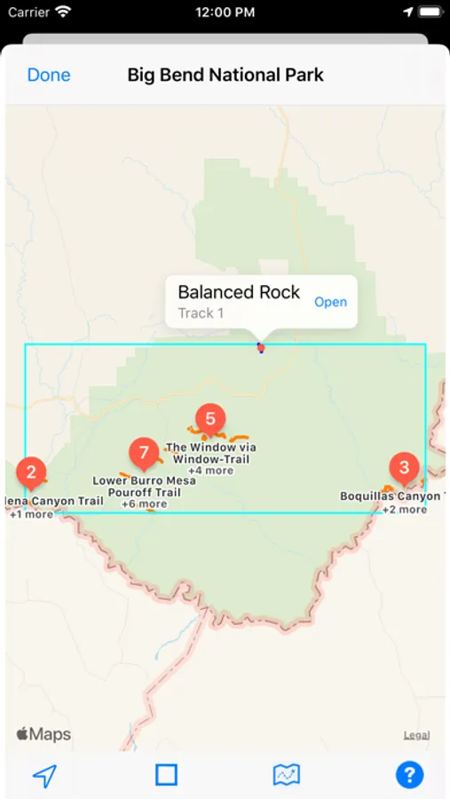
- Organize and quick-view files: Create folders to better organize your GPX files, and preview the tracks of all files within a folder
- Import GPX files to the current GPX file
- Send the waypoints to Apple Maps
- Keep device from sleeping: Option to disable screen auto-lock
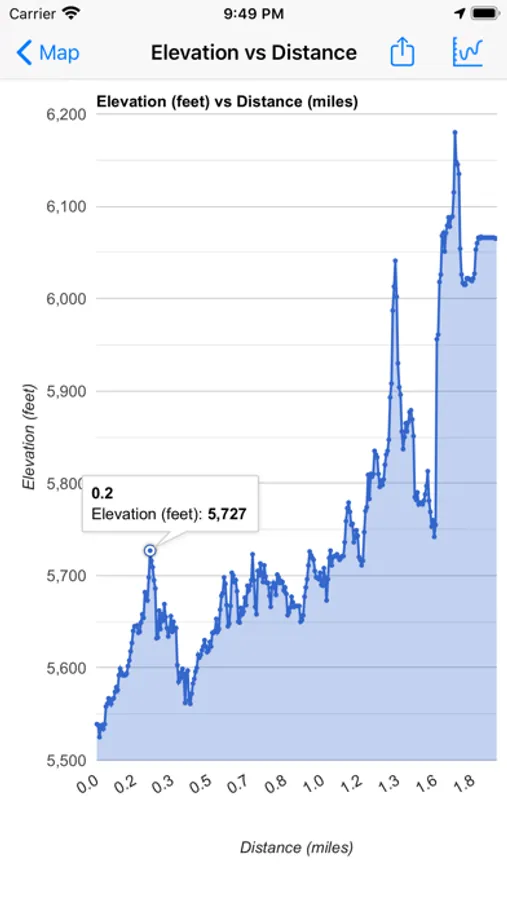
Create and share charts:
- Y axis: Elevation or speed
- X axis: Track points, distance, or time
A sample GPX file is included.
Download free GPX files from many web sites, such as http://www.poi-factory.com and https://www.hikingproject.com.
We also have GPX Viewer and GPX Editor apps for Mac computers. Visit the Mac App Store or our website for more info.
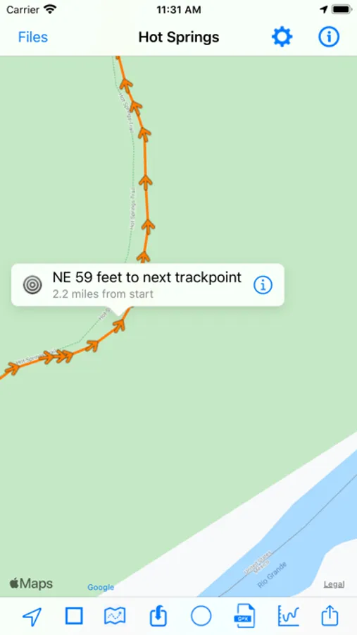
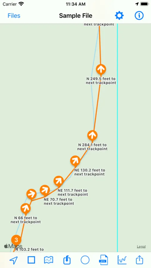
GPX-Viewer Screenshots
Tap to Rate:
Reviews for GPX-Viewer
Afpfeiffer
Doesn’t work
Does not import even a small standard GPX file. I wan my money bank.
Proxy Name
Does what it says on the box.
Solid viewer. The info button at the top right helped me quickly figure out how to use it. The ability to change map styles is much appreciated, and maps render fast when zooming in and out or moving around. There are lots of graphs to analyze the gpx data. I particularly like the speed vs points graph and elevation over time graph for keeping track of my snowboard runs. Lots of apps now are monetized by adds, data mining, or locking users onto their platforms behind a subscription service and leaving them unable to export their data. This app does none of that and the price is right. I would buy it again. To the dev, if you are reading this, please consider implementing a few features: - Share menu integration. Sure, I can open this app itself and then open my gpx track. But being able to share my gpx recording from the app I use for this purpose, directly to this app using the ios share button would be great! - Integration into the Files app. I keep my files saved in my cloud so honestly I have no need to manage them with this app, however I did try to create a folder and put some tracks into it, but I can’t seem to find the created folder in the Files app which is where I would expect it to appear. - A timeline scrub. Some way to view the progress of my hike from start to finish and quickly scrub to a certain point, instead of just manually moving the map view. If you are in search of a simple gpx viewer and analyzer, this is it.