AppRecs review analysis
AppRecs rating 4.1. Trustworthiness 76 out of 100. Review manipulation risk 21 out of 100. Based on a review sample analyzed.
★★★★☆
4.1
AppRecs Rating
Ratings breakdown
5 star
71%
4 star
7%
3 star
0%
2 star
7%
1 star
14%
What to know
✓
Low review manipulation risk
21% review manipulation risk
✓
Credible reviews
76% trustworthiness score from analyzed reviews
✓
High user satisfaction
79% of sampled ratings are 4+ stars (4.1★ average)
About Topo Maps Canada
Topographic maps are useful for recreational activities such as hiking, canoeing, camping, fishing, mountain biking, geocaching, and exploring.
MAPS
Choose from 3 map sources: Canada Base Map (shaded/unshaded), and Toporama.
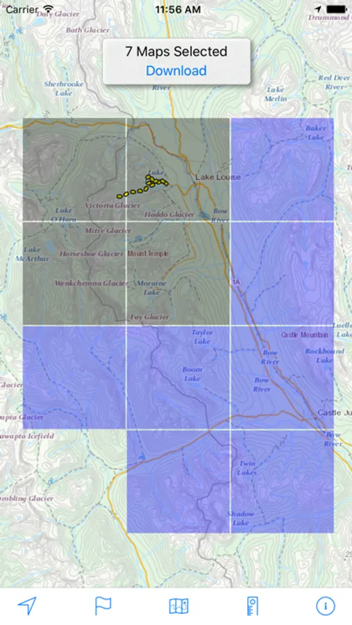
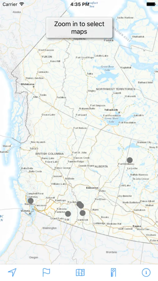
OFFLINE
Download maps for areas of interest to view them later when you don't have Internet access or you don't want to use cell data.
TRACKING
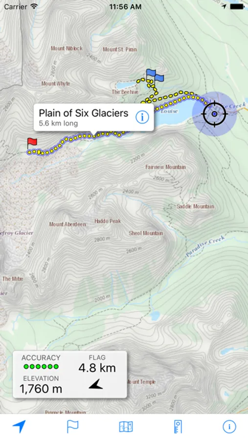
Use location tracking to show where you are on the map, your elevation, and the accuracy of the GPS signal.
FLAGS
Flags are included with map downloads. Add flags (waypoints) to the map to mark your current location or other locations. Import flags from other sources using GPX files and geocache LOC files. Share flags with others using email or AirDrop. Organize your flag types by color, for example, geocaches, trailheads, and summits.
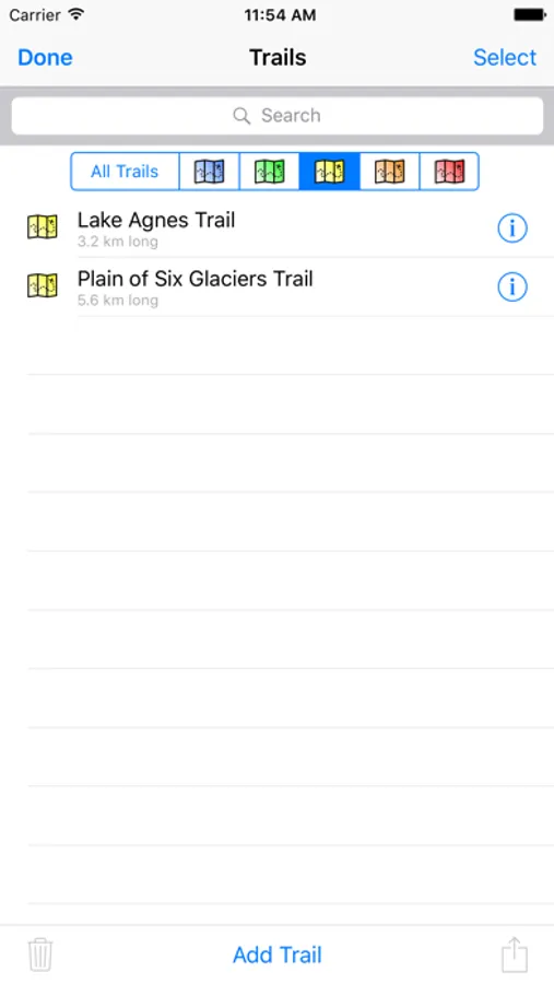
TRAILS
Trails are included with map downloads. Import trails (tracks) using GPX files you find on the Internet or from your personal GPS track collection. Share trails with others using email or AirDrop. Organize your trail types by color, for example, mountain bike trails, hiking trails, and OHV trails.
TRAIL RECORDING
Record your own trails to show where you've been on the map, follow them later, and share with others.
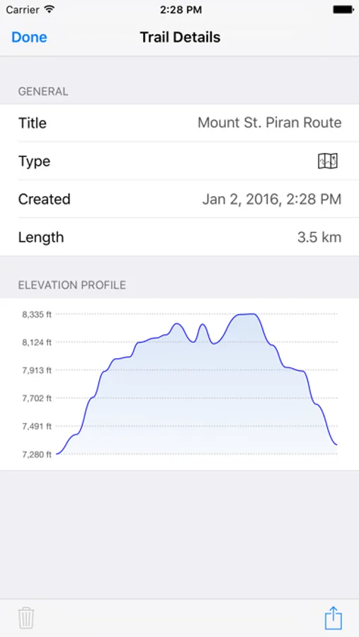
ELEVATION PROFILE
Recorded trails include an elevation profile (distance/elevation chart).
NAVIGATION
Navigate to a flag by following the direction arrow that uses your compass heading. Useful for geocaching.
MEASURE
Measure the distance between points on the map.
Note: Continued use of GPS running in the background can dramatically decrease battery life.
Topo Maps Canada Screenshots
Tap to Rate:
Reviews for Topo Maps Canada
slind907
big fan
used for paddling trip in georgian bay, super useful. works well once downloaded and with phone service off, and flagging system is great.
Auser
Great free app
This is ridiculously useful for any hiking in Canada. You can download sections of interest, which are populated with many trails. You can also load in your own GPX routes, which can be downloaded from many websites. You can drag your finger along a trail to estimate distances. Best of all, there’s no annoying upsell to “pro” features like other apps, this one just works and provides all the functionality you need, including recording your own routes. I recommend this app before trying all the slicker apps with upsell. Makes it easy to appreciate what this one does.