AppRecs review analysis
AppRecs rating 4.9. Trustworthiness 75 out of 100. Review manipulation risk 23 out of 100. Based on a review sample analyzed.
★★★★☆
4.9
AppRecs Rating
Ratings breakdown
5 star
54%
4 star
4%
3 star
12%
2 star
0%
1 star
30%
What to know
✓
Low review manipulation risk
23% review manipulation risk
✓
Credible reviews
75% trustworthiness score from analyzed reviews
⚠
High negative review ratio
30% of sampled ratings are 1–2 stars
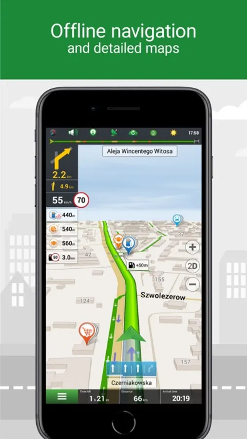
About Navitel Navigator
• Modern user-friendly interface.
• Offline maps. To work with the program and maps, you do not need the Internet: savings in roaming and independence from the quality of communication in the regions.
• Navigation maps with a high level of detail.
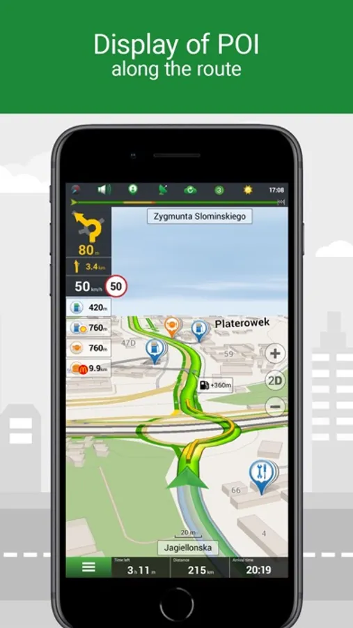
• Easy and convenient POI search by category.
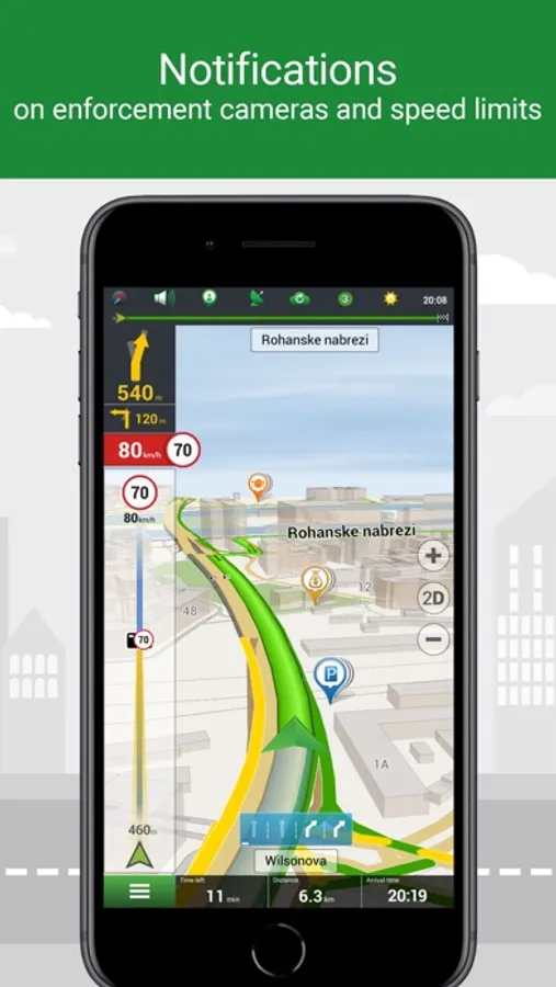
• Visual and voice guidance along the route.
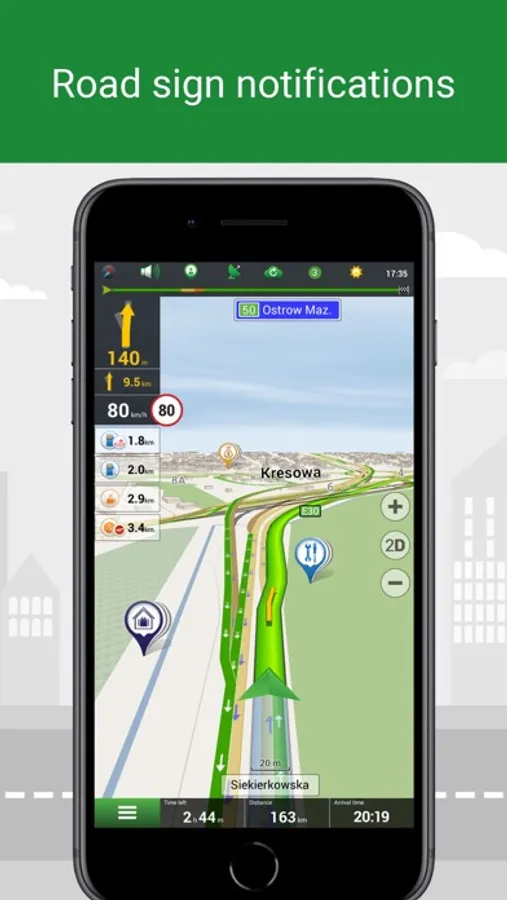
• Information about radars, speed cameras and road restrictions.
• The ability to display information on the windshield of the car — HUD (Head-Up Display)
• CarPlay support.
• Navigation maps of 66 countries are available.
SPECIAL FEATURES
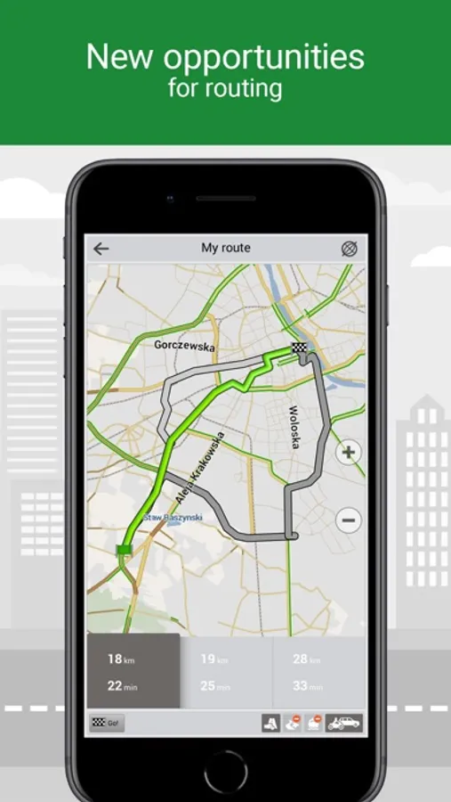
• Fast route calculation. Instant calculation and routing of any length and complexity.
• Three alternative routes with distance and travel time information.
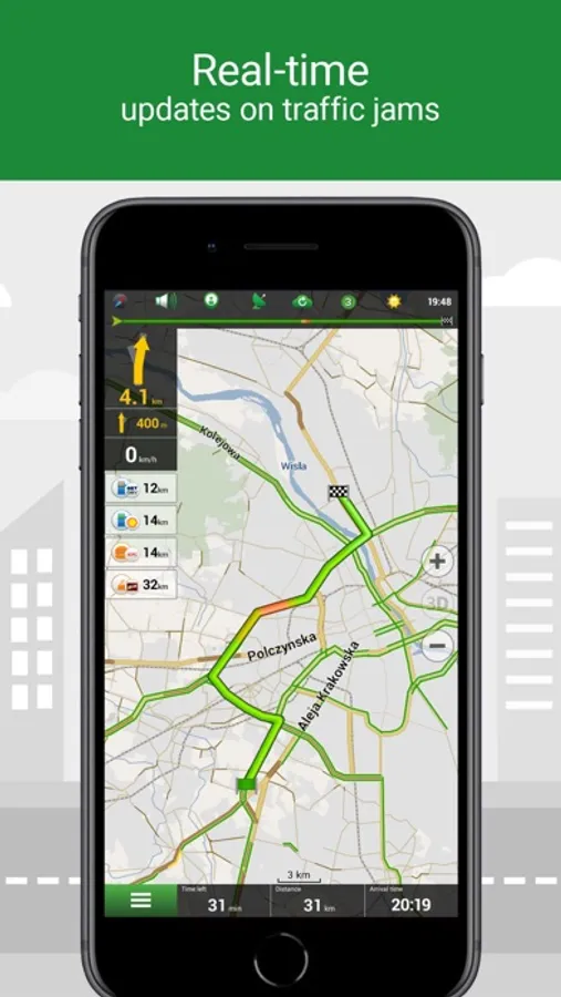
• Navitel.Traffic — information about traffic jams in real time throughout the maps.
• Navitel.Events — information about speed cameras, road accidents, road works and incidents marked on the map by users of the program.
• SpeedCam warnings —information about radars, speed cameras and road restrictions.
• 3D Maps — three-dimensional maps with support for textures and display of building heights.
• 3D Road interchanges — display of multi-level road interchanges in 3D mode.
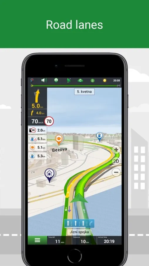
• Lane Assist — route calculations taking multilane traffic into account and visual prompts while following the route.
• Turn-by-turn voice guidance while moving along the route.
• Cargo graph — building routes considering road signs for cars from 3.5 to 40+ tons.
• Unlimited number of waypoints when building a route. Convenient route planning with an unlimited number of waypoints.
• Customizable user interface. Ability to adapt the program interface and map display mode for your own needs.
OFFLINE MAPS FOR DOWNLOAD
Austria, Azerbaijan, Albania, Andorra, Argentina, Armenia, Belarus, Belgium, Bulgaria, Bosnia and Herzegovina, Great Britain, Hungary, Germany, Gibraltar, Greece, Georgia, Denmark, Iran, Iceland, Spain, Kazakhstan, Cyprus, Kyrgyzstan, Latvia, Lithuania, Liechtenstein, Luxembourg, Maldives, Moldova, Monaco, Mongolia, the Netherlands, Norway, Isle of Man, Pakistan, Poland, Portugal, Romania, North Macedonia, Serbia, Slovakia, Slovenia, Tajikistan, Turkmenistan Turkey, Uzbekistan, Philippines, Finland, France, Croatia, Montenegro, Czech Republic, Switzerland, Sweden, Estonia.
If you have any questions contact us: support@navitel.cz.
We will be happy to help you.
Navitel Navigator Screenshots
Tap to Rate:
Reviews for Navitel Navigator
Alex_g_by
Не работает после обновления, служба поддержки не реагирует
После обновления приложение до последней версии оно перестало работать - невозможно восстановить покупку. На форуме полно подобных жалоб но разработчик не реагирует. На письменное обращение (дважды) в службу поддержки ответа нет уже 2 недели. Пользовался приложением 13 лет.
1tatarin
Когда будет новая версия?
Здравствуйте, когда уже выйдетНавител Навигатор 11 для IOS? Давно уже вышло для Android! Вам здесь ещё много недоработок исправить надо! Например как: энергопотребление; лаги; навигатор не видит движения, при перезапуске исправляется. Надеюсь, новая версия скоро выйдет, и недоработки исправят!