AppRecs review analysis
AppRecs rating 4.1. Trustworthiness 81 out of 100. Review manipulation risk 20 out of 100. Based on a review sample analyzed.
★★★★☆
4.1
AppRecs Rating
Ratings breakdown
5 star
55%
4 star
23%
3 star
5%
2 star
0%
1 star
18%
What to know
✓
Low review manipulation risk
20% review manipulation risk
✓
Credible reviews
81% trustworthiness score from analyzed reviews
✓
Good user ratings
77% positive sampled reviews
About FieldMove Clino
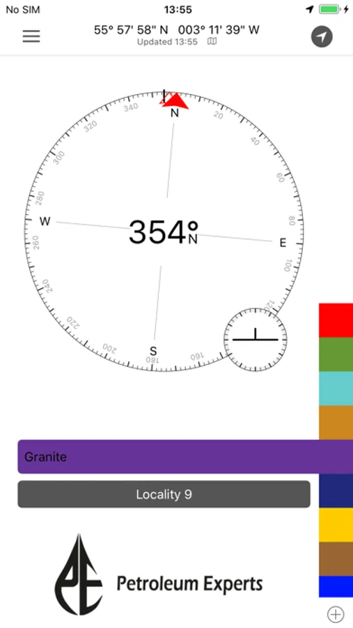
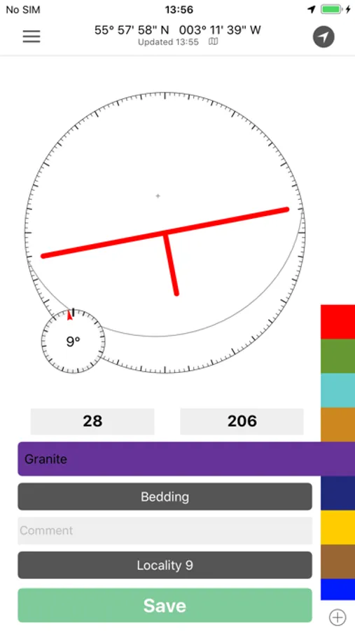
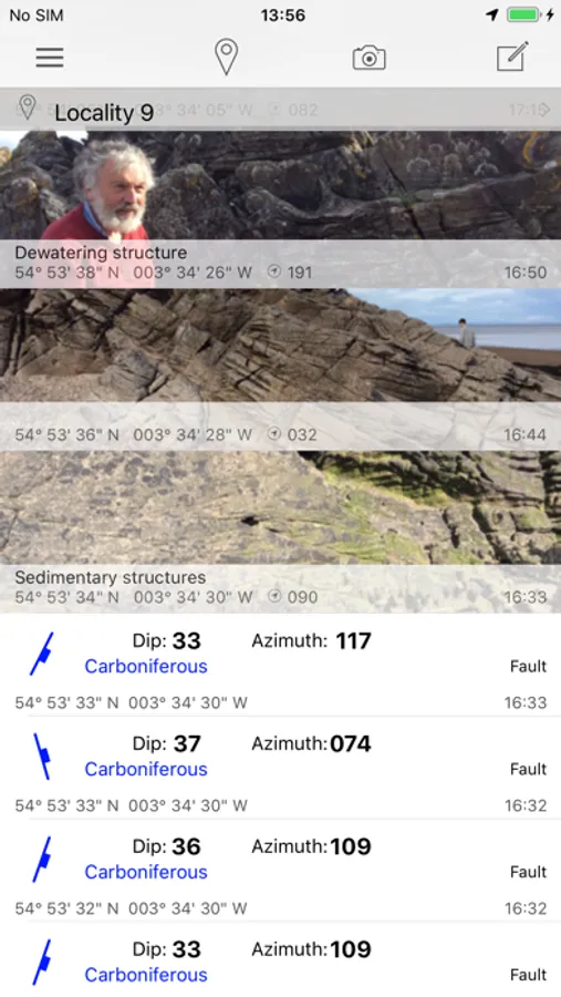
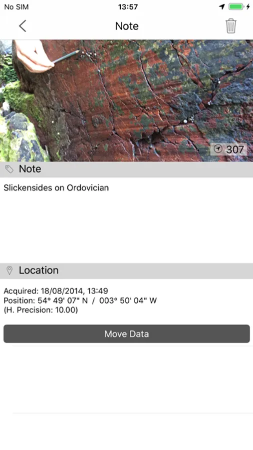
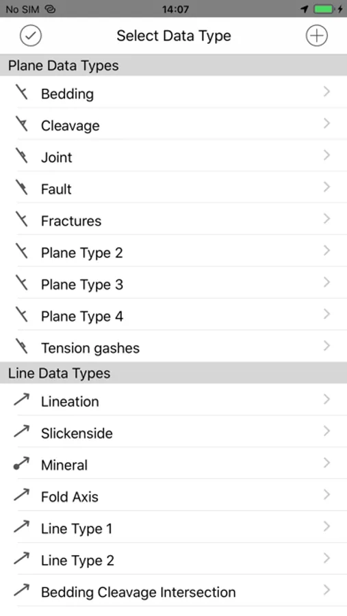
FieldMove Clino is a digital compass-clinometer for data capture on your iPhone, designed for simplicity in the field, and optimized to use the device’s GPS location and orientation sensors. This geology app will allow you to use your phone as a traditional hand-held bearing compass as well as a digital compass-clinometer for measuring and capturing the orientation of planar and linear features in the field. FieldMove Clino allows you to quickly take large amounts of measurements, making your data set much more statistically valid. You can also capture and store georeferenced digital photographs and text notes.
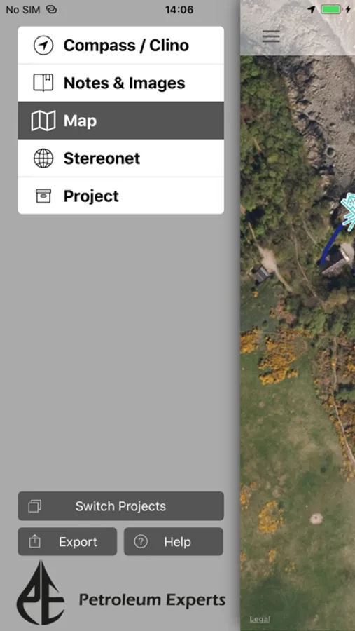
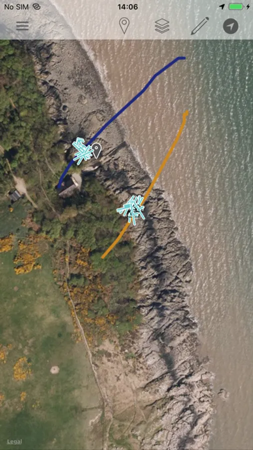
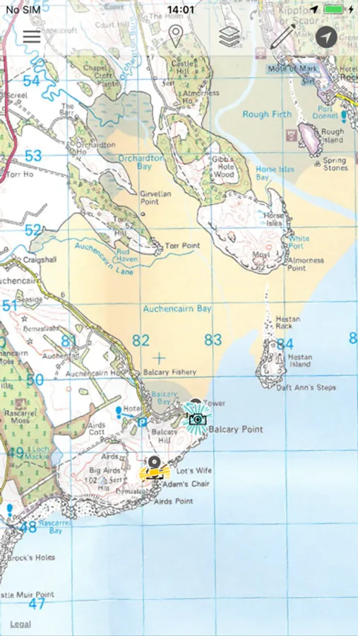
As well as supporting online maps, FieldMove Clino also supports offline maps, so that you can import your own georeferenced basemaps and collect data while disconnected. Data can be exported as MOVE, CSV or KMZ files and then imported directly into FieldMove™, Move™ or other applications like Google Earth.
Additional features:
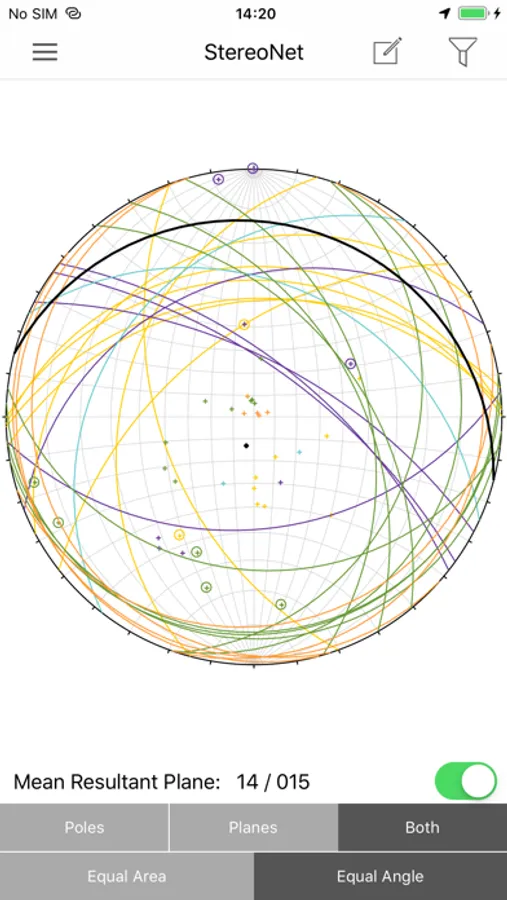
• Display geological data on an equal area or equal angle stereonet, allowing you to perform some basic statistical analysis in the field
• Draw contacts, faults and outcrops on your chosen basemap to create a realistic geological map
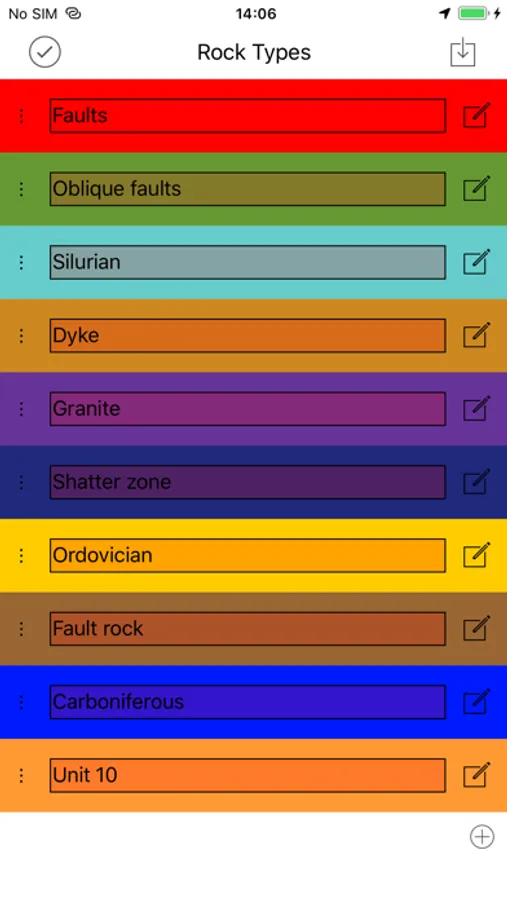
• A new expanded library of symbols for customisation of planar and linear features
• KMZ export, view your data in Google Earth
A more in-depth guide is available on our website: http://www.petex.com/products/move-suite/digital-field-mapping/
NOTE: FieldMove Clino for iPhone will scale up to fit on the iPad and iPad mini.
FieldMove Clino is a Petroleum Experts geological field mapping app designed for forward thinking geologists utilising digital data collection.
---------------------------------
* The use of GPS devices and smartphones as navigation aids. *
Global Positioning System (GPS) devices are commonly used to aid navigation, having grown in popularity over the past decade. Over the last few years, this has extended to smartphones and digital compasses, which are often equipped with GPS functionality.
GPS is a valuable aid to navigation during fieldwork, although it is important to keep safety at the forefront, and we draw your attention to the advice given by a number of mountaineering councils:
“Everyone heading into the hills needs to learn how to read a map, and be able to navigate effectively with a paper map and traditional magnetic compass, especially in poor visibility”.
Petroleum Experts will accept no liability or loss, resulting from the use or misuse of this product.
FieldMove Clino Screenshots
Tap to Rate:
Reviews for FieldMove Clino
The real joe 249
What I want.
All I want is an app that takes strike and dips and saves them with the location info. Why do I need to add a comment to every SND to save it? Why? Why do YOU require this. Just let me Not do that. Also why does it stop the strike and dip measurement when you comment???? This app is so deeply useless I hate it to my core. Seriously, have you attempted to use this?
Chase1324576890
It does the job fairly well but it has problems
It does not work with dark mode which hurts in the field because you drain your phone battery faster when using light mode, and it occasionally has a bad reading and gets stuck that way when doing S/D measurements. This can result in a wacky misunderstanding of the structural features in an area so it is best to keep a brunton compass on you and double check periodically. Otherwise, it’s a solid app!